Shore Acres on Staten Island in Richmond County, New York — The American Northeast (Mid-Atlantic)
Quarantine Boarding Station
Rosebank, Staten Island, New York
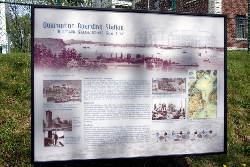
Preventing Infectious Disease
For many years, this boarding station helped to prevent the spread of infectious diseases in the United States. From 1783 to 1971, officers working at this station boarded and inspected thousands of ships coming into New York Harbor each year. In the mid-late 1880’s, the majority of immigrants arriving to the United States entered through New York Harbor and were subject to inspection. Using a tugboat, a team of medical officers travelled into the harbor to inspect incoming vessels and their passengers. If the ships passed inspection, they were given a clean bill of health and could continue. If deadly and contagious diseases were present, the vessels were fumigated and the passengers quarantined until it was safe for them to land in New York. In the nineteenth and early twentieth century, Yellow fever, cholera, typhus, small pox, diphtheria, and measles were among the diseases requiring quarantine.
Quarantine!
The first quarantine law for New York Harbor was passed by the Colonial Legislature in 1758. It quarantined vessels at Bedloe’s Island (now Liberty island). In 1801, a quarantine station at Tomkinsville (sic), Staten Island, was established as the location for quarantine facilities. It was destroyed by arson in 1858. Earlier quarantine facilities failed because nobody wanted to live near hospitals full of highly contagious immigrants. For this reason, between 1870 and 1873, the State of New York built two islands for quarantine purposes: Hoffman Island for healthy passengers on quarantined ships, and Dix (Swinburn) Island for the sick passengers. The facilities on the island included dormitories, kitchens, dining rooms, a laundry, disinfecting and drying chambers, hospital wards, a crematory and a mortuary.
Rosebank
The Rosebank Boarding Station included building used as residences for the medical officers, a laundry, carpenter shop, boathouse, telegraph office and observation tower, laboratory, storerooms and a barn. The facility housed medical officers who would be available on short notice to examine passengers and inspect and fumigate vessels. Rosebank laboratory staff continuously tested rats collected from vessels to monitor for plague infestation. The State of New York sold the property to the United States in 1921, and the Public Health Service continued operations and improved efficiency by constructing new buildings and dormitories. The facility later became part of the Department of Health, Education and Welfare, and it was closed in 1971 along with the majority of the nation’s Quarantine stations as the result of a federal quarantine change that reduced disease inspection in favor of other forms of intervention.

Photographed By Larry Gertner, April 29, 2017
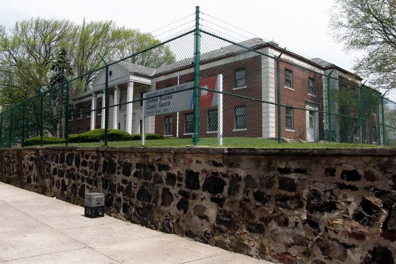
2. Quarantine Boarding Station location
Since 1973, the facility has been in the hands of the USCG.
Although it fronts on Bay Street, the official address is "10 Search Lane", one of the base's interior roads.
The marker is in the driveway, out of frame to the right.
Topics. This historical marker is listed in this topic list: Science & Medicine. A significant historical year for this entry is 1783.
Location. 40° 36.617′ N, 74° 3.789′ W. Marker is on Staten Island, New York, in Richmond County. It is in Shore Acres. Marker is on Bay Street, on the right when traveling north. Touch for map. Marker is at or near this postal address: 10 Search Lane, Staten Island NY 10305, United States of America. Touch for directions.
Other nearby markers. At least 8 other markers are within walking distance of this marker. St. John's Church (about 400 feet away, measured in a direct line); In Memory of The Child Victims of the Oklahoma City Bombing (about 500 feet away); Arthur Von Briesen Park (approx. ¼ mile away); September 11, 2001 Living Memorial Grove (approx. 0.3 miles away); Alice Austen House (approx. 0.3 miles away); Staten Island War Dog Memorial (approx. 0.4 miles away); Father Capodanno Memorial (approx. 0.4 miles away); Firefighter Robert J. Cordice (approx. 0.4 miles away). Touch for a list and map of all markers in Staten Island.
Credits. This page was last revised on July 24, 2023. It was originally submitted on April 30, 2017, by Larry Gertner of New York, New York. This page has been viewed 699 times since then and 73 times this year. Last updated on May 28, 2017, by Larry Gertner of New York, New York. Photos: 1, 2. submitted on April 30, 2017, by Larry Gertner of New York, New York. • Bill Pfingsten was the editor who published this page.
