Hampton Roads Center , Virginia — The American South (Mid-Atlantic)
Battle of Big Bethel
Confederate Victory
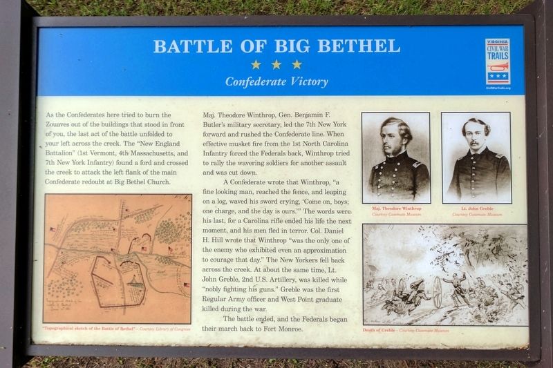
Maj. Theodore Winthrop, Gen. Benjamin F. Butler's military secretary, led the 7th New York forward and rushed the Confederate line. When effective musket fire from the 1st North Carolina Infantry forced the Federals back, Winthrop tried to rally the wavering soldiers for another assault and was cut down.
A Confederate wrote that Winthrop, "a fine looking man, reached the fence, and leaping on a log, waved his sword crying, ‘Come on, boys; one charge, and the day is ours.’" The words were his last, for a Carolina rifle ended his life the next moment, and his men fled in terror. Col. Daniel H. Hill wrote that Winthrop "was the only one of the enemy who exhibited even an approximation to courage that day." The New Yorkers fell back across the creek. At about the same time, Lt. John Greble, 2nd U.S. Artillery, was killed while “nobly fighting his guns." Greble was the first Regular Army officer and West Point graduate killed during the war.
The battle ended, and the Federals began their march back to Fort Monroe.
(captions)
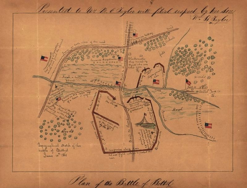
“Topographical sketch of the Battle of Bethel” — Courtesy Library of Congress
Maj. Theodore Winthrop Courtesy Casemate Museum
Lt. John Greble Courtesy Casemate Museum
Death of Greble — Courtesy Casemate Museum
Erected 2016 by Virginia Civil War Trails. (Marker Number 8.)
Topics and series. This historical marker is listed in this topic list: War, US Civil. In addition, it is included in the Virginia Civil War Trails series list. A significant historical date for this entry is June 10, 1861.
Location. 37° 5.487′ N, 76° 25.548′ W. Marker is in Hampton, Virginia. It is in Hampton Roads Center. Marker can be reached from Big Bethel Road (Virginia Route 600) 0.1 miles north of Semple Farm Road, on the left when traveling north. Located in Bethel Park. Touch for map. Marker is in this post office area: Hampton VA 23666, United States of America. Touch for directions.
Other nearby markers. At least 8 other markers are within walking distance of this marker. A different marker also named Battle of Big Bethel (a few steps from this marker); a different marker also named Battle of Big Bethel (a few steps from this marker); Henry Lawson Wyatt (a few steps from this marker); a different marker also named Battle of Big Bethel
(a few steps from this marker); a different marker also named Battle of Big Bethel (within shouting distance of this marker); a different marker also named Battle of Big Bethel (within shouting distance of this marker); a different marker also named Battle of Big Bethel (within shouting distance of this marker); a different marker also named Battle of Big Bethel (within shouting distance of this marker). Touch for a list and map of all markers in Hampton.
Credits. This page was last revised on February 1, 2023. It was originally submitted on May 29, 2017, by Bernard Fisher of Richmond, Virginia. This page has been viewed 445 times since then and 45 times this year. Photos: 1. submitted on May 29, 2017, by Bernard Fisher of Richmond, Virginia. 2. submitted on May 30, 2017. 3. submitted on May 29, 2017, by Bernard Fisher of Richmond, Virginia.


