Hampton Roads Center , Virginia — The American South (Mid-Atlantic)
Battle of Big Bethel
Long-Term Consequences
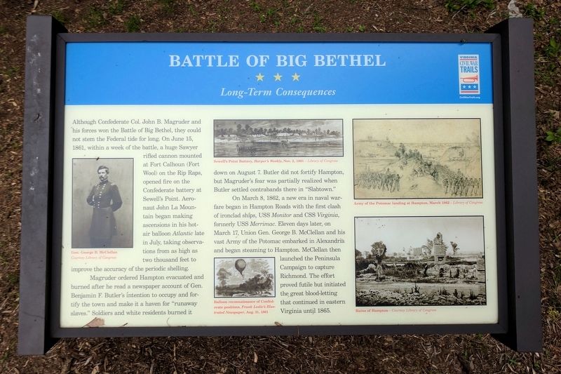
Magruder ordered Hampton evacuated and burned after he read a newspaper account of Gen. Benjamin F. Butler's intention to occupy and fortify the town and make it a haven for "runaway slaves." Soldiers and white residents burned it down on August 7. Butler did not fortify Hampton, but Magruder's fear was partially realized when Butler settled contrabands there in "Slabtown.”
On March 8, 1862, a new era in naval warfare began in Hampton Roads with the first clash of ironclad ships, USS Monitor and CSS Virginia, formerly USS Merrimac. Eleven days later, on March 17, Union Gen. George B. McClellan and his vast Army of the Potomac embarked in Alexandria and began steaming to Hampton. McClellan then launched the Peninsula Campaign to capture Richmond. The effort proved futile but initiated the great blood-letting that continued in eastern Virginia until 1865.
(captions)
Gen. George B. McClellan Courtesy Library of Congress
Sewell’s Point Battery, Harper’s Weekly, Nov. 2, 1861 — Library of Congress
Balloon reconnaissance of Confederate positions, Frank Leslie’s Illustrated Newspaper, Aug. 31, 1861
Army of the Potomac landing at Hampton, March 1862 — Library of Congress
Ruins of Hampton — Courtesy Library of Congress
Erected 2016 by Virginia Civil War Trails. (Marker Number 10.)
Topics and series. This historical marker is listed in this topic list: War, US Civil. In addition, it is included in the Virginia Civil War Trails series list. A significant historical year for this entry is 1861.
Location. 37° 5.491′ N, 76° 25.561′ W. Marker is in Hampton, Virginia. It is in Hampton Roads Center. Marker can be reached from Big Bethel Road (Virginia Route 600) 0.1 miles north of Semple Farm Road, on the left when traveling north. Located in Bethel Park. Touch for map. Marker is in this post office area: Hampton VA 23666, United States of America. Touch for directions.
Other nearby markers. At least 8 other markers are within walking distance of this marker. A different marker also named Battle of Big Bethel (here, next to this marker); a different marker also named Battle of Big Bethel (a few steps from this marker); a different marker also named Battle of Big Bethel (a few steps from this marker); a different marker also named Battle of Big Bethel (a few steps from this marker); Battle of Big Bethel Union Monument (a few steps from this marker); a different marker also named Battle of Big Bethel (a few steps from this marker); a different marker also named Battle of Big Bethel (within shouting distance of this marker); a different marker also named Battle of Big Bethel (within shouting distance of this marker). Touch for a list and map of all markers in Hampton.
Credits. This page was last revised on February 1, 2023. It was originally submitted on May 29, 2017, by Bernard Fisher of Richmond, Virginia. This page has been viewed 400 times since then and 34 times this year. Photos: 1, 2. submitted on May 29, 2017, by Bernard Fisher of Richmond, Virginia.

