Colonial Heights, Virginia — The American South (Mid-Atlantic)
The Old Brick (Kennon) House
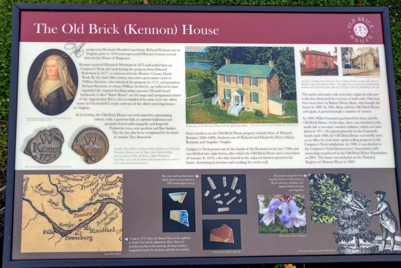
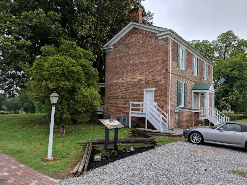
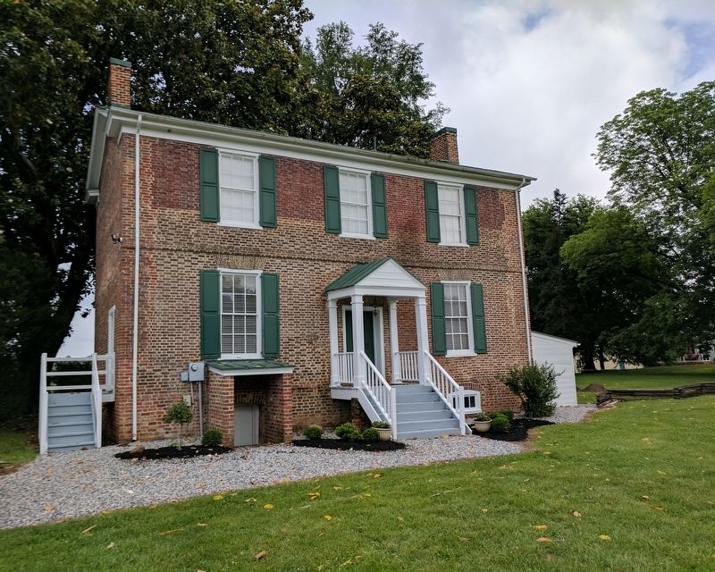
Kennon married Elizabeth Worsham in 1675 and settled here on Conjurer's Neck after purchasing the property from Edward Robenson in 1677, as referenced in the Henrico County Deeds Book. By the mid-18th century, successive generations (such as William Kennon, who inherited the property in 1711, and grandson Richard Kennon, to whom William deeded it), are believed to have expanded the original dwelling using expensive Flemish bond brickwork. Called "Brick House" on old maps and navigational charts of the Appomattox River, this is considered by some to be the oldest home in Chesterfield County and one of the oldest surviving houses in Virginia.
In its heyday, the Old Brick House was well suited for entertaining visitors, with a spacious hall, an upstairs ballroom and grounds dotted with magnolia and Imperial Paulownia trees, rose gardens and lilc bushes. The site has also been recognized for its stand of mature Tree Boxwood.
Grave markers on the Old Brick House property include those of Richard Kennon (1684-1688), firstborn son of Richard and Elizabeth; Henry Isham Kennon; and Angeline Vaughan.
Conjurer's Neck passed out of the hands of the Kennons in the late 1700s and was divided into eight farms, after which the Old Brick House had a succession of tenants. In 1879, a fire that started in the adjacent kitchen spread to the house, destroying its interior and cracking the north wall.
The north and south walls were later replaced with new walls that eliminated the recesses at both ends. This may have been done by Robert Henry Batte, who bought the house in 1880. In 1885, Batte sold the Old Brick House, and again, it passed through a number of owners.
In 1909, Willis Comstock purchased the farm and the Old Brick House. At the time, there was attached to the north side a two-story wooden addition, which was torn down in 1971. Occupied primarily by the Comstock family until 1988, the Old Brick House was briefly used as an office for real estate agents selling property in the Conjurer's Neck subdivision. In 1990, it was deeded to the Conjurer's Neck Homeowners Association, with ownership transferred to the Old Brick House Foundation in 2001. The house was included on the National Register of Historic Places in 2003.
(captions)
(top left) Mary Kennan, firstborn child of Richard and Elizabeth (Worsham) Kennon, married Major John Fairfax Bolling, great-grandson of John and Rebecca Rolfe (Pocahontas). Portrait of Mary Kennon courtesy of William and Mary, Muscarelle Museum of Art
(left) Glass seals with the Kennan family name that were used on wine bottles produced on the farm Photo courtesy of John A. Rooney, Jr. and the Comstock family
Aerial view of the Old Brick House and the Appomattox River Image based on photo by Tredegar Drone Works Inc./tdroneworks.com
(top left) A Bolling house that once stood in Hopewell had a design and structure similar to that of the Kennon House. (top right) A new section was attached to the northern end of the brick house after the 1879 fire, with an outbuilding to the left. Photos courtesy of the Comstock family
A map of 1751 shows the Kennon House at the confluence of Swift Creek and the Appomattox River. Due to its prominent position on the waterway, the house became a navigational marker for merchants and other river travelers. Image/Public Domain
Pipe stems and household pottery shards found on the grounds in a 2002 archaeological survey Photos courtesy of John A. Rooney, Jr.
The grounds and gardens have long been home to a lush variety of flowers and trees, including roses, Imperial Paulownia trees and magnolias. Photos courtesy of John A. Rooney, Jr. 18th century woodcut of a garden/Public Domain
Erected by The Old Brick House Foundation.
Topics. This historical marker is listed in these topic lists: Colonial Era • Settlements & Settlers.
Location. 37° 17.127′ N, 77° 21.955′ W. Marker is in Colonial Heights, Virginia. Marker is on Waterfront Drive east of Dunston Point Parkway, on the right when traveling east. Touch for map. Marker is at or near this postal address: 131 Waterfront Dr, Colonial Heights VA 23834, United States of America. Touch for directions.
Other nearby markers. At least 8 other markers are within 3 miles of this marker, measured as the crow flies. Conjurer's Field Prehistoric Native American Village (here, next to this marker); The Brick House At Conjurer's Neck (within shouting distance of this marker); Fort Clifton (approx. ¼ mile away); a different marker also named Fort Clifton (approx. 0.3 miles away); a different marker also named Fort Clifton (approx. half a mile away); Confederate Fortification (approx. 0.6 miles away); Ellerslie (approx. 2.3 miles away); a different marker also named Ellerslie (approx. 2.3 miles away). Touch for a list and map of all markers in Colonial Heights.
Also see . . . The Old Brick House Foundation. (Submitted on May 29, 2017.)
Credits. This page was last revised on April 30, 2021. It was originally submitted on May 29, 2017, by Bernard Fisher of Richmond, Virginia. This page has been viewed 705 times since then and 82 times this year. Photos: 1, 2, 3. submitted on May 29, 2017, by Bernard Fisher of Richmond, Virginia.


