Williamsburg in Clermont County, Ohio — The American Midwest (Great Lakes)
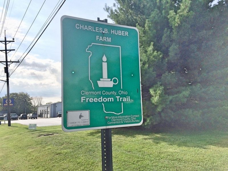
Charles B. Huber Farm
Clermont County, Ohio Freedom Trail
— National Underground Railroad Network to Freedom —
Erected 2002 by Clermont County and the National Park Service. (Marker Number 30.)
Topics and series. This historical marker is listed in these topic lists: Abolition & Underground RR • African Americans. In addition, it is included in the National Underground Railroad Network to Freedom series list.
Location. 39° 3.6′ N, 84° 3.835′ W. Marker is in Williamsburg, Ohio, in Clermont County. Marker is on West Main Street (Ohio Route 276) east of Tollgate Road, on the right when traveling east. Touch for map. Marker is at or near this postal address: 975 West Main Street, Williamsburg OH 45176, United States of America. Touch for directions.
Other nearby markers. At least 8 other markers are within walking distance of this marker. Williamsburg (within shouting distance of this marker); a different marker also named Williamsburg (about 400 feet away, measured in a direct line); Williamsburg Veterans Memorial (approx. ¼ mile away); In Recognition of 200 Years of Freedom and Dedication (approx. 0.3 miles away); Williamsburg Township Cemetery (approx. 0.3 miles away); The Town Square (approx. half a mile away); Marcus Sims - Huber Tannery Location (approx. ¾ mile away); Dr. L.T. Pease Home Site (approx. 0.8 miles away). Touch for a list and map of all markers in Williamsburg.
More about this marker. This marker is one of nineteen sites included in the Network to Freedom program of the National Park Service.
The majority of the Freedom Trail sites are not open to the public. Please respect the privacy & property as some of these sites are residential homes and businesses.
Regarding Charles B. Huber Farm. The lot across the street was once part of the farm owned by Charles B. Huber, stationmaster of the Underground Railroad for Williamsburg. In addition to secreting fugitives at his home, Huber hid them in the haybarn and cornshocks at this farm on the outskirts of town.
Also see . . . Clermont Freedom Trail. Discover Clermont website entry (Submitted on September 21, 2017, by Mark Hilton of Montgomery, Alabama.)
Credits. This page was last revised on October 9, 2023. It was originally submitted on September 21, 2017, by Mark Hilton of Montgomery, Alabama. This page has been viewed 289 times since then and 16 times this year. Photos: 1, 2. submitted on September 21, 2017, by Mark Hilton of Montgomery, Alabama.

