Near Poteet in Atascosa County, Texas — The American South (West South Central)
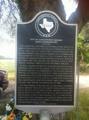
Site of Jose Antonio Navarro Ranch Headquarters
(2.3 Mi. SSE)
Inscription.
This land had once been allocated in the 1700s as a ranch for Mission San Jose in San Antonio (20 mi. N), but in the 1820s was left unsettled. In 1828 prominent San Antonio resident Jose Antonio Navarro (1795-1871) beseeched the Governor of the Mexican state to grant him four leagues of land for pasture. Navarro officially received his grant for this land on the Atascosa River in 1831, though he might have occupied the ranch earlier.
In 1836, Navarro signed the Texas Declaration of Independence, and in the following years was occupied by business and politics elsewhere. By 1853 he had concentrated his ranching interests here and spent the summers in a log house overlooking the Atascosa River. He registered his cattle brand in Atascosa County in 1856, and donated land for a county seat in 1857, though the seat was moved to Pleasanton in 1858.
The 1860 census listed 400 cattle, 200 swine, 35 horses, and 12 oxen on the ranch of almost 18,000 acres. Oil was noted on this land as early as 1867. Navarro turned the ranch over to his sons after the Civil War, and following his death in 1871 in San Antonio, the land was divided among his five children. This acreage remained in the family until his son Sixto Eusebio Navarro (b.1833) sold the old ranch home in 1894.
Erected 1986 by Texas Historical Commission. (Marker Number 4819.)
Topics. This historical marker is listed in these topic lists: Hispanic Americans • Settlements & Settlers • War, Texas Independence. A significant historical year for this entry is 1828.
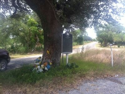
Location. 29° 2.63′ N, 98° 39.225′ W. Marker is near Poteet, Texas, in Atascosa County. Marker is at the intersection of Farm to Market Road 1333 and Curvier Road, on the left when traveling south on Route 1333. Touch for map. Marker is in this post office area: Poteet TX 78065, United States of America. Touch for directions.
Other nearby markers. At least 8 other markers are within 9 miles of this marker, measured as the crow flies. Amphion and Amphion Cemetery (approx. 3.3 miles away); Rossville (approx. 3.4 miles away); Anchorage Cemetery (approx. 3.7 miles away); Rossville Cemetery (approx. 4.2 miles away); Poteet (approx. 4.8 miles away); Sand Branch Baptist Church (approx. 6.2 miles away); Kings Highway Camino Real — Old San Antonio Road (approx. 6.8 miles away); Shiloh Cemetery (approx. 8.6 miles away). Touch for a list and map of all markers in Poteet.
Related markers. Click here for a list of markers that are related to this marker.
Credits. This page was last revised on December 11, 2017. It was originally submitted on June 20, 2012, by John A Hensarling of Campbellton, Texas. This page has been viewed 1,884 times since then and 57 times this year. Last updated on December 8, 2017, by Cosmos Mariner of Cape Canaveral, Florida. Photos: 1, 2. submitted on June 21, 2012, by John A Hensarling of Campbellton, Texas. • Bernard Fisher was the editor who published this page.

