Near White City in Jackson County, Oregon — The American West (Northwest)
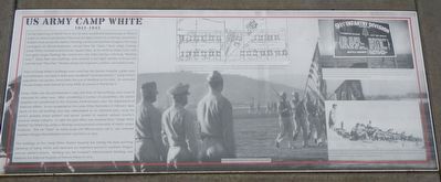
US Army Camp White
1941-1945

Photographed By Barry Swackhamer, September 21, 2017
1. US Army Camp White Marker
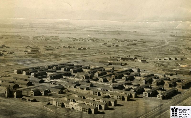
Captions: (top center) The center of Camp White was the "building core." a mile wide and four mile long on either side of the new Crater Lake Highway. Division troops were housed to the east and Post troops (that ran the camp) and others were to the west. The huge Station Hospital was a separate rectangular area at the north, The building core had more than 1400 buildings when it was completed.; (bottom center) General Thomas, 2nd fro the right, reviews the Troops, 1942.; (top right) The first of the two divisions at Camp White was the 91st, the Fir (sic) Tree Division, that was reactivated here in September 1942. Under the command of Maj. General Charles H. Gerhardt, Camp White's tough training earned it the reputation as "The Alcatraz of Army Camps." The 91st served with distinction on the European front, participating in battle in Rome and the Arno River. The division was deactivated at Camp Rucker, Alabama in December 1945.; (bottom right) Much of the 77-square miles of Camp White was occupied by the two huge training ranges, Feagle to there south and Antelope to the south. There troops experienced live-ammo exercises, learned to use their weapons, ford the Rogue River under fire, storm pillboxes and even capture the "Nazi Village," a collection of relocated farm houses.
Most of Camp White buildings were wood but the Station Hospital, a giant 1400-bed institution, was built of brick and considered "semi-permanent." Camp White's population was 40,000, three times the size of Medford at the time. An estimated 100,000 troops were trained at Camp White for service in World War II.
Camp White was decommissioned in 1945 and most of the buildings were razed or relocated for other uses. After, considering a number of possibilities, the station hospital was transferred to the Veterans Administration, now the Department of Veterans Affairs. It was re-opened as Camp White Domicillary in February 1949. Much of the old building core was redeveloped as an industrial park, using the army's gridded street pattern and power system to support Jackson County's postwar timber industry. In 1960 the post office was renamed from "Camp White Station" to White City, today a thriving unincorporated community of nearly 10,000 residents. The VA "Dom" as many locals still affectionately call it, was renamed Southern Oregon Rehabilitation Center and Clinics in 2003.
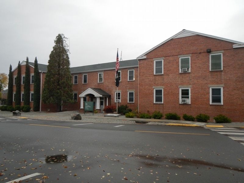
The buildings of the Camp White Station Hospital are among the best surviving elements of Camp White and represent an important period of southern Oregon and our nation's history. Building 200, the hospital's Administration Building, was listed on the National Register of Historic Places in 2015.
Erected by Southern Oregon Rehabilitation Center and Clinics.
Topics. This historical marker is listed in these topic lists: Forts and Castles • Science & Medicine • War, World II. A significant historical month for this entry is February 1949.
Location. 42° 26.443′ N, 122° 50.414′ W. Marker is near White City, Oregon, in Jackson County. Marker is on Avenue H near Crater Lake Highway (Oregon Route 62). Touch for map. Marker is in this post office area: White City OR 97503, United States of America. Touch for directions.
Other nearby markers. At least 8 other markers are within 5 miles of this marker, measured as the crow flies. Bybee Ferry (approx. 2.7 miles away); Eagle Point Veterans Memorial (approx. 3 miles away); Antelope Creek Bridge (approx. 3 miles away); Eagle Point (approx. 3.1 miles away); Snowy Butte Mill (approx. 3.1 miles away); Eagle Point National Cemetery Vietnam Memorial (approx. 3.2 miles away); Oregon Fallen War Heroes Memorial (approx. 4˝ miles away); Table Rock Monument (approx. 4.9 miles away).
More about this marker. The marker is located if front of the Southern Oregon Rehabilitation Center and Clinics Administration building, #200.
Credits. This page was last revised on October 19, 2020. It was originally submitted on January 13, 2018, by Barry Swackhamer of Brentwood, California. This page has been viewed 456 times since then and 85 times this year. Photos: 1, 2, 3. submitted on January 13, 2018, by Barry Swackhamer of Brentwood, California.

