Scappoose in Columbia County, Oregon — The American West (Northwest)
History of Scappoose

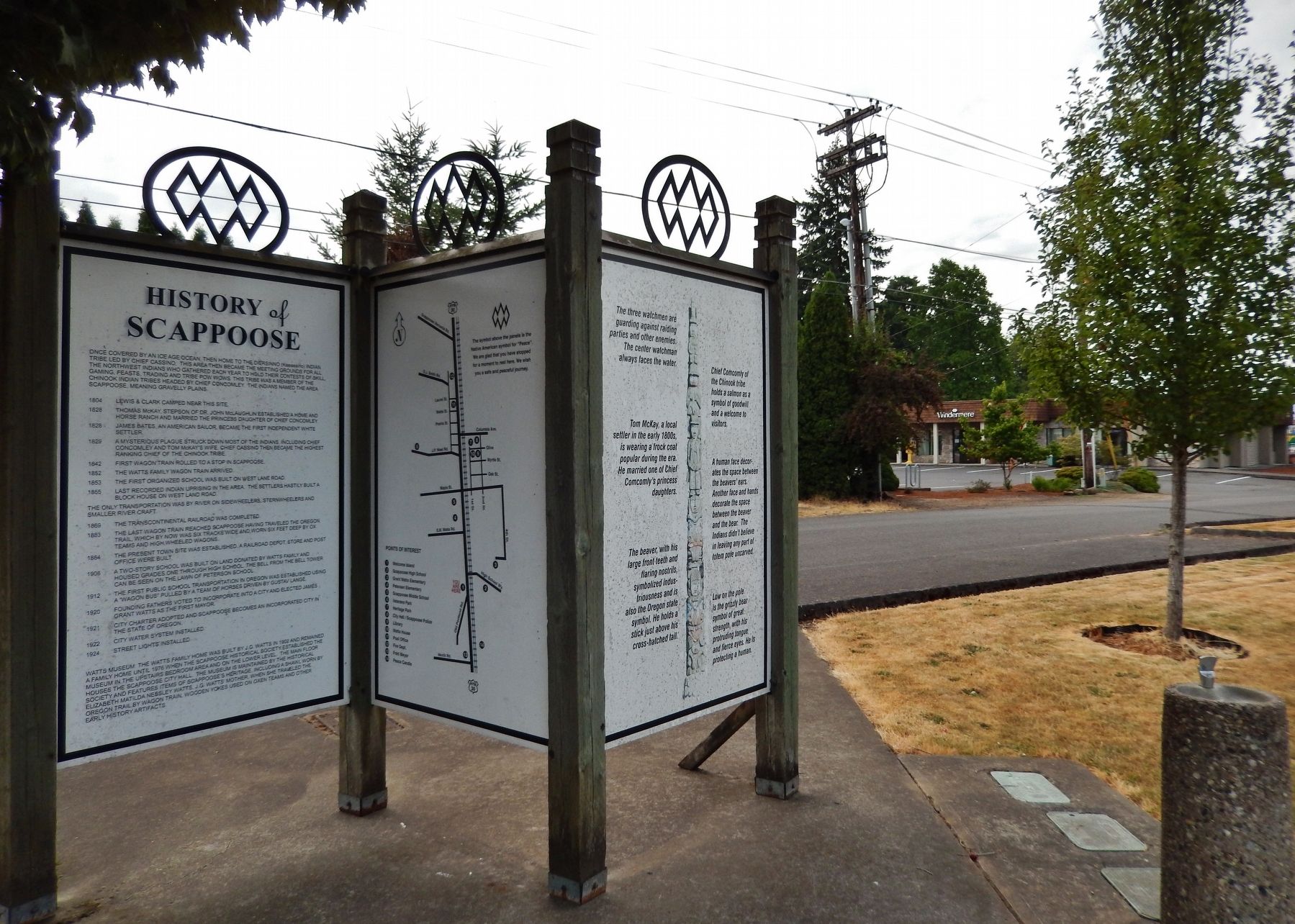
Photographed By Cosmos Mariner, July 10, 2015
1. History of Scappoose
The Columbia County Historian Home Page website entry
Click for more information.
Click for more information.
Panel 1
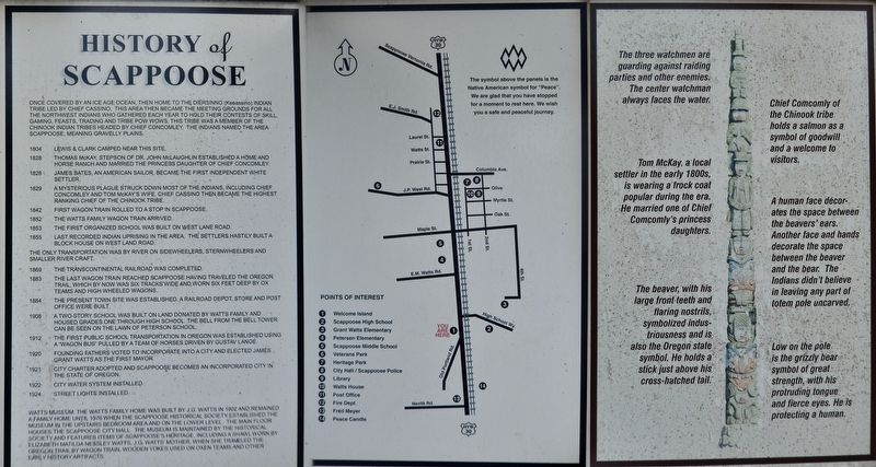
Once covered by an Ice Age ocean, then home to the Diersinno (Keeassino) Indian Tribe led by Chief Cassino, this area then became the meeting grounds for all the Northwest Indians who gathered each year to hold their contests of skill, gaming, feasts, trading and tribe pow wows. This tribe was a member of the Chinook Indian Tribes headed by Chief Concomley. The Indians named the area Scappoose, meaning gravelly plains.
1804 – Lewis & Clark camped near this site.
1828 – Thomas McKay, stepson of Dr. John McLaughlin established a home and horse ranch and married the princess daughter of Chief Concomley.
1828 – James Bates, an American sailor, became the first independent white settler.
1829 – A mysterious plague struck down most of the Indians, including Chief Concomley and Tom McKay’s wife. Chief Cassino then became the highest ranking chief of the Chinook Tribe.
1842 – First wagon train rolled to a stop in Scappoose.
1852 – The Watts family wagon train arrived.
1853 – The first organized school was built on West Lane Road.
1855 – Last recorded Indian uprising in the area, the settlers hastily built a block house on West Land Road.
The only transportation was by river on sidewheelers, sternwheelers and smaller river craft.
1869 – The Transcontinental Railroad was completed.
1883 – The last wagon train reached Scappoose having traveled the Oregon Trail, which by now was six tracks wide and worn six feet deep by ox teams and high wheeled wagons.
1884 – The present town site was established. A railroad depot, store and post office were built.
1908 – A two-story school was built on Land donated by Watts family and housed grades one through high school. The bell from the bell tower can be seen on the lawn of Peterson School.
1912 – The first public school transportation in Oregon was established using a “Wagon Bus” pulled by a team of horses driven by Gustav Lange.
1920 – Founding fathers voted to incorporate into a city and elected James Grant Watts as the first mayor.
1921 – City Charter adopted and Scappoose becomes an incorporated city in the State of Oregon.
1922 – City water system installed.
1924 – Street lights installed.
Watts Museum: The Watts family home was built by J.G. Watts in 1902 and remained a family home until 1976 when the Scappoose Historical Society established the museum in the upstairs bedroom area and on the lower level. The main floor houses the Scappoose City Hall. The
museum is maintained by the Historical Society and features items of Scappoose’s heritage, including a shawl worn by Elizabeth Matilda Nessley Watts, J.G. Watts’ mother, when she traveled the Oregon Trail by wagon train, wooden yokes used on oxen teams and other early history artifacts.
Panel 2
The symbol above the panels is the Native American symbol for “Peace.” We are glad that you have stopped for a moment to rest here. We wish you a safe and peaceful journey.
Points of Interest
1 - Welcome Island
2 - Scappoose High School
3 - Grant Watts Elementary
4 - Petersen Elementary
5 - Scappoose Middle School
6 - Veterans Park
7 - Heritage Park
8 - City Hall / Scappoose Police
9 - Library
10 - Watts House
11 - Post Office
12 - Fire Dept
13 – Fred Meyer
14 – Peace Candle
Panel 3
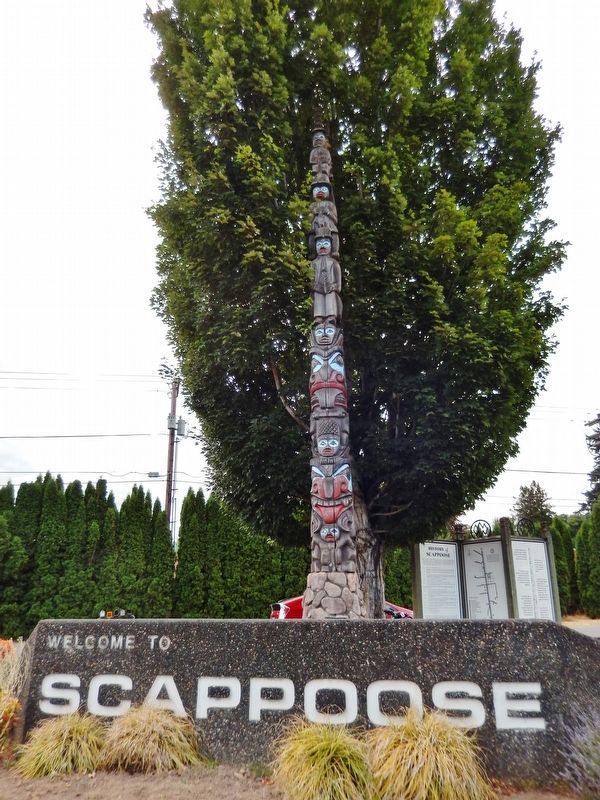
The three watchmen are guarding against raiding parties and other enemies. The center watchman always faces the water.
Chief Comcomly of the Chinook tribe holds a salmon as a symbol of goodwill and a welcome to visitors.
Tom McKay, a local settler in the early 1800s, is wearing a frock coat popular during the era. He married one of Chief Comcomly's princess daughters.
A human face decorates the
space between the beavers' ears. Another face and hands decorate the space between the beaver and the bear. The Indians didn't believe in leaving any part of totem pole uncarved.
The beaver, with his large front teeth and flaring nostrils, symbolized industriousness and is also the Oregon state symbol. He holds a stick just above his cross-hatched tail.
Low on the pole is the grizzly bear symbol of great strength, with his protruding tongue and fierce eyes. He is protecting a human.
Topics and series. This historical marker is listed in these topic lists: Exploration • Native Americans • Notable Places • Settlements & Settlers. In addition, it is included in the Lewis & Clark Expedition series list.
Location. 45° 44.896′ N, 122° 52.649′ W. Marker is in Scappoose, Oregon, in Columbia County. Marker is at the intersection of Columbia River Highway (U.S. 30) and SW Old Portland Road, on the left when traveling north on Columbia River Highway. Marker is located in a small plaza on the west side of the highway, across the highway from Scappoose High School. Touch for map. Marker is at or near this postal address: 51891 SW Old Portland Road, Scappoose OR 97056, United States of America. Touch for directions.
Other nearby markers. At least 8 other markers are within 9 miles of this marker, measured as the crow flies. Route of Lewis and Clark National Historic Trail (here, next to this marker); Lewis and Clark on the Columbia (here, next to this marker); Thomas McKay (a few steps from this marker); Fort William (approx. 5.6 miles away); a different marker also named Fort William (approx. 5.6 miles away); Lewis & Clark Discovery Trail (approx. 8.8 miles away); down the trodden path... (approx. 8.8 miles away); Warrior Rock Fog Bell (approx. 8.9 miles away). Touch for a list and map of all markers in Scappoose.
Credits. This page was last revised on November 12, 2021. It was originally submitted on January 21, 2018, by Cosmos Mariner of Cape Canaveral, Florida. This page has been viewed 1,073 times since then and 122 times this year. Photos: 1. submitted on January 21, 2018, by Cosmos Mariner of Cape Canaveral, Florida. 2, 3. submitted on January 22, 2018, by Cosmos Mariner of Cape Canaveral, Florida. • Bill Pfingsten was the editor who published this page.

