Near Beulah in Crook County, Wyoming — The American West (Mountains)
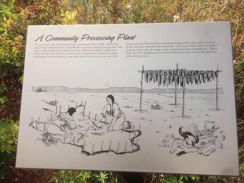
A Community Processing Plant
The enormous task of butchering began immediately after the kill. Adult men and women worked in teams to rapidly skin carcasses and begin cutting them into pieces small enough to be carried out of the sinkhole, possibly by adolescents. Meat and hides were placed on travois (poles and platforms harnessed to dogs) and dragged to the processing camp where most of the meat was cut into thin strips and dried. Marrow bones were broken open with stone mauls to extract the fat and other nutrients they contained. Later some of this meat was further processed into a type of sausage, most commonly known as pemmican. Bison skulls were also smashed open to remove brains that were used in the laborious hide-tanning process.
Topics. This historical marker is listed in these topic lists: Animals • Industry & Commerce • Native Americans.
Location. 44° 32.147′ N, 104° 9.384′ W. Marker is near Beulah, Wyoming, in Crook County. Marker is on Old Hwy 14, 3 miles State Highway 86. This marker is located within the Vore Site. Touch for map. Marker is at or near this postal address: 5526 Old Hwy 14, Beulah WY 82712, United States of America. Touch for directions.
Other nearby markers. At least 8 other markers are within 3 miles of this marker, measured as the crow flies. Discovering the Vore Archaeological Site (a few steps from this marker); Trapping Buffalo (within shouting distance of this marker); Understanding Bison Behavior Brought Success (within shouting distance of this marker); Preparing for Impending Blizzards (within shouting distance of this marker); The Ideal Hunting Ground (within shouting distance of this marker); Vore Buffalo Jump (within shouting distance of this marker); The Custer Trail (approx. 2˝ miles away); Rich Colors, Rich Lands (approx. 2˝ miles away). Touch for a list and map of all markers in Beulah.
Credits. This page was last revised on June 7, 2021. It was originally submitted on January 22, 2018, by Ruth VanSteenwyk of Aberdeen, South Dakota. This page has been viewed 176 times since then and 12 times this year. Photos: 1, 2. submitted on January 22, 2018, by Ruth VanSteenwyk of Aberdeen, South Dakota. • Andrew Ruppenstein was the editor who published this page.

