Near Oregon City in Clackamas County, Oregon — The American West (Northwest)
Baker Site
Inscription.
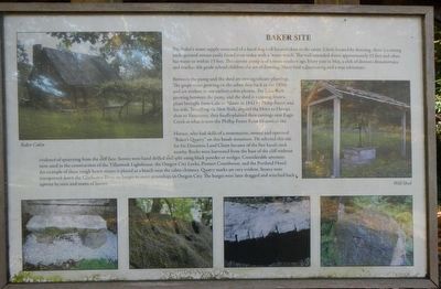
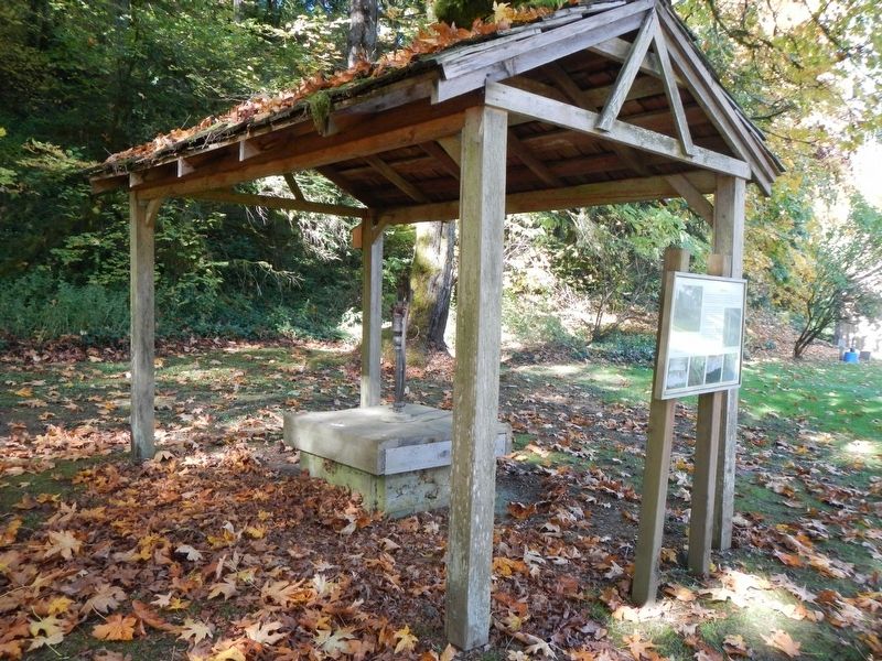
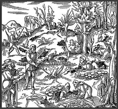
The Baker's water supply consisted of a hand dug well located close to the cabin. Likely located by dowsing , there is a strong underground stream easily found even today with a 'water-witch.' The well extended down approximately 25 feet and often has water to within 15 feet. The current pump is of a more modern age. Every year in May, a club of dowsers demonstrates and teaches 4th grade school children the art of dowsing. Many find it fascinating and a true adventure.
Between the pump and the shed are two significant plantings. The grape vines growing on the arbor date back to the 1800s and are evident in our earliest cabin photos. The Lilac bush growing between the pump and the shed is a cutting from a plant brought from Calaise, Maine in 1842 by Phillip Foster and his wife. Traveling via New York, around the Horn to Hawaii, then to Vancouver, they finally planted their cuttings near Eagle Creek at what is now the Phillip Foster Farm Historical site.
Horace, who had skills as a stone mason, owned and operated "Baker's Quarry" on this basalt mountain. He selected this site for his Donation Land Claim because of the fine basalt rock nearby. Rocks were harvested from the base of the cliff without evidence of quarrying from the cliff face. Stones were hand drilled and split using black powder or wedges. Considerable amounts were used in the construction of the Tillamook Lighthouse, the Oregon City Locks, Pioneer Courthouse, and the Portland Hotel. An example of these rough hewn stones is placed near the cabin chimney. Quarry marks are very evident. Stones were transported down the Clackamas River on barges to meet steamships in Oregon City. The barges were later dragged and winched back upriver by men and teams of horses.
Erected by Baker Cabin Historical Society.
Topics. This historical marker is listed in these topic lists: Agriculture • Horticulture & Forestry • Settlements & Settlers.
Location. 45° 23.367′ N, 122° 29.809′ W. Marker is near Oregon City, Oregon, in Clackamas County. Marker can be reached from South Gronlund Road near Carver Road, on the right when traveling west. Touch for map. Marker is at or near this postal address: 1800 South Gronlund Road, Oregon City OR 97045, United States of America. Touch for directions.
Other nearby markers. At least 8 other markers are within 5 miles of this marker, measured as the crow flies. The Baker Cabin (within shouting distance of this marker); Baker Cabin Pioneer Church (within shouting distance of this marker); Baker Cabin Historical Society (within shouting distance of this marker); The Baker Cabin Overview (within shouting distance of this marker); The Baker Family
(within shouting distance of this marker); Area Commerce (about 300 feet away, measured in a direct line); Grinding Rock (about 300 feet away); Willamette Falls, circa 1880 (approx. 5 miles away). Touch for a list and map of all markers in Oregon City.
More about this marker. This marker is located on the grounds of Baker Cabin Historical Site between the Pioneer Church and Baker Cabin.
Also see . . .
1. Water Witching 101 - YouTube. (Submitted on February 20, 2018, by Barry Swackhamer of Brentwood, California.)
2. Dowsing as a Method of Finding Underground Water - Geology.com. Although some dowsers have a record of regularly producing good results, the United States Geological Survey reports that most geologists and hydrogeologists do not endorse the practice of dowsing. The National Ground Water Association, in a position statement, “strongly opposes the use of water witches to locate groundwater on the grounds that controlled experimental evidence clearly indicates that the technique is totally without scientific merit”... (Submitted on February 20, 2018, by Barry Swackhamer of Brentwood, California.)
Credits. This page was last revised on February 20, 2018. It was originally submitted on February 20, 2018, by Barry Swackhamer of Brentwood, California. This page has been viewed 204 times since then and 12 times this year. Photos: 1, 2, 3. submitted on February 20, 2018, by Barry Swackhamer of Brentwood, California.


