Eastport in Annapolis in Anne Arundel County, Maryland — The American Northeast (Mid-Atlantic)
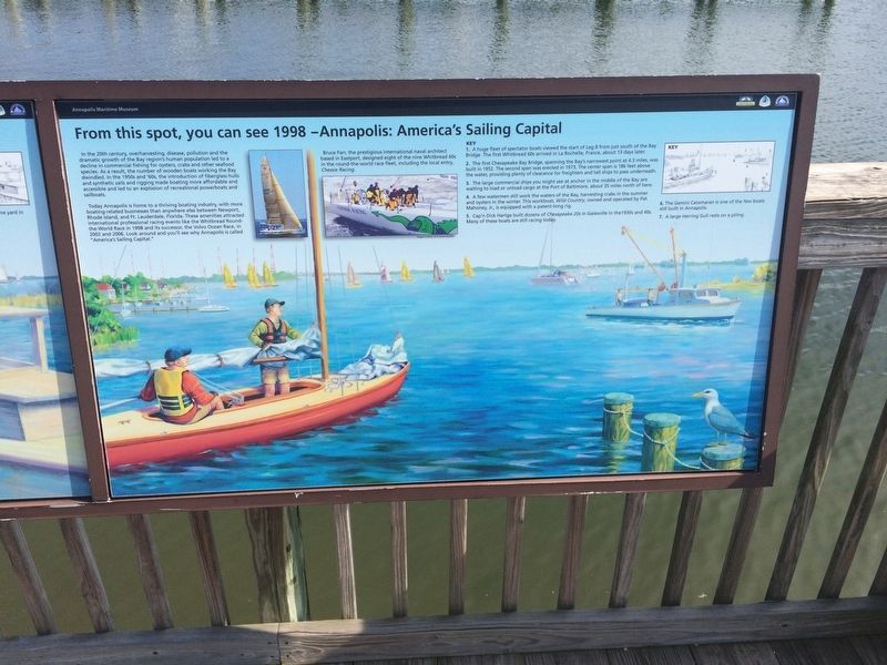
From this spot, you can see 1998 - Annapolis: America's Sailing Capital
Annapolis Maritime Museum

Photographed By Devry Becker Jones (CC0), March 10, 2018
1. From this spot, you can see 1998 - Annapolis: America's Sailing Capital Marker
In the 20th century, overharvesting, disease, pollution and the dramatic growth of the Bay region's human population led to the decline in commercial fishing for oysters, crabs and other seafood species. As a result, the number of wooden boats working the Bay dwindled. In the 1950s and '60s, the introduction of fiberglass hulls and synthetic sails and rigging made boating more affordable and accessible and led to an explosion of recreational powerboats and sailboats.
Today Annapolis is home to a thriving boating industry, with more boating-related businesses than anywhere else between Newport, Rhode Island, and Ft. Lauderdale, Florida. These amenities attracted international professional racing events like the Whitbread Round-the-World Race in 1998 and its successor, the Volvo Ocean Race, in 2002 and 2006. Look around and you'll see why Annapolis is called "America's Sailing Capital."
Bruce Farr, the prestigious international naval architect based in Eastport, designed eight of the nine Whitbread 60s in the round-the-world race fleet, including the local entry, Chessie Racing.
Key
1. A huge fleet of spectator boats viewed the start of Leg 8 from just south of the Bay Bridge. The first Whitbread 60s arrived in La Rochelle, France, about 13 days later.
2. The first Chesapeake Bay Bridge, spanning the Bay's narrowest point at 4.3 miles, was built in 1952. The second span was erected in 1973. The center span is 186 feet above the water, providing plenty of clearance for freighters and tall ships to pass underneath.
3. The large commercial ships you might see at anchor in the middle of the bay are waiting to load or unload cargo at the Port of Baltimore, about 35 miles north of here.
4. A few watermen still work the waters of the Bay, harvesting crabs in the summer and oysters in the winter. This workboat, Wild Country, owned and operated by Pat Mahoney, Jr., is equipped with a patent-tong rig.
5. Cap'n Dick Hartge built dozens of Chesapeake 20s in Galesville in the 1930s and 40s. Many of these boats are still racing today.
6. The Gemini Catamaran is one of the few boats still built in Annapolis.
7. A large Herring Gull rests on a piling.
Erected by Chesapeake Bay Trust.
Topics. This historical marker is listed in these topic lists: Animals • Bridges & Viaducts • Waterways & Vessels. A significant historical year for this entry is 1998.
Location. 38° 58.127′ N, 76° 28.562′ W. Marker is in Annapolis, Maryland, in Anne Arundel County. It is in Eastport. Marker can be reached

Photographed By Devry Becker Jones (CC0), March 10, 2018
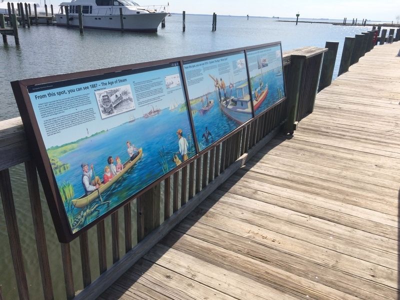
2. From this spot, you can see 1998 - Annapolis: America's Sailing Capital Marker
Other nearby markers. At least 8 other markers are within walking distance of this marker. Oysters: Vital to Commerce. Vital to Culture. (here, next to this marker); Oysters: Vital to Nature. Vital to Our Future. (here, next to this marker); Oysters: Vital to the Lifeline of the Chesapeake (here, next to this marker); From this spot, you can see 1919 - Oysters: The Bay's "White Gold" (here, next to this marker); From this spot, you can see 1887 - The Age of Steam (here, next to this marker); From this spot, you can see 1672 - Providence: Settlement on the Severn (here, next to this marker); From this spot, you can see 1608 - Captain John Smith's Chesapeake Voyages (here, next to this marker); From this spot, you can see 1774 - The "Annapolis Tea Party" (a few steps from this marker). Touch for a list and map of all markers in Annapolis.
Credits. This page was last revised on September 18, 2023. It was originally submitted on March 11, 2018, by Devry Becker Jones of Washington, District of Columbia. This page has been viewed 266 times since then and 28 times this year. Photos: 1, 2. submitted on March 11, 2018, by Devry Becker Jones of Washington, District of Columbia. • Bill Pfingsten was the editor who published this page.