Memphis in Shelby County, Tennessee — The American South (East South Central)
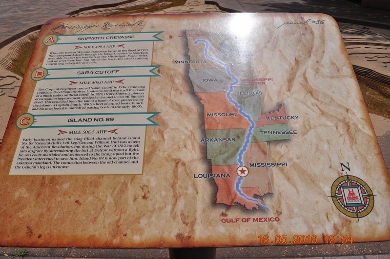
Skipwith Crevasse/Sara Cutoff/Island No. 89
Panel #36 Mississippi Riverwalk
A. Skipwith Crevasse
Mile 499.4 AHP
When the levee at Skipwith Plantation broke in the flood of 1913, the water poured slowly through the break. Couriers on horseback were able to alert the residents of the Mississippi-Yazoo Delta, and no lives were lost. Just inside the levee, the riverís rushing current dug a deep 100-acre hole.
B. Sara Cutoff
Mile 505.0 AHPM
The Corps of Engineers opened Sarah Cutoff in 1936, removing Louisiana Bend from the river. Louisiana Bend was itself the result of a much earlier artificial cutoff. In 1929 Henry Shreve, a pioneer of navigation improvement, dredged a channel to cut off Bunchís Bend. This bend had been the lair of a band of river pirates led by the infamous Captain Bunch. With a fleet of armed boats, Bunch and his men looted hundreds of passing boats in the early 1800ís
C. Island No. 89
Mile 506.5 AHP
Early Boatmen named the snag-filled channel behind Island No. 89 “General Hullís Left Leg.” General William Hull was a hero of the American Revolution, but during the War of 1812, he fell into disgrace by surrendering to the fort at Detroit without a fight. He was court-martialed and sentenced to the firing squad but the President intervened to save him. Island No.89 is now part of the Arkansas mainland. The connection between the old channel and the Generalís leg is unknown.
Erected by Mississippi Riverwalk. (Marker Number 36.)
Topics. This historical marker is listed in these topic lists: Disasters • War, US Revolutionary • Waterways & Vessels. A significant historical year for this entry is 1913.
Location. 35° 8.968′ N, 90° 3.507′ W. Marker is in Memphis, Tennessee, in Shelby County. Marker is on Riverside Drive. Mud Island Mississippi Riverwalk. Touch for map. Marker is at or near this postal address: 125 N Front St, Memphis TN 38103, United States of America. Touch for directions.
Other nearby markers. At least 8 other markers are within walking distance of this marker. The Mississippi Riverwalk (here, next to this marker); Ohio River (here, next to this marker); Cairo, Illinois (here, next to this marker); Islands No. 2, 3, and 4 / Fort Jefferson, Kentucky / Birdís Point, Missouri (here, next to this marker); Island No. 5 (Wolf Island)/Belmont, Missouri/Columbus, Kentucky (here, next to this marker); Donaldson Point, Missouri/Island No. 8/Hickman, Kentucky/Dorena Crevasse (here, next to this marker); New Madrid, Missouri/Cates Casting Field/Island No. 10 (here, next to this marker); Tiptonville, Tennessee/Bixby Towhead (here, next to this marker). Touch for a list and map of all markers in Memphis.
Also see . . . William Hull. William Hull (June 24, 1753 – November 29, 1825) was an American soldier and politician. He fought in the American Revolution and was appointed as Governor of Michigan Territory (1805–13), gaining large land cessions from several Native American tribes under the Treaty of Detroit (1807). As a general in the War of 1812, Hull is best remembered for surrendering Fort Detroit to the British on August 16, 1812 following the Siege of Detroit. After the battle, Hull was court-martialed, convicted, and sentenced to death. However, after he received a pardon from President James Madison, his reputation recovered somewhat. (Submitted on March 27, 2018, by Sandra Hughes Tidwell of Killen, Alabama, USA.)
Credits. This page was last revised on April 17, 2018. It was originally submitted on March 27, 2018, by Sandra Hughes Tidwell of Killen, Alabama, USA. This page has been viewed 160 times since then and 17 times this year. Last updated on April 11, 2018, by Byron Hooks of Sandy Springs, Georgia. Photo 1. submitted on March 27, 2018, by Sandra Hughes Tidwell of Killen, Alabama, USA. • Andrew Ruppenstein was the editor who published this page.
