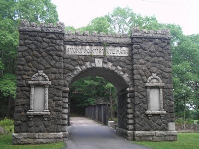
Stony Point in Rockland County, New York — The American Northeast (Mid-Atlantic)
The American Strategy
In reaction to Sir Henry Clinton’s move against Stony Point, the Continental Army marched north from New Jersey, to protect West Point, and a plan was devised to counter the British advance.
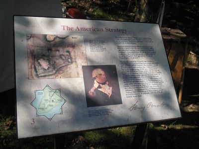
Apprised of the formidable British defenses at Stony Point by Captain Allan McLane, an American officer who had gained entrance to the enemy fort, General Washington determined that a frontal attack in daylight would most likely fail. Consequently, a night assault, to be led by Brigadier General Anthony Wayne of Pennsylvania, was planned.
Wayne commanded the Corps of Light Infantry, a select force which probed enemy lines, fought skirmishes, and executed difficult missions. Two columns – a total of 1150 men – would comprise the Continental force. The main assault group of 700 men, commanded personally by General Wayne, would wade through the waters on the southern flank. At the same time, a smaller, secondary column would approach from the north. To eliminate the possibility of accidental gunfire and preserve the key element of surprise, both columns were armed with unloaded muskets and fixed bayonets. In the center of the peninsula, two companies of North Carolina troops, commanded by Major Hardy Murfree, would fire volleys to distract the British and divert the fort’s defenders. An additional force of 300 men, under General Peter Muhlenberg of Pennsylvania, would be held in reserve. At midnight, July 15, 1779, the attack would begin.
Erected by Stony Point Battlefield State Historic Site.
Topics and series. This historical marker is listed in these topic lists: Notable Events • Notable Places • War, US Revolutionary. In addition, it is included in the Former U.S. Presidents: #01 George Washington series list. A significant historical date for this entry is July 15, 1868.
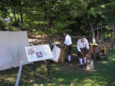
Location. 41° 14.494′ N, 73° 58.498′ W. Marker is in Stony Point, New York, in Rockland County. Marker can be reached from Stony Point Park Road, on the left when traveling east. The marker is found in the British camp located near the Stony Point Museum. Touch for map. Marker is in this post office area: Stony Point NY 10980, United States of America. Touch for directions.
Other nearby markers. At least 8 other markers are within walking distance of this marker. 17th British Regiment of Foot (here, next to this marker); Stony Point Battlefield (here, next to this marker); "I … imagined them to be British Troops, but found my mistake by being wounded and taken prisoner." (a few steps from this marker); British Defenses: The Outer Works (a few steps from this marker); Capture of Stony Point (within shouting distance of this marker); The British Occupy Stony Point
(within shouting distance of this marker); “By the light occasioned by the flash of the gun I could perceive a body of them...” (within shouting distance of this marker); Fraser’s Highlanders (about 300 feet away, measured in a direct line). Touch for a list and map of all markers in Stony Point.
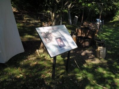
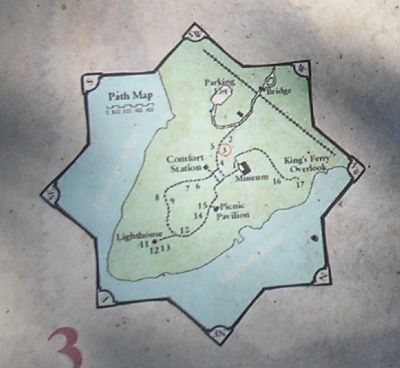
More about this marker. The upper left of the marker features an 18-century map of Stony Point Battlefield by British Lt. William Marshall 63rd Regiment of Foot with directional arrows added to indicate approximate lines of attack. Map reproduced courtesy of The Historical Society of Pennsylvania. Below this is a “Portrait of Brigadier General Anthony Wayne by Edward Savage painted in 1795. Reproduced courtesy of The New York Historical Society, New York City.” The lower left of the marker contains a map of the walking tour of the Stony Point Battlefield.
Related markers. Click here for a list of markers that are related to this marker. This series of markers follow the walking tour of the Stony Point Battlefield.
Also see . . .
1. Stony Point Battlefield State Historic Site. New York State Parks, Recreation and Historic Preservation website
entry (Submitted on September 20, 2008, by Bill Coughlin of Woodland Park, New Jersey.)
2. The Battle of Stoney (sic) Point. American Revolution War website entry (Submitted on September 20, 2008, by Bill Coughlin of Woodland Park, New Jersey.)
Credits. This page was last revised on January 16, 2022. It was originally submitted on September 20, 2008, by Bill Coughlin of Woodland Park, New Jersey. This page has been viewed 963 times since then and 20 times this year. Last updated on January 15, 2022, by Carl Gordon Moore Jr. of North East, Maryland. Photos: 1, 2, 3, 4, 5. submitted on September 20, 2008, by Bill Coughlin of Woodland Park, New Jersey. • J. Makali Bruton was the editor who published this page.
