City of Westminster in Greater London, England, United Kingdom — Northwestern Europe (the British Isles)
Royal Wedding 2011
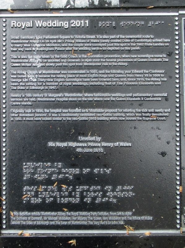
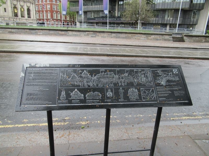
Broad Sanctuary links Parliament Square to Victoria Street. It is also part of the ceremonial route to Westminster Abbey. On 29 April 2011 Prince William of Wales (newly created Duke of Cambridge) arrived here to marry Miss Catherine Middleton, and the couple were conveyed past this spot in the 1902 State Landau on their way back to Buckingham Palace after the wedding service as depicted on this panel.
This is also the route taken by the Gold Coach in the Coronation Procession, when new sovereigns come to Westminster Abbey to be anointed and crowned. In April 2002 the funeral procession of Queen Elizabeth The Queen Mother marched slowly past this spot from Westminster Hall to the Abbey.
The Abbey Church of Westminster was consecrated in 1065, and the following year Edward the Confessor was buried here. It became the resting place of most English Kings and Queens from Henry VII in 1509 to George II in 1760. Thirty-nine English Sovereigns have been crowned here, and, since 1919, the Abbey has been the setting for a number of royal weddings, including that of The Princess Elizabeth and the Duke of Edinburgh in 1947.
Nearby is 16th century St Margaret's Westminster, where fashionable weddings and parliamentary memorial services are held. Westminster Hospital stood on the site where now the Queen Elizabeth II Conference Centre stands.
Originally built in 1834 the hospital was founded as a ‘charitable proposal for relieving the sick and needy and other distressed persons’. It was a handsomely castellated neo-Gothic building, which was finally demolished in 1950. It must have looked similar to the neo-Gothic 1913 building which now houses the Supreme Court.
His Royal Highness Prince Henry of Wales
4th June 2013
In this depiction outside Westminster Abbey, the Royal Wedding Party includes, from left to right: The Duchess of Cornwall, Mr. Michael Middleton, Her Majesty The Queen, Mrs. Middleton and the Prince of Wales. behind: The Duke of Edinburg and The Dean of Westminster, The Very Rev’d Dr John Hall.
( right end of the panel )
Jubilee Walkway route map
The Jubilee Walkway was established to commemorate the Silver Jubilee of Her Majesty Queen Elizabeth II in 1977. It encircles the centre of London, embracing many historic buildings and views. It is approximately 15 miles (24 kilometres) in length.
Follow the Jubilee Walkway by foot, using the circular Walkway plates embedded in the ground around London. For leaflets and further information on walks in London telephone xxxx xxx xxxx www.jubileewalkway.com
Erected 2013.
Topics. This historical marker is listed in this topic list: Notable Events.
Location. 51° 29.992′ N, 0° 7.705′ W. Marker is in City of Westminster, England, in Greater London. Marker is at the intersection of Victoria Street and The Sanctuary, on the right when traveling east on Victoria Street. Touch for map. Marker is in this post office area: City of Westminster, England SW1P 3BD, United Kingdom. Touch for directions.
Other nearby markers. At least 8 other markers are within walking distance of this marker. St. Margaret’s Church (about 90 meters away, measured in a direct line); Cromwell Association Memorial Tablet (about 90 meters away); Parliament Square (about 120 meters away); Richard Savage (about 150 meters away); The Beaverbrook Foundation (about 180 meters away); a different marker also named Parliament Square (about 180 meters away); Trial of William Wallace (about 210 meters away); The Jewel Tower (about 210 meters away). Touch for a list and map of all markers in City of Westminster.
Credits. This page was last revised on January 27, 2022. It was originally submitted on May 29, 2018, by Michael Herrick of Southbury, Connecticut. This page has been viewed 134 times since then and 12 times this year. Photos: 1, 2, 3. submitted on May 29, 2018, by Michael Herrick of Southbury, Connecticut.


