Sheppards in Buckingham County, Virginia — The American South (Mid-Atlantic)
Eve of Appomattox
Inscription.
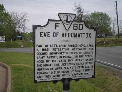
Part of Lee’s army passed here, April 8, 1865, retreating westward. The second (Humphrey’s) Corps of Grant’s army passed, in pursuit, in the afternoon of the same day. Grant spent the night here, receiving early in the morning of April 9 a note from Lee in regard to surrender. He sent a reply and then went on to Appomattox.
Erected 1930 by Conservation & Development Commission. (Marker Number F-60.)
Topics and series. This historical marker is listed in this topic list: War, US Civil. In addition, it is included in the Virginia Department of Historic Resources (DHR) series list. A significant historical month for this entry is April 1815.
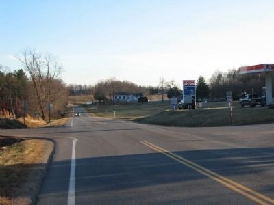
Location. 37° 23.445′ N, 78° 29.108′ W. Marker is in Sheppards, Virginia, in Buckingham County. Marker is at the intersection of James Madison Hwy (U.S. 15) and Francisco Road (Virginia Route 636), on the right when traveling south on James Madison Hwy. Touch for map. Marker is in this post office area: Farmville VA 23901, United States of America. Touch for directions.
Other nearby markers. At least 8 other markers are within 7 miles of this marker, measured as the crow flies. New Store Village (here, next to this marker); Clifton (within shouting distance of this marker); March to Appomattox (approx. 2.4 miles away); Millbrook (approx. 4 miles away); New Store (approx. 4.1 miles away); Civilian Conservation Corps Camp P-56, Company 1367 (approx. 6 miles away); Samuel P. Bolling (approx. 6.2 miles away); James F. Lipscomb (approx. 6.2 miles away). Touch for a list and map of all markers in Sheppards.
Also see . . . Lee's Retreat. Virginia's Retreat guide. (Submitted on September 28, 2008, by Bill Coughlin of Woodland Park, New Jersey.)
Credits. This page was last revised on June 16, 2016. It was originally submitted on September 28, 2008, by Bill Coughlin of Woodland Park, New Jersey. This page has been viewed 1,104 times since then and 24 times this year. Photos: 1. submitted on September 28, 2008, by Bill Coughlin of Woodland Park, New Jersey. 2. submitted on March 26, 2010, by Craig Swain of Leesburg, Virginia.

