Near Laingsburg in Clinton County, Michigan — The American Midwest (Great Lakes)
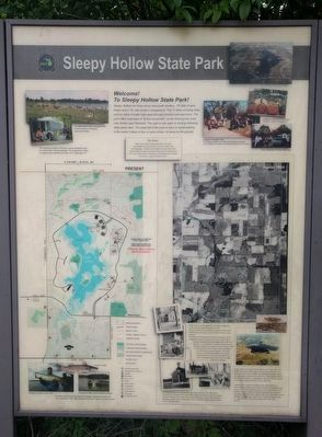
Sleepy Hollow State Park
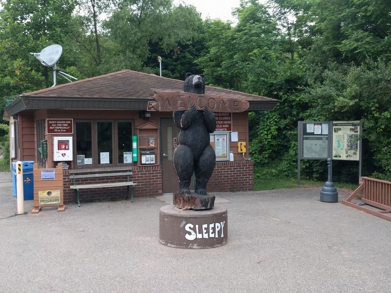
Welcome! To Sleepy Hollow State Park!
The Name
When it came time to decide the name of the park, a great debate arose between the cities of St. Johns, Elsie and Laingsburg. All three towns wanted the park to bare their name. Instead, the name was chosen from one of the landowners, I.B. Crane, whose name is reminiscent of the fictional hero Ichabod Crane of the "Legend of Sleepy Hollow."
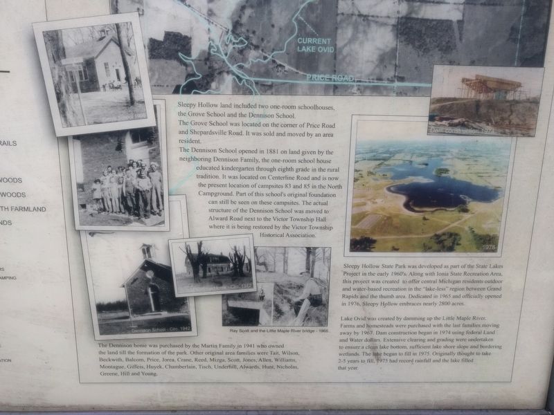
Sleepy Hollow land included two one-room schoolhouses, the Grove School and the Dennison School.
The Grove School was located on the corner of Price Road and Shepardsville Road. It was sold and moved by an area resident.
The Dennison School opened in 1881 on land given by the neighboring Dennison Family, the one-room school house educated kindergarten through eighth grade in the rural tradition. It was located on Centerline Road and is now the present location of campsites 83 and 85 in the North Campground. Part of this school's foundation can still be seen on these campsites. The actual structure of the Dennison School was moved to Alward Road next to Victor Township Hall where it is being restored by the Victor Township Historical Association.
The Dennison home was purchased by the Martin Family in 1941 who owned the land until the formation of the park. Other original area families were Tait, Wilson, Beckwith, Balcom, Price, Jorea, Crane, Reed, Mizga, Scott, Jones, Allen, Williams, Montague, Giffeis, Huyek, Chamberlain, Tisch, Underhill, Alwards, Hunt, Nicholas, Greene, Hill and Young.
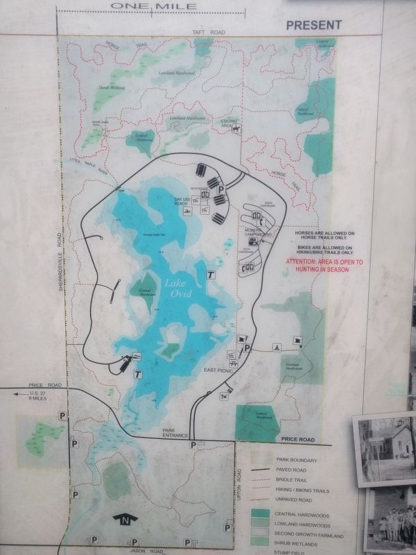
Sleepy Hollow State Park was developed as part of the State Lakes Project in the early 1960's. Along with Ionia State Recreation Area, this project was created to offer central Michigan residents outdoor and water-based recreation in the "lake-less" region between Grand Rapids and the thumb area. Dedicated in 1965 and officially opened in 1976, Sleepy Hollow embraces nearly 2800 acres.
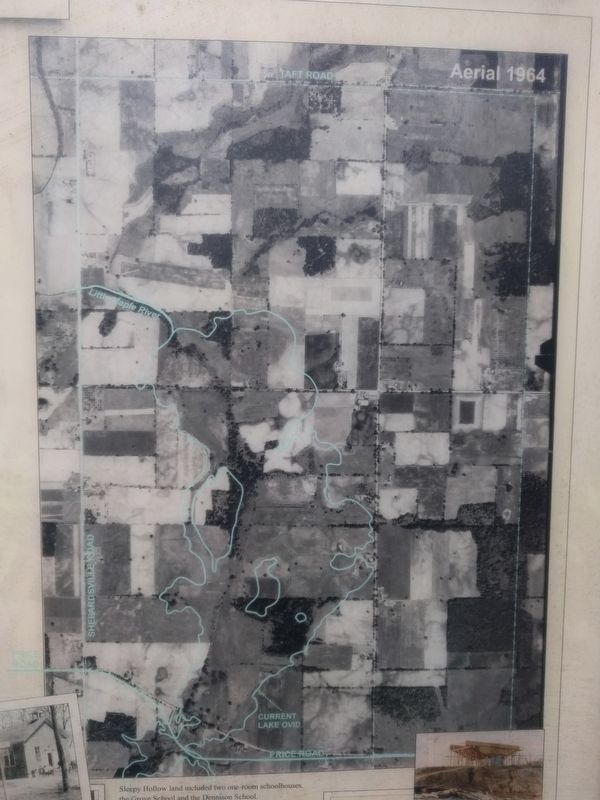
Lake Ovid was created by damming up the Little Maple River. Farms and homesteads were purchased with the last families moving away by 1967. Dam construction began in 1974 using federal Land and Water dollars. Extensive clearing and grading were undertaken to ensure a clean lake bottom, sufficient lake shore slope and bordering
Photographed By Joel Seewald, June 24, 2018
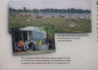
2. Closeup of Upper Left Images
Top image caption:
The swim beach area is equipped with a beach house for changing and toilet facilities.
Bottom image caption:
The campground offers 20/30 amp service camping as well as modern toilet / shower buildings. The campground is filled to capacity every weekend from May 15th to September 15th.
The swim beach area is equipped with a beach house for changing and toilet facilities.
Bottom image caption:
The campground offers 20/30 amp service camping as well as modern toilet / shower buildings. The campground is filled to capacity every weekend from May 15th to September 15th.
Topics. This historical marker is listed in this topic list: Parks & Recreational Areas. A significant historical year for this entry is 1881.
Location. 42° 56.536′ N, 84° 24.138′ W. Marker is near Laingsburg, Michigan, in Clinton County. Marker is on State Park Drive, 1˝ miles north of East Price Road, on the right. Marker is to the right of the campground registration station. Touch for map. Marker is at or near this postal address: 7835 East Price Road, Laingsburg MI 48848, United States of America. Touch for directions.
Other nearby markers. At least 8 other markers are within 5 miles of this marker, measured as the crow flies. First Professional Football Game in Michigan (approx. 4.2 miles away); Anthony Bontrager Building (approx. 4.6 miles away); Emily Kelley Building (approx. 4.6 miles away); Old Kent Bank (approx. 4.6 miles away); Ovid Veterans Memorial (approx. 4.6 miles away); George D. Sowers House (approx. 4.7 miles away); Village of Ovid / First Congregational Church of Ovid (approx. 4.7 miles away); Carriage House (approx. 4.7 miles away).
Also see . . . Sleepy Hollow State Park. (Submitted on July 2, 2018, by Joel Seewald of Madison Heights, Michigan.)
Photographed By Joel Seewald, June 24, 2018
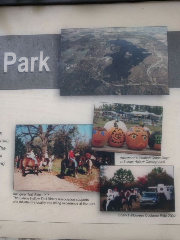
3. Closeup of Upper Right Images
Left image caption:
Inaugural Trail Ride 1997.
The Sleepy Hollow Trail Riders Association supports and maintains a quality trail riding experience at the park.
Middle right image caption:
Halloween's Ichabod Crane Days at Sleepy Hollow Campground.
Lower right image caption:
Scary Halloween Costume Ride 2002
Inaugural Trail Ride 1997.
The Sleepy Hollow Trail Riders Association supports and maintains a quality trail riding experience at the park.
Middle right image caption:
Halloween's Ichabod Crane Days at Sleepy Hollow Campground.
Lower right image caption:
Scary Halloween Costume Ride 2002
Credits. This page was last revised on July 2, 2018. It was originally submitted on July 2, 2018, by Joel Seewald of Madison Heights, Michigan. This page has been viewed 591 times since then and 98 times this year. Photos: 1, 2, 3, 4, 5, 6, 7. submitted on July 2, 2018, by Joel Seewald of Madison Heights, Michigan.
