San Diego in San Diego County, California — The American West (Pacific Coastal)
El Camino Real
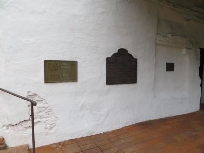
This plaque is placed on the 250th anniversary of the birth of California’s Apostle Padre Junipero Serra O.F.M., to mark the Southern terminus of El Camino Real as Padre Serra knew it and helped to blaze it.
Landmark No. 784
Erected 1963 by The California State Park Commission in cooperation with the Committee For El Camino Real, December 29, 1963. (Marker Number 784.)
Topics and series. This historical marker is listed in these topic lists: Churches & Religion • Exploration • Roads & Vehicles. In addition, it is included in the California Historical Landmarks, and the El Camino Real, “The King's Highway” (California) series lists. A significant historical date for this entry is November 24, 1840.
Location. 32° 47.056′ N, 117° 6.377′ W. Marker is in San Diego, California, in San Diego County. Marker is mounted on the front of the main building at the Mission San Diego de Acala. Touch for map. Marker is at or near this postal address: 10818 San Diego Mission Road, San Diego CA 92108, United States of America. Touch for directions.
Other nearby markers. At least 8 other markers are within 5 miles of this marker, measured as the crow flies. Mission San Diego de Alcala (here, next to this marker); The Campanario (within shouting distance of this marker); La Playa Trail (within shouting distance of this marker); The Church (within shouting distance of this marker); San Diego State University (approx. 2 miles away); The Freedom Tree (approx. 3.9 miles away); 1915-16 Isthmus (Fun Zone) (approx. 4.1 miles away); Balboa Park Carousel (approx. 4.2 miles away). Touch for a list and map of all markers in San Diego.
Also see . . .
1. California Bell. This is a commercial site for the company that manufactures the replacement bells for installation along the original El Camino Real. There is a very informative article regarding the history and current status of this historical route. (Submitted on October 1, 2008, by Syd Whittle of Mesa, Arizona.)
2. Looking Back: The Mission Bells Along the El Camino Real. San Jose Public Library website entry (Submitted on February 3, 2022, by Larry Gertner of New York, New York.)
Credits. This page was last revised on February 3, 2022. It was originally submitted on October 1, 2008, by Syd Whittle of Mesa, Arizona. This page has been viewed 2,668 times since then and 85 times this year. Photos: 1. submitted on October 1, 2008, by Syd Whittle of Mesa, Arizona. 2. submitted on April 10, 2015, by Bill Kirchner of Tucson, Arizona.

