Mammoth in Yellowstone National Park in Park County, Wyoming — The American West (Mountains)
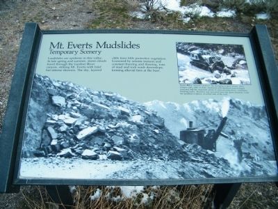
Mt. Everts Mudslides
Temporary Scenery
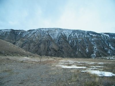
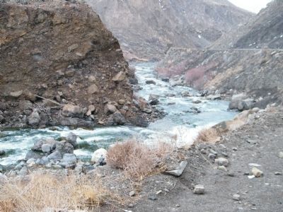
Inset photo caption - Down valley, toward Gardiner, the slumping is more severe. After a heavy rain, cliffs of shale, mudstone and sandstone turn to liquid mud and half the mountain seems to come pouring down, sometimes blocking traffic. Boulders and uprooted trees ride great distances. Look for landslide evidence on either side of the road.
Erected by National Park Service.
Topics. This historical marker is listed in this topic list: Natural Features.
Location. 44° 58.711′ N, 110° 41.523′ W. Marker is in Yellowstone National Park, Wyoming, in Park County. It is in Mammoth. Marker is on North Entrance Road (U.S. 89), on the left when traveling south. Sign is one mile north of the Albright Visitor Center at a large turnout. Touch for map. Marker is in this post office area: Yellowstone National Park WY 82190, United States of America. Touch for directions.
Other nearby markers. At least 8 other markers are within walking distance of this marker . Mail Carrier’s Cabin (approx. 0.3 miles away); From Soldier to Ranger (approx. 0.4 miles away); The Post Exchange (approx. 0.4 miles away); A Soldier’s Life (approx. 0.4 miles away); Fort Yellowstone (approx. 0.4 miles away); Fort Yellowstone National Historic Landmark (approx. 0.4 miles away); Life in the Fort (approx. 0.4 miles away); The Parade Ground (approx. 0.4 miles away). Touch for a list and map of all markers in Yellowstone National Park.
Credits. This page was last revised on February 16, 2023. It was originally submitted on February 28, 2011, by Rich Pfingsten of Forest Hill, Maryland. This page has been viewed 760 times since then and 12 times this year. Last updated on September 16, 2018, by Craig Baker of Sylmar, California. Photos: 1, 2, 3. submitted on February 28, 2011, by Rich Pfingsten of Forest Hill, Maryland. • Bill Pfingsten was the editor who published this page.


