Near Malta in Cassia County, Idaho — The American West (Mountains)
Where Trails Meet - Raft River Valley Trails
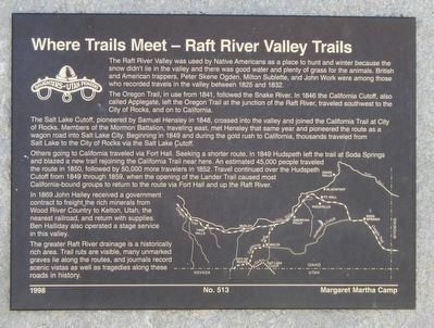
Inscription.
The Raft River Valley was used by Native Americans as a place to hunt and winter because the snow didn't lie in the valley and there was good water and plenty of grass for the animals. British and American trappers, Peter Skene Ogden, Milton Sublette, and John Work were among those who recorded travels in the valley between 1825 and 1832.
The Oregon Trail, in use from 1841, followed the Snake River. In 1846 the California Cutoff, also called Applegate, left the Oregon Trail at the junction of the junction of the Raft River, traveled southwest to the City of Rocks, and on to California.
The Salt Lake Cutoff, pioneered by Samuel Hensley in 1848, crossed into the valley and joined the California Trail at City of Rocks. Members of the Mormon Battalion, traveling east, met Hensley that same year and pioneered the route as a wagon road into Salt Lake City. Beginning in 1849 and during the gold rush to California, thousands traveled from Salt Lake to City of Rocks via the Salt Lake Cutoff.
Others going to California traveled via Fort Hall. Seeking a shorter route, in 1849 Hudspeth left the trail at Soda Springs and blazed a new trail rejoining the California Trail near here. An estimated 45,000 people traveled the route in 1850, followed by 50,000 more travelers in 1852. Travel continued over the Hudspeth Cutoff from 1849 through 1859, when the opening of the Lander Trail caused most California-bound groups to return to the route via Fort Hall and up the Raft River.
In 1869 John Hailey received a government contract to freight the rich minerals from Wood River County to Kelton, Utah, the nearest railroad, and return with supplies. Ben Halliday also operated a stage service in this valley.
The greater Raft River drainage is a historically rich area. Trail ruts are visible, many unmarked graves lie along the routes, and journals record scenic vistas as well as tragedies along these roads of history.
Erected 1998 by Daughters of Utah Pioneers, Margaret Martha Camp. (Marker Number 513.)
Topics and series. This historical marker is listed in these topic lists: Roads & Vehicles • Settlements & Settlers. In addition, it is included in the California Trail, and the Daughters of Utah Pioneers series lists. A significant historical year for this entry is 1825.
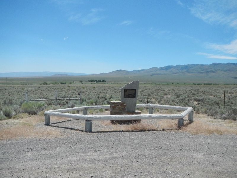
Location. 42° 17.076′ N, 113° 25.47′ W. Marker is near Malta, Idaho, in Cassia County. Marker is at the intersection of Gamble Lane (County Highway 1700 S) and State Highway 77, on the right when traveling east on Gamble Lane. Touch for map. Marker is in this post office area: Malta ID 83342, United States of America. Touch for directions.
Other nearby markers. At least 8 other markers are within 12 miles of this marker, measured as the crow flies
. California Trail - Cassia Creek (approx. 0.4 miles away); Hudspeth's Cutoff (approx. 0.6 miles away); Mc Clendon Springs (approx. 3.7 miles away); California Trail - Leaving Cassia Creek (approx. 7.2 miles away); Idahome (approx. 9 miles away); California Trail - Raft River Valley (approx. 10.2 miles away); California Trail - Summit Creek (approx. 11.1 miles away); California Trail (approx. 11.1 miles away). Touch for a list and map of all markers in Malta.
Credits. This page was last revised on September 27, 2018. It was originally submitted on September 27, 2018, by Barry Swackhamer of Brentwood, California. This page has been viewed 498 times since then and 69 times this year. Photos: 1, 2. submitted on September 27, 2018, by Barry Swackhamer of Brentwood, California.

