Falmouth in Cornwall, England, United Kingdom — Northwestern Europe (the British Isles)
Falmouth Docks
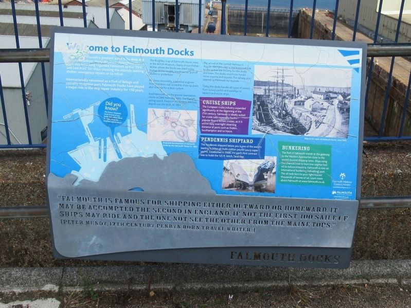
Welcome to Falmouth Docks
The port of Falmouth’s greatest asset is its deep and sheltered harbour. Amny mariners throughout the centuries have long regarded Falmouth as the “First and Last Port” for ships crossing the Atlantic seeking shelter, emergency repairs or to refuel.
Internationally renowned as a Port of Refuge and casualty reception port, Falmouth Docks have played a major role in the ship repair industry for 150 years.
The Burghley map of Falmouth Haven, now in the British Museum, clearly shows Porhan Withe, where the Docks are sited today. Porhan Withe reughly translates as port of shelter or protection.
Mr. James Abernethy, a talented engineer from Aberdeen was invited to draw up plans and costings for a dock system.
Lord Falmouth laid the granite foundation stone on 28th February1860. The Danish sailing vessel, FrederickVII became the first ship to use the docks in 1861.
The arrival of the Cornish Railway in August 1863 provided a vital transport link to the rest of the country for the docks and town. The docks could now handle more imports and exports. The railway also opened up Falmouth for tourists.
Today the docks handle all types of vessels from luxury yachts and warships to tankers and cruise ships.
Cruise Ships
The European cruise industry expanded significantly at the beginning of the 21st century. Falmouth is ideally suited for cruise calls especially for the popular Round Britain cruises, as it is within easy overnight steaming distance of ports such as Dublin, Southampton and Le Havre.
Pendennis Shipyard
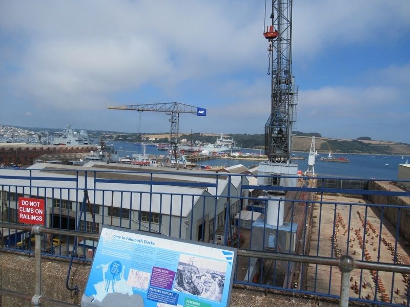
The Pendennis shipyard below you is one of the world's leading builders of multi-million pound luxury super yachts. Established in 1988, the yard's first contract was to build the 125 ft. ketch, Taramber.
Bunkering
The Port of Falmouth stands at the gateway to the Western Approaches close to the world's busiest shipping lanes. Ships using the Channel have to burn low sulphur fuel oil to reduce emissions. Falmouth is now an international bunkering (refuelling) port. The oil tank farm to your right houses thousands of tonnes of oil. Learn more about Falmouth at www.falmouth.co.uk.
Falmouth is famous for shipping either outward or homeward. It may be accompted the second in England, if not the first 100 saile of ships may ride and the one not see the other from the main tops.” [Peter Mundy, 17th century Penryn Travel Writer.]
Topics. This historical marker is listed in these topic lists: Industry & Commerce • Waterways & Vessels.
Location. 50° 9.071′ N, 5° 3.188′ W. Marker is in Falmouth, England, in Cornwall. Marker is on Pendennis Rise, 0.2 kilometers south of Castle Drive, on the right when traveling south. Touch for map. Marker is in this post office area: Falmouth, England TR11 4FB, United Kingdom. Touch for directions.
Other nearby markers. At least 8 other markers are within walking distance of this marker. National Maritime Museum Cornwall (approx. 0.6 kilometers away); Discovery Quay (approx. 0.7 kilometers away); HMS Forte IV (approx. 0.7 kilometers away); Russian Convoy Memorial (approx. 0.7 kilometers away); Killigrew Pyramid (approx. 0.7 kilometers away); The Port of Falmouth (approx. 0.9 kilometers away); Pendennis Point (approx. one kilometer away); Watching the waterline (approx. 1.1 kilometers away). Touch for a list and map of all markers in Falmouth.
Also see . . . Welcome to Falmouth. (Submitted on September 30, 2018, by Michael Herrick of Southbury, Connecticut.)
Credits. This page was last revised on January 27, 2022. It was originally submitted on September 30, 2018, by Michael Herrick of Southbury, Connecticut. This page has been viewed 216 times since then and 16 times this year. Photos: 1, 2. submitted on September 30, 2018, by Michael Herrick of Southbury, Connecticut.

