Fort Mifflin in Philadelphia in Philadelphia County, Pennsylvania — The American Northeast (Mid-Atlantic)
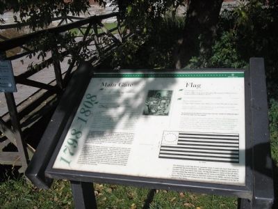
Main Gate / Flag
1798 – 1808
Main Gate
Report from the Fort
21 January 1802 • Major J.J. Ulrich Rivardi
I was speaking of the eastern Gate which is not finished yet, as I understand by General Irvine that the materials are paid for and which he has some time ago estimates made which he no doubt transmitted … The fort’s units finishing and hanging the main gate.
Report from the Fort
20 May 1807 • Lieutenant Jonathan Williams,
Inspector of Fortifications
…the entrance of the fort, which is now much expanded, moving to the injurious position of the gate, which is totally unprotected by any part of the work … The Gate is in a very imperfect state. The arch above it having been covered is beginning to decay, and the pieces at the side are carried but two thirds of the stone, already cut for finishing the Gate is lying at the landing. The position of this gate is so great a contradiction of that essential rule of fortification "that it might be in question whether instead of finishing it, it might be defended from the flank."
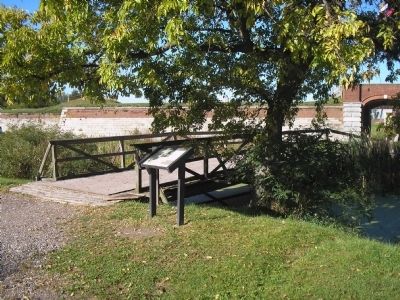
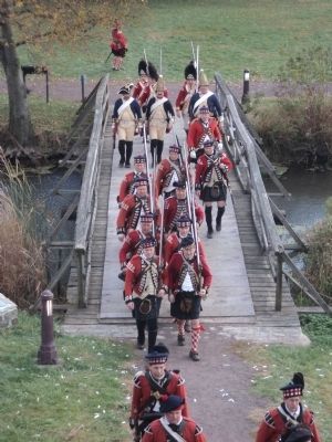
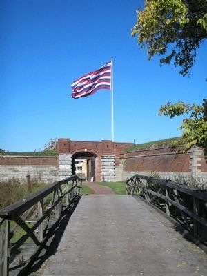
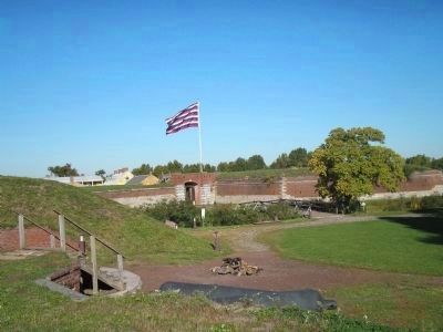
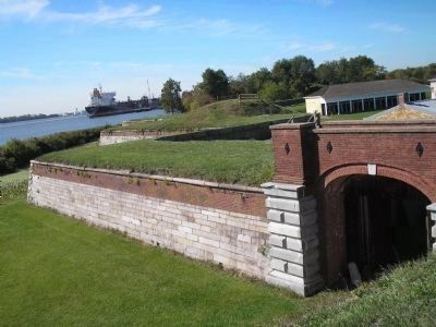
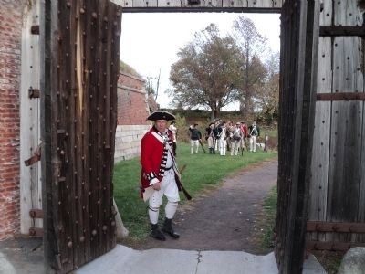
The monumental east gate that faces the Delaware was eventually finished in its original location and the doors were hung. By 1835 reports indicate that it was again in a decayed state. Repairs were completed by 1839. Evidently the gate’s design was part of L’Enfant’s overall plan begun in 1794. The gate faced the Delaware and the landing wharf of the water battery, ready to greet those who landed by ship. It is the only grand portal through the ramparts, and was the receiving entrance for horses, wagons, carts, large ordnance, marching troops, and the like.
A close look at the masonry construction of the gate and the adjoining walls readily identifies the construction periods. The eleven-foot wall of cut stone blocks to the left of the gate dates from John Montrésor’s plan of 1772 with repairs from after the Revolution. A brick extension above the stone stems from the 1794 reconstruction for the mud ramparts. The gate identifies the approximate beginning of the post Revolutionary wall. The cut marble of the gate’s piers is probably what Williams saw lying at the wharf, not yet installed even in 1807. The stone and brick wall to the right of the gate represents the newly extended wall that completes the enclosure and creates the northeast bastion housing the casemates. The narrow openings in the brick provide light and ventilation for the casemates.
Flag
Report from the Fort
27 May 1800 • Orders from Theodore Meminger to William Irvine,
Superintendent of Military Stores
One large flag for the use of the Gatehouse of Fort Mifflin
Report from the Fort
17 April 1801 • Order from Major J.J. Ulrich Rivardi, to the same
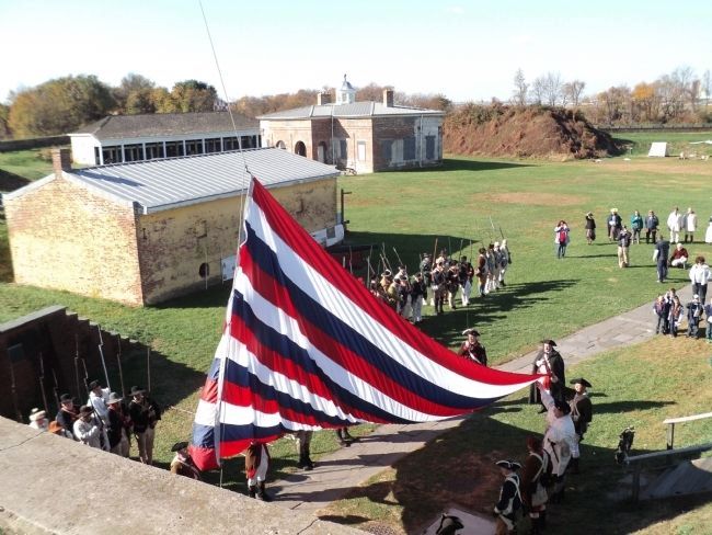
Be placed to deliver ... as much bunting as will make a flag for Fort Mifflin of thirty feet hoist and ninety feet fly.
The dimensions for this flag were revised three days later. Details for making the flag in the following design were also supplied:
I think that 55 feet in the fly will be sufficient. The hoist will be determined by the width of the Bunting, say half a yard including the same for each of the 16 stripes will make it 24 feet. The field ought to be square and formed of 8 breadths or half the hoist. The stars in my opinion look handsomer if arranged in the form of an oval, extending in the direction of the fly… As it is much wanted at the fort, I will thank you to have it made as speedily as possible.
The dimensions of the flag that Rivardi requested mean it could only have flown from an exceptionally tall and strong pole. This was probably a wooden octagonal pole placed in the same marble base that is used today. The flag that flies is a replica of the red, white, and blue striped flag depicted in drawings and art works of the Battle of Fort Mifflin in 1777. This flag has been an important symbol at Fort Mifflin, because the flying flag fooled the British and allowed time for the valiant American defenders of the fort to retreat to New Jersey.
Erected by
Fort Mifflin Historic Site.
Topics. This historical marker is listed in these topic lists: Forts and Castles • Notable Places • War, US Revolutionary. A significant historical date for this entry is January 21, 1802.
Location. 39° 52.517′ N, 75° 12.709′ W. Marker is in Philadelphia, Pennsylvania, in Philadelphia County. It is in Fort Mifflin. Marker can be reached from W Fort Mifflin Road, on the right when traveling east. The marker is near the picnic grounds at Fort Mifflin. Touch for map. Marker is at or near this postal address: 6400 Hog Island Rd, Philadelphia PA 19153, United States of America. Touch for directions.
Other nearby markers. At least 8 other markers are within walking distance of this marker. Native Plants of Fort Mifflin (here, next to this marker); What Makes Wetlands? (a few steps from this marker); Artillery (within shouting distance of this marker); Muddy Island in the Marsh (within shouting distance of this marker); Expert Fishers of Fort Mifflin (within shouting distance of this marker); Casemates or Bombproofs (within shouting distance of this marker); The Siege of Fort Mifflin (within shouting distance of this marker); Quartermaster’s Store (within shouting distance of this marker). Touch for a list and map of all markers in Philadelphia.
More about this marker. The lower right of the marker features a picture of the flag requested by Major Rivardi. It has
a “Hoist” of 24 feet and a “Fly” of 55 feet and has 16 stripes and a field with 16 stars arranged in an oval. The upper portion of the marker contains a picture of “Stone masons at work.”
Related markers. Click here for a list of markers that are related to this marker. This series of markers follow the walking tour of Fort Mifflin.
Also see . . .
1. The Fort that saved America. The Official Website of Fort Mifflin on the Delaware. (Submitted on October 14, 2008, by Bill Coughlin of Woodland Park, New Jersey.)
2. Fort Mifflin Groundplan. Layout of Fort Mifflin, the Fort that saved America. (Submitted on October 14, 2008, by Bill Coughlin of Woodland Park, New Jersey.)
Credits. This page was last revised on February 2, 2023. It was originally submitted on October 14, 2008, by Bill Coughlin of Woodland Park, New Jersey. This page has been viewed 1,142 times since then and 11 times this year. Last updated on March 13, 2021, by Carl Gordon Moore Jr. of North East, Maryland. Photos: 1, 2. submitted on October 14, 2008, by Bill Coughlin of Woodland Park, New Jersey. 3. submitted on November 10, 2013, by Bill Coughlin of Woodland Park, New Jersey. 4, 5. submitted on October 14, 2008, by Bill Coughlin of Woodland Park, New Jersey. 6. submitted on November 10, 2013, by Bill Coughlin of Woodland Park, New Jersey. 7. submitted on October 14, 2008, by Bill Coughlin of Woodland Park, New Jersey. 8. submitted on November 15, 2014, by Bill Coughlin of Woodland Park, New Jersey. • Bill Pfingsten was the editor who published this page.
