The Working Farm
Ulysses S. Grant National Historic Site
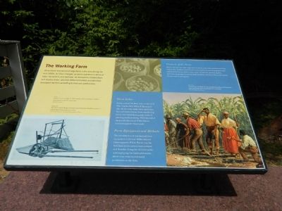
White Haven was typical of large farms in the area during the mid-1800s. As times changed, so did its operation in terms of labor, equipment, and methods. Its two owners, Colonel Dent and Ulysses Grant, also had different interests and therefore developed the farm according to their own preferences.
Farm Labor
Slaves worked the farm prior to the Civil War. Charles, Bob, Willis, William, and Jim did the daily tasks while additional free and enslaved men from neighboring farms were hired during peak times of planting and harvesting. With the end of slavery, all laborers at White Haven received wages for their work.
Farm Equipment and Methods
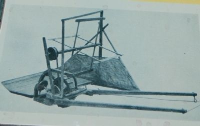
The introduction of mechanized farm equipment in the late 1830s reduced labor expenses. White Haven was the first farm in the area to have a reaper and thresher. using the choicest seeds and employing the latest philosophy about crop rotation enhanced production on the farm.
Products of the Farm
Dent's interest was cash crops such as wheat, oats, corn, potatoes, and hay sold at city markets. Grant's interests focused on producing grasses and clover for his horses. Both owners grew nectarines, peaches, apples, apricots, and grapes as well as sweet potatoes, carrots, melons, and squash for personal consumption.
Topics and series. This historical
Location. 38° 33.125′ N, 90° 21.094′ W. Marker is near Affton, Missouri, in St. Louis County. Marker can be reached from Grant Road. Touch for map. Marker is at or near this postal address: 7400 Grant Road, Saint Louis MO 63123, United States of America. Touch for directions.
Other nearby markers. At least 8 other markers are within walking distance of this marker. New Buildings for White Haven (here, next to this marker); Slaves Only (here, next to this marker); The Roads to White Haven (here, next to this marker); The White Haven Estate: Other Houses (here, next to this marker); Early Owners of the Farm (here, next to this marker); White Haven's Outbuildings (here, next to this marker); Green Haven? (here, next to this marker); Outbuildings / ~150 Years Ago—Colored Troops (within shouting distance of this marker). Touch for a list and map of all markers in Affton.
Credits. This page was last revised on April 24, 2020. It was originally submitted on September 3, 2012, by Bill Pfingsten of Bel Air, Maryland. This page has been viewed 354 times since then and 8 times this year. Last updated on October 15, 2018, by Devry Becker Jones of Washington, District of Columbia. Photos: 1, 2. submitted on September 3, 2012, by Bill Pfingsten of Bel Air, Maryland. • Andrew Ruppenstein was the editor who published this page.

