East Hanover Township near Grantville in Dauphin County, Pennsylvania — The American Northeast (Mid-Atlantic)
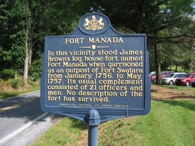
Fort Manada
Erected 1970 by Pennsylvania Historical and Museum Commission.
Topics and series. This historical marker is listed in these topic lists: Forts and Castles • War, French and Indian. In addition, it is included in the Pennsylvania Historical and Museum Commission series list. A significant historical month for this entry is January 1756.
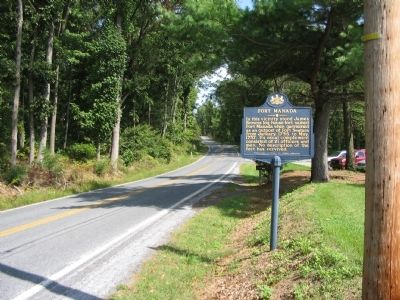
Location. 40° 23.706′ N, 76° 41.003′ W. Marker is near Grantville, Pennsylvania, in Dauphin County. It is in East Hanover Township. Marker is on Mountain Road (State Highway 443), on the right when traveling east. Located in front of the Manada Country Club. Touch for map. Marker is at or near this postal address: 9524 Mountain Rd, Grantville PA 17028, United States of America. Touch for directions.
Other nearby markers. At least 8 other markers are within 6 miles of this marker, measured as the crow flies. Hanover Church (approx. 2.3 miles away); Hanover Resolves (approx. 2˝ miles away); Union Canal (approx. 4.2 miles away); Barnett's Fort (approx. 5.2 miles away); Lindley Murray (approx. 5˝ miles away); Blue Mountain Forts (approx. 5˝ miles away); Indiantown (approx. 5.7 miles away); Indiantown Gap Military Reservation (approx. 6 miles away).
Related marker. Click here for another marker that is related to this marker. To better understand the relationship to the other Blue Mountain Forts, study the marker shown.
Also see . . . Manada Fort. From a report on the location of frontier forts, drafted in 1896. (Submitted on October 15, 2008, by Craig Swain of Leesburg, Virginia.)
Credits. This page was last revised on February 7, 2023. It was originally submitted on October 15, 2008, by Craig Swain of Leesburg, Virginia. This page has been viewed 1,767 times since then and 89 times this year. Photos: 1, 2. submitted on October 15, 2008, by Craig Swain of Leesburg, Virginia.

