Rotterdam Junction in Schenectady County, New York — The American Northeast (Mid-Atlantic)
Plotter Kill Aqueduct
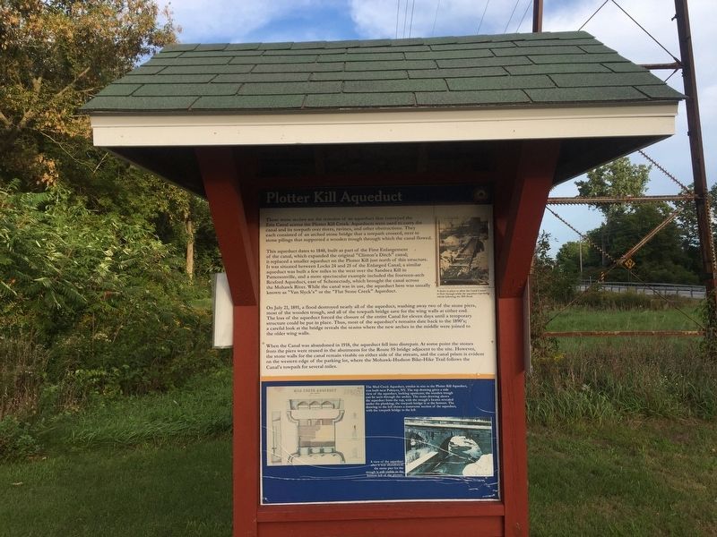
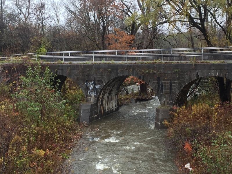
These stone arches are the remains of an aqueduct that conveyed the Erie Canal across the Plotter Kill Creek. Aqueducts were used to carry the canal and its towpath over rivers, ravines, and other obstructions. They each consisted of an arched stone bridge that a towpath crossed, next to stone pilings that supports a wooden trough through which the canal flowed.
This aqueduct dates to 1840, built as part of the First Enlargement of the canal, which expanded the original “Clinton’s Ditch” canal; it replaced a smaller aqueduct on the Plotter Kill just north of this structure. It was situated between Locks 24 and 25 of the Enlarged Canal; a similar aqueduct was built a few miles to the west over the Sandsea Kill in Pattersonville, and a more spectacular example included the fourteen-arch Rexford Aqueduct, east of Schenectady, which brought the canal across the Mohawk River. While the canal was in use, the aqueduct here was usually known as “Van Slyck’s” or the Flat Stone Creek” Aqueduct.
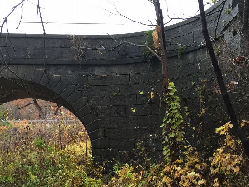
On July 21, 1890, a flood destroyed nearly all of the aqueduct, washing away two of the stone piers, most of the wooden trough, and all the towpath bridge save for the wing walls at either end. The loss of the aqueduct forced the closure of the entire Canal for eleven days until a temporary structure could be put in place. Thus, most of the aqueduct’s remains date back to the 1890’s; a careful look at the bridge reveals the seams where the new arches in the middle were joined to the older wing walls.
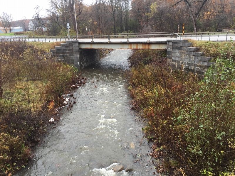
When the Canal was abandoned in 1918. The aqueduct fell into disrepair. At some point the stones from piers were reused in the abutments for the Route 5S bridge adjacent to the site. However, the stone walls for the canal remain visible on either side of the stream, and the canal prism is evident on the western edge of the parking lot, where the Mohawk-Hudson Bike-Hike Trail follows the Canal’s towpath for several miles.
Caption for upper photo: A sluice in place allow the Canal’s water to flow through the aqueduct while the aqueduct was being rebuilt following the 1891 flood.
Caption for illustration: The Mud Creek Aqueduct, similar in size to the Plotter Kill Aqueduct, was built near Palmyra, NY. The top drawing gives a side view of the aqueduct, looking upstream; the wooden trough can be seen through the arches. The Main drawing shows the aqueduct from the top, with the trough’s beams revealed under the planking; the towpath bridge is at the bottom. The drawing to the left shows a transverse section of the aqueduct, with the towpath bridge to the left.
Caption for bottom photo: A view of the aqueduct after it was abandoned; the stone pier for the trough is still visible in the bottom left of the picture.
Topics and series. This historical marker is listed in this topic list: Waterways & Vessels. In addition, it is included in the Erie Canal series list. A significant historical date for this entry is July 21, 1890.
Location. 42° 50.787′ N, 74° 0.825′ W. Marker is in Rotterdam Junction, New York, in Schenectady County. Marker is on 5S, on the left. Marker is in Kiwani's Park parking lot. Touch for map. Marker is in this post office area: Rotterdam Junction NY 12150, United States of America. Touch for directions.
Other nearby markers. At least 8 other markers are within 2 miles of this marker, measured as the crow flies. Canal Aqueduct (about 500 feet away, measured in a direct line); Pre-Columbian Cemetery (approx. 0.6 miles away); Alan Fairbanks (approx. 0.8 miles away); Jan Mabee House (approx. 1.6 miles away); a different marker also named Jan Mabee House (approx. 1.6 miles away); The Movable Dam at Lock 8 (approx. 1.7 miles away); Sacandaga Road (approx. 1.8 miles away); The Beukendaal Battle (approx. 1.8 miles away). Touch for a list and map of all markers in Rotterdam Junction.
Regarding Plotter Kill Aqueduct. The aqueduct was part of the 2nd, enlarged Erie Canal.
Related marker. Click here for another marker that is related to this marker. Aqueduct over Mud Creek, as mentioned on the marker
Also see . . . Old Plotter Kill Aqueduct - Erie Canal. The Travels of Tug 44 website entry:
Photos of the Plotter Kill Aqueduct (Submitted on May 25, 2021, by Howard C. Ohlhous of Duanesburg, New York.)
Credits. This page was last revised on July 27, 2022. It was originally submitted on November 6, 2018, by Steve Stoessel of Niskayuna, New York. This page has been viewed 582 times since then and 33 times this year. Photos: 1, 2, 3, 4. submitted on November 6, 2018, by Steve Stoessel of Niskayuna, New York. • Andrew Ruppenstein was the editor who published this page.


