Near Salt Flat in Hudspeth County, Texas — The American South (West South Central)
A Precious Resource / Un Preciado Recurso
Guadalupe Mountains National Park
(English)
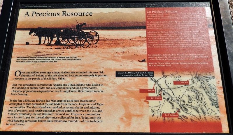
Over one million years ago a large, shallow lake occupied this area. Salt deposits left behind as the lake dried up became an extremely important resource to the people of the El Paso Valley.
Salt was considered sacred to the Apache and Tigua Indians, who used it in the tanning of animal hides and as a condiment and food preservative. Hispanic populations depended on salt to supplement their limited income from farming.
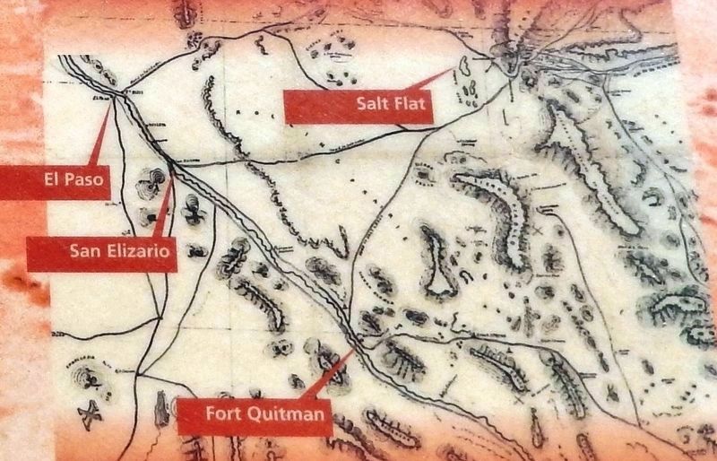
In the late 1870s, the El Paso Salt War erupted as El Paso businessmen attempted to take control of the salt beds from the local Hispanic and Tigua communities. The short-lived war resulted in several deaths and injuries, loss of property, and nearly caused an armed conflict between the U.S. and Mexico. Eventually the salt flats were claimed and Hispanic communities were forced to pay for the salt they once collected for free. Today, only the wind blowing across the barren flats remains to remind us of this turbulent time in history.
(Spanish)
Hace más de un millón de años, un lago extenso y someto ocupo esta área. Cuando se secó, quedaron expuestos depósitos de sal que pasaron a ser un recurso importante para la gente del Valle de El Paso.
La sal era sagrada para los indios Apaches y Tiguas, quienes la utilizaban para curtir pieles, y para preservar y condimentar alimentos. Los pueblos Hispanos dependían de la sal para complementar sus limitados ingresos provenientes de la agricultura.
A finales de los 1870’s, en El Paso la Guerra de Sal comenzó cuando unos empresarios intentaron tomar los depósitos de sal de comunidades Hispanas y Tigua. Este corra guerra resulto en muertes y heridos, perdidos materiales, y casi provoco un conflicto armado entre L. U. A. y México. Eventualmente, los depósitos de sal fueron reclamadas, y las comunidades Hispanas fueron forzadas a pagar por la sal que utilizaban libremente. Hoy, solo el viento que sopla por estas andas llanuras no recuerda de este turbulento suceso histórico.
Erected by National Park Service, United States Department of the Interior.
Topics. This historical marker is listed in these topic lists: Industry & Commerce • Native Americans • Settlements & Settlers.
Location. 31° 45.068′ N, 105° 1.069′ W. Marker is near Salt Flat, Texas, in Hudspeth County. Marker is on U.S. 62/180, 3.4 miles east of Ranch to Market Road 1576, on the right when traveling east. Touch for map. Marker is in this post office area: Salt Flat TX 79847, United States of America. Touch for directions.
Other nearby markers. At least 8 other markers are within 16 miles of this marker, measured as the crow flies. El Paso Salt War (a few steps from
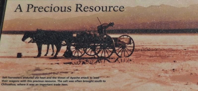
2. Marker photo: Salt harvester loading his wagon
Salt harvesters endured the heat and the threat of Apache attack to load their wagons with this precious resource. The salt was often brought south to Chihuahua, where it was an important trade item.
Los trabajadores de la sal sufrían del calor y los ataques Apaches cuando cargaban este valioso recurso. La sal era enviada a Chihuahau y el sur, donde era un importante producto comercial.
Los trabajadores de la sal sufrían del calor y los ataques Apaches cuando cargaban este valioso recurso. La sal era enviada a Chihuahau y el sur, donde era un importante producto comercial.
Also see . . .
1. El Paso Salt War. Legends of America website entry (Submitted on January 16, 2022, by Larry Gertner of New York, New York.)
2. Guadalupe Mountains National Park. National Park Service website entry (Submitted on January 7, 2019.)
Credits. This page was last revised on January 17, 2022. It was originally submitted on January 5, 2019, by Cosmos Mariner of Cape Canaveral, Florida. This page has been viewed 227 times since then and 21 times this year. Photos: 1. submitted on January 5, 2019, by Cosmos Mariner of Cape Canaveral, Florida. 2, 3, 4, 5. submitted on January 6, 2019, by Cosmos Mariner of Cape Canaveral, Florida. • Bernard Fisher was the editor who published this page.
