Marker Logo HMdb.org THE HISTORICAL
MARKER DATABASE
“Bite-Size Bits of Local, National, and Global History”
Near Columbia City in Whitley County, Indiana — The American Midwest (Great Lakes)
 

Eel River Battlefield

War of 1812


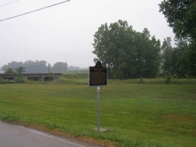
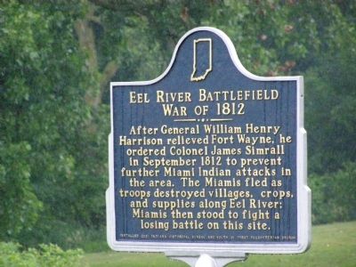
Eel River Battlefield - War of 1812 Marker image. Click for full size.
Photographed By Christopher Light, June 24, 2007
1. Eel River Battlefield - War of 1812 Marker
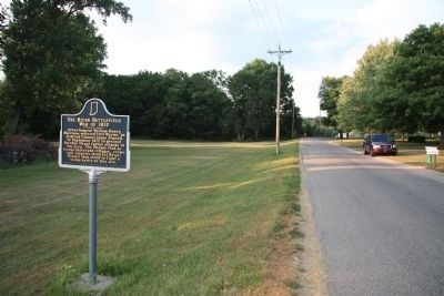
Inscription. After General William Henry Harrison relieved Fort Wayne, he ordered Colonel James Simrall in September 1812 to prevent further Miami Indian attacks in the area. The Miamis fled as troops destroyed villages, crops, and supplies along Eel River; Miamis then stood to fight a losing battle on this site.
 
Erected 2001 by Installed 2001 Indiana Historical Bureau and Youth of First Presbyterian Church. (Marker Number 92.2001.1.)
 
Topics and series. This historical marker is listed in these topic lists: Native AmericansWar of 1812. In addition, it is included in the Former U.S. Presidents: #09 William Henry Harrison, the Indian Wars Battlefield Trails, and the Indiana Historical Bureau Markers series lists. A significant historical month for this entry is September 1812.
 
Location. 41° 8.318′ N, 85° 27.412′ W. Marker is near Columbia City, Indiana, in Whitley County. Marker is on Paige Road near Raber Road. It is at the junction of S. Raber, E. Mowrey & Paige Roads at the Eel River bridge, NE corner
Paid Advertisement
Click on the ad for more information.
Please report objectionable advertising to the Editor.
Click or scan to see
this page online
along Paige Road, 2.8 miles SE of Whitley County Courthouse, Columbia City. Touch for map. Marker is in this post office area: Columbia City IN 46725, United States of America. Touch for directions.
 
Other nearby markers. At least 5 other markers are within 2 miles of this marker, measured as the crow flies. Whitley County Viet Nam Memorial (approx. 1.6 miles away); Whitley County Korean War Memorial (approx. 1.6 miles away); The Island (approx. 1.6 miles away); Old Settlers Monument (approx. 1.9 miles away); Whitley County Courthouse (approx. 2.1 miles away). Touch for a list and map of all markers in Columbia City.
 
Also see . . .
1. The Eel River of Northern Indiana. Monograph by Jay A. Taylor presented September ll, 2000 at a meeting of the Historical Society North Manchester, Indiana. (Submitted on June 27, 2007.) 

2. Eel River (Wabash River tributary). Wikipedia entry (Submitted on February 20, 2012, by Dale K. Benington of Toledo, Ohio.) 
 
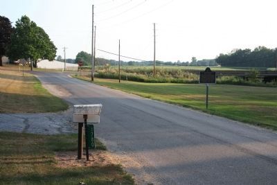
Eel River Battlefield - War of 1812 Marker image. Click for full size.
Photographed By Christopher Light, June 24, 2007
2. Eel River Battlefield - War of 1812 Marker
Eel River Battlefield - War of 1812 Marker image. Click for full size.
Photographed By Christopher Light, June 24, 2007
3. Eel River Battlefield - War of 1812 Marker
Eel River Battlefield Marker image. Click for full size.
Photographed By Dale K. Benington, July 21, 2011
4. Eel River Battlefield Marker
View of the historical marker looking south along East Paige Road towards the intersection with South Raber Road. The Raber Road bridge over the Eel River is seen in the right back corner of the picture.
Eel River Battlefield Marker image. Click for full size.
Photographed By Dale K. Benington, July 21, 2011
5. Eel River Battlefield Marker
View of the historical marker looking north along East Paige Road.
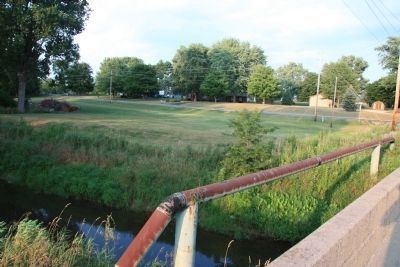
Eel River Battlefield Marker image. Click for full size.
Photographed By Dale K. Benington, July 21, 2011
6. Eel River Battlefield Marker
View from the South Raber Road Bridge over the Eel River looking east towards the distant historical marker and the low lands where the Eel River Battlefield was located.
 
 
Credits. This page was last revised on January 2, 2021. It was originally submitted on June 26, 2007, by Christopher Light of Valparaiso, Indiana. This page has been viewed 6,515 times since then and 83 times this year. Photos:   1, 2, 3. submitted on June 26, 2007, by Christopher Light of Valparaiso, Indiana.   4, 5, 6. submitted on February 20, 2012, by Dale K. Benington of Toledo, Ohio. • J. J. Prats was the editor who published this page.
Share this page.  
Share on Tumblr
m=1335

CeraNet Cloud Computing sponsors the Historical Marker Database.
This website earns income from purchases you make after using our links to Amazon.com. We appreciate your support.
Paid Advertisement
Apr. 26, 2024