Westover Hills in Richmond, Virginia — The American South (Mid-Atlantic)
Atlantic Coastline Railroad Bridge
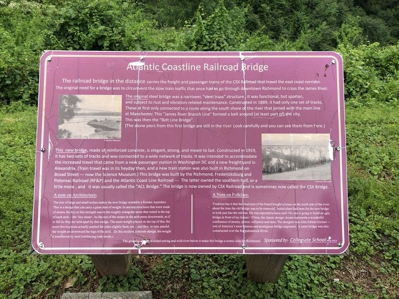
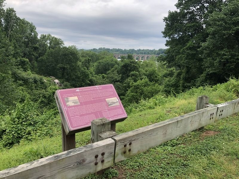
The railroad bridge in the distance carries the freight and passenger trains of the CSX Railroad that travel the east coast corridor. The original need for a bridge was to circumvent the slow train traffic that once had to go through downtown Richmond to cross and the James River.
The original steel bridge was a narrower, "steel truss" structure. It was functional, but spartan, and subject to rust and vibration-related maintenance. Constructed in 1889, it had only one set of tracks. These at first only connected to a route along the south shore of the river that joined with the main line at Manchester. This "James River Branch Line" formed a belt around (at least part of) the city. This was then the "Belt Line Bridge".
(The stone piers from this bridge are still in the river. Look carefully and you can see them from here.)
The new bridge, made of reinforced concrete, it is elegant, strong, and meant to last. Constructed in 1919, it has two sets of tracks and was connected to a wide network of tracks. It was intended to accommodate the increased travel that came from a new passenger station in Washington DC and a new freight yard in Alexandria. (Train travel was in its heyday then, and a new train station was also built in Richmond on Broad Street --- now the Science Museum.) This bridge was built by the Richmond, Fredericksburg and Potomac Railroad (RF&P) and the Atlantic Coast Line Railroad --- The latter owned the southern half, or a little more, and it was usually called the "ACL Bridge." The bridge is now owned by the CSX Railroad and is sometimes now called the CSX Bridge.
A note on Architecture:
The mix of large and small arches makes the new bridge resemble a Roman Aqueduct. This is a design that can carry a great deal of weight. In ancient structures that were made of stones, the key to this strength was in the roughly triangular stone that rested in the top of each arch -- the "key stone". As the rest of the stones in the arch press downwards, as if to fall in, they are held apart by this wedge. The more weight placed on the top of this, the more this keystone actually pushed the sides slightly back out ... and they, in turn passed the weight on downward the legs of the arch. (In this modern, concrete design, the weight is transferred by steel reinforcing rods inside.)
A Note on Folklore:
Tradition has it that the chairman of the board bought a house on the north side of the river about the time the old bridge was to be removed. Initial plans had been for the new bridge to look just like the old one. He was reported to have said "No one is going to build an ugly bridge in front of my house!"
The graceful arches, wooded setting and wild river below it make this bridge a scenic icon for Richmond.
Erected 2011 by Collegiate School.
Topics. This historical marker is listed in these topic lists: Architecture • Bridges & Viaducts • Railroads & Streetcars. A significant historical year for this entry is 1889.
Location. 37° 31.767′ N, 77° 29.494′ W. Marker is in Richmond, Virginia. It is in Westover Hills. Marker is at the intersection of Riverside Drive and Evelyn Byrd Road, on the right when traveling west on Riverside Drive. Touch for map. Marker is at or near this postal address: 5301 Riverside Drive, Richmond VA 23225, United States of America. Touch for directions.
Other nearby markers. At least 8 other markers are within walking distance of this marker. Pumps and Parties (approx. 0.6 miles away); Mule-Fueled Waterway (approx. 0.6 miles away); Water Water Everywhere (approx. 0.6 miles away); Byrd Park Pump House (approx. 0.6 miles away); Breaking Stones with Feathers (approx. 0.6 miles away); Richmond at the Falls (approx. 0.6 miles away); River & Canal (approx. 0.6 miles away); Maymont, Gilded Age Estate (approx. 0.8 miles away). Touch for a list and map of all markers in Richmond.
Credits. This page was last revised on February 1, 2023. It was originally submitted on May 11, 2019, by Devry Becker Jones of Washington, District of Columbia. This page has been viewed 528 times since then and 81 times this year. Photos: 1, 2. submitted on May 11, 2019, by Devry Becker Jones of Washington, District of Columbia.

