Near Franklin in Williamson County, Tennessee — The American South (East South Central)
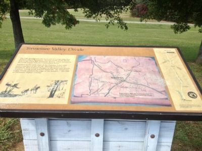
Tennessee Valley Divide
Travelers in the early days of the Natchez Trace were more conscious of the divide. Moving on foot or on horseback, they noticed changes in elevation and stream direction. Going north toward Nashville, the Tennessee Valley Divide marked the edge of the frontier — the end of Chickasaw Indian Country.
Topics and series. This historical marker is listed in this topic list: Notable Places. In addition, it is included in the Natchez Trace series list.
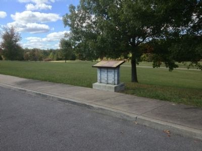
Location. 35° 50.051′ N, 87° 4.093′ W. Marker is near Franklin, Tennessee, in Williamson County. Marker is on Natchez Trace Parkway (at milepost 423.9), on the right when traveling north. Touch for map. Marker is in this post office area: Franklin TN 37064, United States of America. Touch for directions.
Other nearby markers. At least 8 other markers are within 5 miles of this marker, measured as the crow flies. Duck River Ridge Smarden and Mobley's Cut / Duck River Ridge and The Treaties of Hopewell (approx. 0.6 miles away); Boston (approx. 1.8 miles away); Bending Chestnut (approx. 2 miles away); U.S.D. 1812 (approx. 2.2 miles away); Garrison (approx. 2.8 miles away); Richard "Dick" Poyner (approx. 3.1 miles away); Greenbrier (approx. 4.2 miles away); Dr. George B. Hunter Farm / Along Leiper's Fork (approx. 4˝ miles away). Touch for a list and map of all markers in Franklin.
Also see . . . Natchez Trace Parkway. National Park Service (Submitted on October 15, 2012, by Bernard Fisher of Richmond, Virginia.)
Credits. This page was last revised on July 11, 2019. It was originally submitted on October 11, 2012, by Sandra Hughes Tidwell of Killen, Alabama, USA. This page has been viewed 776 times since then and 36 times this year. Last updated on July 9, 2019, by Larry Gertner of New York, New York. Photos: 1, 2. submitted on October 11, 2012, by Sandra Hughes Tidwell of Killen, Alabama, USA. 3, 4. submitted on June 10, 2015, by Duane Hall of Abilene, Texas. • Andrew Ruppenstein was the editor who published this page.


