Near Mansfield in Tioga County, Pennsylvania — The American Northeast (Mid-Atlantic)
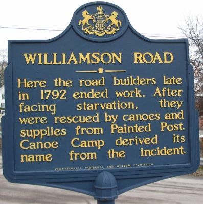
Williamson Road
Erected 1953 by Pennsylvania Historical and Museum Commission.
Topics and series. This historical marker is listed in this topic list: Roads & Vehicles. In addition, it is included in the Pennsylvania Historical and Museum Commission series list. A significant historical year for this entry is 1792.
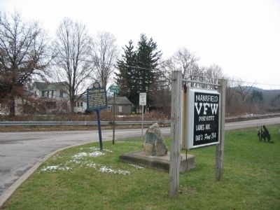
Location. 41° 46.951′ N, 77° 4.174′ W. Marker is near Mansfield, Pennsylvania, in Tioga County. Marker is at the intersection of Susquehanna Trail (Business U.S. 15) and Spencer Road, on the right when traveling south on Susquehanna Trail. Located in front of the Mansfield VFW. Touch for map. Marker is in this post office area: Mansfield PA 16933, United States of America. Touch for directions.
Other nearby markers. At least 8 other markers are within 2 miles of this marker, measured as the crow flies. Camp of the Pioneers (a few steps from this marker); Corning & Blossburg Railroad (approx. 1.6 miles away); Veterans Memorial (approx. 1.7 miles away); Mansfield Soldiers Orphan School (approx. 1.8 miles away); World War I Memorial (approx. 1.8 miles away); a different marker also named Veterans Memorial (approx. 1.8 miles away); World War Memorial (approx. 1.8 miles away); Rural Electrification (approx. 1.8 miles away). Touch for a list and map of all markers in Mansfield.
Credits. This page was last revised on June 16, 2016. It was originally submitted on December 9, 2008, by Craig Swain of Leesburg, Virginia. This page has been viewed 863 times since then and 37 times this year. Photos: 1, 2, 3. submitted on December 9, 2008, by Craig Swain of Leesburg, Virginia.


