Warsaw in Coshocton County, Ohio — The American Midwest (Great Lakes)
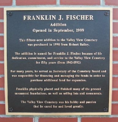
Franklin J. Fischer
Addition
— Opened in September, 1999 —
The addition is named for Franklin J. Fischer because of his dedication, commitment, and service to the Valley View Cemetery for fifty years (from 1942-1992).
For many years, he served as Secretary of the Cemetery Board and was responsible for financing and managing the funds in order to purchase additional land for expansion.
Franklin physically placed and finished many of the present monument foundations, as well as selling lots and monuments.
The Valley View Cemetery was his hobby and passion that he cared for and loved greatly.
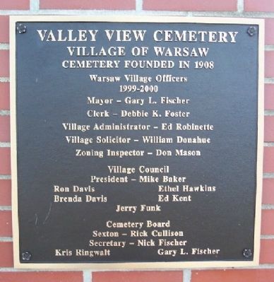
Erected 1999 by Valley View Cemetery Board.
Topics. This historical marker is listed in this topic list: Cemeteries & Burial Sites. A significant historical month for this entry is September 1999.
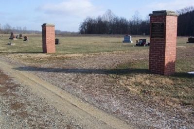
Location. 40° 19.463′ N, 82° 0.789′ W. Marker is in Warsaw, Ohio, in Coshocton County. Marker can be reached from Ohio Route 60, one mile south of Warsaw. Marker is at the rear of Valley View Cemetery. Touch for map. Marker is in this post office area: Warsaw OH 43844, United States of America. Touch for directions.
Other nearby markers. At least 8 other markers are within 8 miles of this marker, measured as the crow flies. The Founding of Warsaw, Ohio (approx. 0.8 miles away); Colonel William Simmons (approx. 0.8 miles away); The Warsaw Hotel (approx. 0.8 miles away); Scout Headquarters (approx. 0.8 miles away); The Site of White Woman’s Village (approx. 2.9 miles away); Helmick Covered Bridge (approx. 6 miles away); Arlie Dale Mullet (approx. 6 miles away); Bouquet’s Camp (approx. 7.4 miles away). Touch for a list and map of all markers in Warsaw.
Credits. This page was last revised on November 29, 2019. It was originally submitted on December 26, 2008, by William Fischer, Jr. of Scranton, Pennsylvania. This page has been viewed 1,010 times since then and 17 times this year. Photos: 1, 2, 3. submitted on December 26, 2008, by William Fischer, Jr. of Scranton, Pennsylvania. 4. submitted on March 11, 2010, by William Fischer, Jr. of Scranton, Pennsylvania. • Kevin W. was the editor who published this page.


