Near Henrico in Henrico County, Virginia — The American South (Mid-Atlantic)
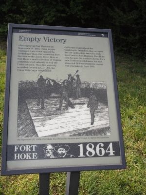
Empty Victory
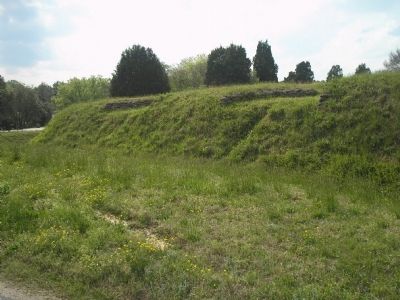
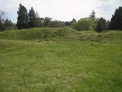
Fort Hoke – 1864
Ord’s men overwhelmed the Confederate defenders, then occupied the fort until orders arrived to withdraw back to Fort Harrison. Fort Hoke then became the southern anchor for a new Confederate defensive line that protected Richmond until the capital was evacuated in April 1865.
Erected by Richmond National Battlefield Park - National Park Service.
Topics. This historical marker is listed in this topic list: War, US Civil. A significant historical month for this entry is April 1865.
Location. This marker has been replaced by another marker nearby. It was located near 37° 25.06′ N, 77° 23.148′ W. Marker was near Henrico, Virginia, in Henrico County. Marker was at the intersection of Battlefield Park Road and Hoke Brady Road, on the left when traveling south on Battlefield Park Road. Marker is in the Fort Hoke Unit of the Richmond National Battlefield Park. Touch for map. Marker was in this post office area: Henrico VA 23231, United States of America. Touch for directions.
Other nearby markers. At least 8 other markers are within walking distance of this location. Fort Hoke: Empty Victory (within shouting distance of this marker); Storming the Fort (approx. 0.9 miles away); Well (approx. 0.9 miles away); Confederate Trenches (approx. 0.9 miles away); Bombproof and Casemate (approx. 0.9 miles away); The Fort Parapet (approx. 0.9 miles away); Bombproof (approx. 0.9 miles away); Building Fort Burnham (approx. 0.9 miles away). Touch for a list and map of all markers in Henrico.
More about this marker. The bottom of the marker features a picture of Confederate soldiers manning a cannon at Fort Hoke. It has a caption of “On September 29, 1864, Fort Hoke had about four cannon and 75 men to defend this position.”
Related marker. Click here for another marker that is related to this marker. New Marker At This Location titled "Fort Hoke: Empty Victory".
Also see . . .
1. Battlefield Tour - Ft Gilmer to Ft Brady. Richmond National Battlefield Park website. (Submitted on January 6, 2009, by Bill Coughlin of Woodland Park, New Jersey.)
2. Fort Harrison. Richmond Battlefields Fort Harrison website. (Submitted on January 6, 2009, by Bill Coughlin of Woodland Park, New Jersey.)
Credits. This page was last revised on November 5, 2021. It was originally submitted on January 6, 2009, by Bill Coughlin of Woodland Park, New Jersey. This page has been viewed 1,086 times since then and 18 times this year. Photos: 1. submitted on January 6, 2009, by Bill Coughlin of Woodland Park, New Jersey. 2. submitted on August 22, 2010, by Craig Swain of Leesburg, Virginia. 3, 4, 5. submitted on January 6, 2009, by Bill Coughlin of Woodland Park, New Jersey.


