Appomattox in Appomattox County, Virginia — The American South (Mid-Atlantic)
Grantís Pursuit
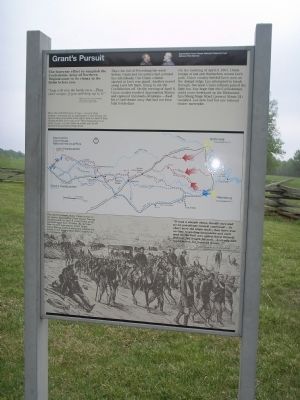
The four-year effort to vanquish the Confederate Army of Northern Virginia came to its climax in the fields before you.
“Legs will win the battle men Ö. They canít escape, if you will keep up to it.”
Maj. Gen. E.O.C.Ord, Commander, Union Army of the James, to his men on April 8, 1865
Since the fall of Petersburg the week before, Grant and his armies had pursued Lee relentlessly. One Union column slashed at Leeís rear guard. Another moved along Leeís left flank, trying to cut the Confederates off. On the evening of April 8, Union cavalry reached Appomattox Station and captured trainloads of rations – food for a Confederate army that had not been fully fed in days.
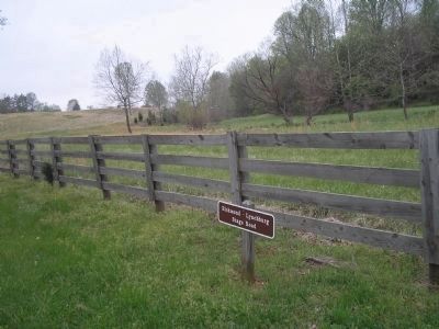
On the morning of April 9, 1865, Union troops at last put themselves across Leeís path. Union cavalry battled Leeís men on the distant ridge. Lee attempted to break through, but soon Union infantry joined the fight too. Any hope that the Confederates could move westward on the Richmond-Lynchburg Stage Road (present Route 24) vanished. Lee now had but one rational choice: surrendered.
More than 60,000 Union troops – most of three armies – pursued Lee to Appomattox Court House. On April 8 they mounted a final effort, and on April 9, they finally blocked Leeís way west. They deployed just in front of you – in the fields on either side of the Richmond-Lynchburg Stage Road.
“It was a steeple chase, hurdle race and go-as-you please contest combinedÖ So short were the stops made, that there was no time to unsling knapsacks and each man as the halt was called threw himself down at full length for restÖ A steady and rapid march for fourteen hours... ”
George W. Linn, 10th Pennsylvania, describing the Union march on April 8, 1865
Erected by Appomattox Court House National Historical Park, National Park Service, Dept. of the Interior.
Topics. This historical marker is listed in this topic list: War, US Civil. A significant historical month for this entry is April 1934.
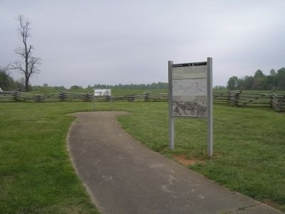
Location. 37° 22.387′ N, 78° 49.022′ W. Marker is in Appomattox, Virginia, in Appomattox County. Marker is on Old Courthouse Road (Virginia Route 24), on the left when traveling west. Marker is in the Appomattox Court House National Historical Park, near the western entrance to the park. Touch for map. Marker is in this post office area: Appomattox VA 24522, United States of America. Touch for directions.
Other nearby markers. At least 8 other markers are within walking distance of this marker. Battle of Appomattox Station (a few steps from this marker); ďMessage of PeaceĒ (a few steps from this marker); Heritage Garden (approx. half a mile away); North Carolina Monument (approx. 0.6 miles away); a different marker also named The North Carolina Monument (approx. 0.6 miles away); Raine Cemetery and Monument (approx. 0.7 miles away); North Carolina (approx. 0.7 miles away); Confederate Artillery Position (approx. ĺ mile away). Touch for a list and map of all markers in Appomattox.
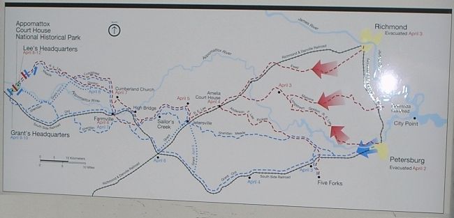
More about this marker. The bottom of the marker contains a picture of Federal troops on the march. It has a caption of “This sketch (below) shows Union troops on the road to Appomattox Court House. During the final push on April 8, some Union units marched more than 35 miles. By the time they reached Appomattox Court House, many Federal soldiers were only slightly less fatigued and hungry than their Confederate counterparts.” Above this is a map showing the Confederate Retreat and Union pursuit from Petersburg to Appomattox Court House, indicating encounters along the way.
Also see . . .
1. Appomattox Court House National Historic Park. National Park Service website. (Submitted on January 21, 2009, by Bill Coughlin of Woodland Park, New Jersey.)
2. Appomattox Court House
. CWSAC Battle Summaries website. (Submitted on January 21, 2009, by Bill Coughlin of Woodland Park, New Jersey.)
Credits. This page was last revised on March 25, 2021. It was originally submitted on January 21, 2009, by Bill Coughlin of Woodland Park, New Jersey. This page has been viewed 1,079 times since then and 10 times this year. Photos: 1, 2, 3, 4. submitted on January 21, 2009, by Bill Coughlin of Woodland Park, New Jersey. 5. submitted on March 25, 2021, by Bradley Owen of Morgantown, West Virginia.
