Marker Logo HMdb.org THE HISTORICAL
MARKER DATABASE
“Bite-Size Bits of Local, National, and Global History”
West Sacramento in Yolo County, California — The American West (Pacific Coastal)
 

Tower Bridge

West Sacramento River Walk


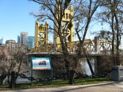
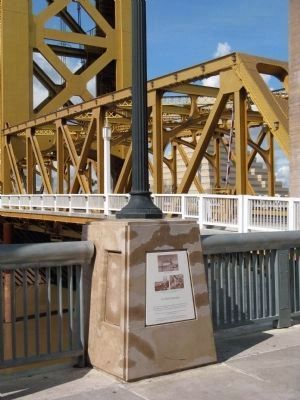
Tower Bridge Marker image. Click for full size.
Photographed By Syd Whittle, January 29, 2009
1. Tower Bridge Marker
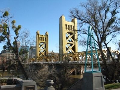
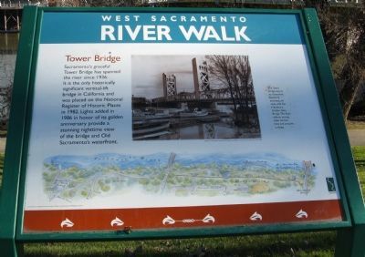
Inscription. Sacramento’s graceful Tower Bridge has spanned the river since 1936. It is the only historically significant vertical-lift bridge in California and was placed on the National Register of Historic Places in 1982. Lights added in 1986 in honor of its golden anniversary provide a stunning nighttime view of the bridge and Old Sacramento’s waterfront.

The Tower Bridge shares its streamline Moderne architectural style with San Francisco’s Golden Gate Bridge. This style reflects strong, clean vertical lines and smooth surfaces.
 
Erected by City of West Sacramento.
 
Topics. This historical marker is listed in these topic lists: ArchitectureBridges & ViaductsWaterways & Vessels. A significant historical year for this entry is 1936.
 
Location. 38° 34.879′ N, 121° 30.569′ W. Marker is in West Sacramento, California, in Yolo County. Marker is located on the “River Walk” at River Walk Park on the Sacramento River. The park is located at the end of the 600 block of 2nd Street. Touch for map. Marker is in this post office area: West Sacramento CA 95605, United States of America. Touch for directions.
 
Other nearby markers. At least 8 other markers are within walking distance of this marker. A different marker also named Tower Bridge (within shouting distance of this marker); Salmon Cannery (about 700 feet away, measured in a direct line); First Pacific Coast Salmon Cannery
Paid Advertisement
Click on the ad for more information.
Please report objectionable advertising to the Editor.
Click or scan to see
this page online
(about 700 feet away); The Rivers’ Flow (about 700 feet away); Hydraulic Mining (about 700 feet away); Pony Express Bridge (about 700 feet away); Veterans Plaza (about 700 feet away); a different marker also named The Tower Bridge (about 800 feet away). Touch for a list and map of all markers in West Sacramento.
 
Tower Bridge Marker with the Tower Bridge in the Background image. Click for full size.
Photographed By Syd Whittle, January 29, 2009
2. Tower Bridge Marker with the Tower Bridge in the Background
Tower Bridge Looking East Toward Sacramento image. Click for full size.
Photographed By Syd Whittle, January 29, 2009
3. Tower Bridge Looking East Toward Sacramento
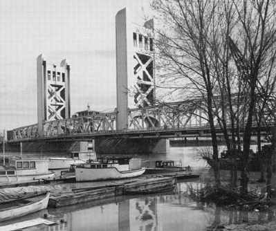
Photo on Marker image. Click for full size.
California State Library, Calif. History Section, March 15, 1936
4. Photo on Marker
Tower Bridge from the West March 15, 1936
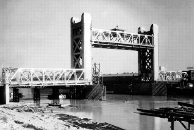
Tower Bridge from the West - Under Construction image. Click for full size.
California State Library, Calif. History Section, circa 1935
5. Tower Bridge from the West - Under Construction
November 1935
The Tower Bridge Marker image. Click for more information.
Photographed By Syd Whittle, February 24, 2009
6. The Tower Bridge Marker
Marker located at the River Front Promenade in Old Sacramento

Click for more information.
 
 
Credits. This page was last revised on January 3, 2020. It was originally submitted on January 29, 2009, by Syd Whittle of Mesa, Arizona. This page has been viewed 2,545 times since then and 44 times this year. Photos:   1, 2, 3, 4, 5. submitted on January 29, 2009, by Syd Whittle of Mesa, Arizona.   6. submitted on February 26, 2009, by Syd Whittle of Mesa, Arizona.
Share this page.  
Share on Tumblr
m=15711

CeraNet Cloud Computing sponsors the Historical Marker Database.
This website earns income from purchases you make after using our links to Amazon.com. We appreciate your support.
Paid Advertisement
Apr. 26, 2024