Cumberland Township near Gettysburg in Adams County, Pennsylvania — The American Northeast (Mid-Atlantic)
High Water Mark Walking Tour
July 3, 1863 - Third Day
Maj. Edmund Rice, U.S.A.
19th Massachusetts Infantry
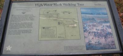
The green trail to your left leads to the scene of the climax of Pickett's Charge, the decisive action widely known as the "High Water Mark of the Confederacy." Historic sites along the way include General Meade's headquarters, the Angle, the Copse of Trees, and the Brian Farm.
The one-mile loop walk requires about 45 minutes. Wayside exhibits describe major historic features and events. In addition, a self-guiding brochure with a map of the walking tour is available in the Cyclorama Center behind you.
For your safety, and the protection of the park's resources, please do not climb on cannon or monuments. Watch for traffic at tour road crossings.
Erected by Gettysburg National Military Park.
Topics. This historical marker is listed in this topic list: War, US Civil.
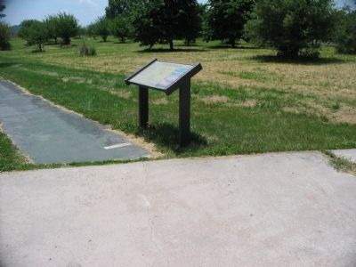
Location. 39° 48.928′ N, 77° 14.068′ W. Marker is near Gettysburg, Pennsylvania, in Adams County. It is in Cumberland Township. Marker can be reached from Hancock Avenue, on the right when traveling north. Located on the west side of the Cyclorama Building in Gettysburg National Military Park. Touch for map . Marker is in this post office area: Gettysburg PA 17325, United States of America. Touch for directions.
Other nearby markers. At least 8 other markers are within walking distance of this marker. Abraham Brian Farm (within shouting distance of this marker); Battery F, Fifth U.S. Artillery (within shouting distance of this marker); The Brian Farm (within shouting distance of this marker); Ninth Massachusetts Battery (within shouting distance of this marker); Third Brigade (within shouting distance of this marker); Third Division (within shouting distance of this marker); 107th Regiment Pennsylvania Infantry (within shouting distance of this marker); 111th New York Infantry (within shouting distance of this marker). Touch for a list and map of all markers in Gettysburg.
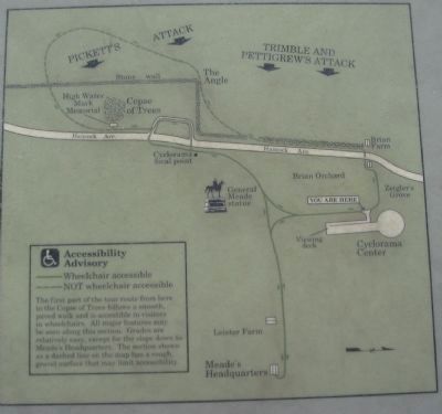
More about this marker. In the center of the marker is a map of the walking tour route. On the right is a section of the Cyclorama painting. The High Water Mark Walking Tour leads through the heart of the landscape depicted in this section of the Gettysburg Cyclorama painting. It was here on the afternoon of July 3, 1863, that Lee's second invasion of the North was decisively stopped.
Regarding High Water Mark Walking Tour. The Cyclorama building mentioned in the marker text is now closed. The painting was moved to the new Gettysburg

Photographed By Craig Swain, December 27, 2008
2. Tour Map
The map carries the following advisory:
The first part of the tour route from here to the Copse of Trees follows a smooth, paved walk and is accessible to visitors in wheelchairs. All major features may be seen along this section. Grades are relatively easy, except for the slope down to Meade's Headquarters. The section shown as a dashed line on the map has a rough, gravel surface that may limit accessibility.
The first part of the tour route from here to the Copse of Trees follows a smooth, paved walk and is accessible to visitors in wheelchairs. All major features may be seen along this section. Grades are relatively easy, except for the slope down to Meade's Headquarters. The section shown as a dashed line on the map has a rough, gravel surface that may limit accessibility.
Credits. This page was last revised on February 7, 2023. It was originally submitted on February 10, 2009, by Craig Swain of Leesburg, Virginia. This page has been viewed 1,072 times since then and 30 times this year. Photos: 1, 2, 3. submitted on February 10, 2009, by Craig Swain of Leesburg, Virginia.

