Cumberland Township near Gettysburg in Adams County, Pennsylvania — The American Northeast (Mid-Atlantic)
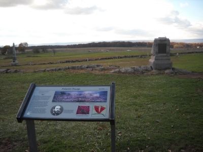
Pickett's Charge
July 3, 1863 - Third Day
"I felt proud of that charging column of Americans, even though they were rebels.... They were citizen soldiers, American volunteers."
1st Lt. Benjamin F. Rittenhouse U.S.A.
5th U.S. Artillery, Battery D
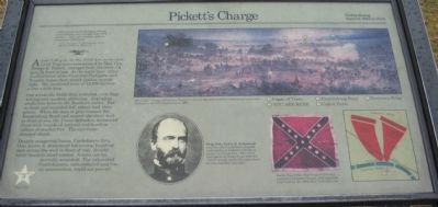
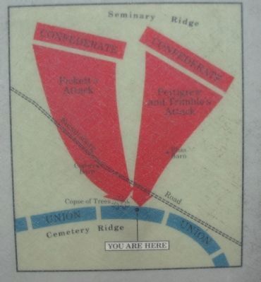
About 3:00 p.m. on the third day, more than 5,000 Virginians commanded by Maj. Gen. George E. Pickett, emerged from the trees 3/4 mile in front of you. At the same time other Confederates under Generals Pettigrew and Trimble began their attack farther to your right. The combined force of 12,000 formed a line a mile long.
Out across the fields they marched, with flags waving and muskets glittering. Exploding shells tore holes in the Southern ranks. But as dead and wounded fell, others took their places. When the men in gray crossed the Emmitsburg Road and neared the stone wall in front of you, the Union defenders decimated them with rounds of canister and horrible volleys of musket fire. The survivors charged ahead.
Despite staggering losses, Confederate Brig. Gen. Lewis A. Armistead led several hundred men across the wall in front of you. Amidst bitter hand-to-hand combat, Armistead fell mortally wounded. The exhausted Confederates, outnumbered and low on ammunition, could not prevail.
Erected by Gettysburg National Military Park.
Topics. This historical marker is listed in this topic list: War, US Civil. A significant historical date for this entry is July 3, 1863.
Location. This marker has been replaced by another marker nearby. It was located near 39° 48.771′ N, 77° 14.136′ W. Marker was near Gettysburg, Pennsylvania, in Adams County. It was in Cumberland Township. Marker was on Hancock Avenue, on the left when traveling north. Located near the "Copse of Trees" on Cemetery Ridge in Gettysburg National Military Park. Touch for map. Marker was in this post office area: Gettysburg PA 17325, United States of America. Touch for directions.
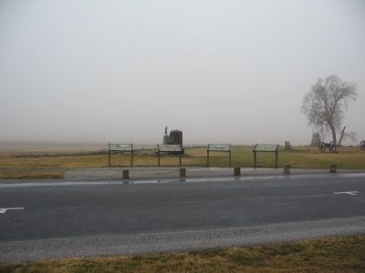
Other nearby markers. At least 8 other markers are within walking distance of this location. A Change in Plans (here, next to this marker); A Thunderous Duel (here, next to this marker); Against All Odds (here, next to this marker); Death at the Wall (here, next to this marker); 72nd Regiment Pennsylvania Volunteers (a few steps from this marker); First Pennsylvania Cavalry (a few steps from this marker); Major General Alexander Webb (a few steps from this marker); Second Brigade (within shouting distance of this marker). Touch for a list and map of all markers in Gettysburg.
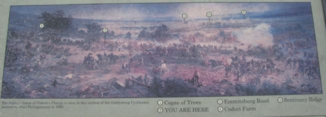
More about this marker. In the upper center is a section of the Gettysburg Cyclorama painting: The furious climax of Pickett's Charge is seen in this section of the Gettysburg Cyclorama painted by Paul Philippoteaux in 1883.
(1) Copse of Trees
(2) You are here
(3) Emmitsburg Road
(4) Codori Farm
(5) Seminary Ridge
In the lower center is a portrait of Brig. Gen. Lewis A. Armistead who was the only Confederate brigade commander in Pickett's Charge to pierce the Union line. The small monument in front of you with the "scroll" design marks the spot where he was mortally wounded.
Also in the lower center is a photo of Battle flag of the 18th Virginia Infantry carried in Pickett's Charge, and captured near here by the 59th new York Infantry. To the lower right is a map depicting the route of the Confederate charge.
Related marker. Click here for another marker that is related to this marker. New Marker At This Location titled "A Thunderous Duel".
Credits. This page was last revised on February 7, 2023. It was originally submitted on February 14, 2009, by Craig Swain of Leesburg, Virginia. This page has been viewed 1,966 times since then and 28 times this year. Photos: 1, 2, 3, 4. submitted on February 14, 2009, by Craig Swain of Leesburg, Virginia. 5. submitted on November 14, 2010, by Bill Coughlin of Woodland Park, New Jersey.
