Near Boyds in Montgomery County, Maryland — The American Northeast (Mid-Atlantic)
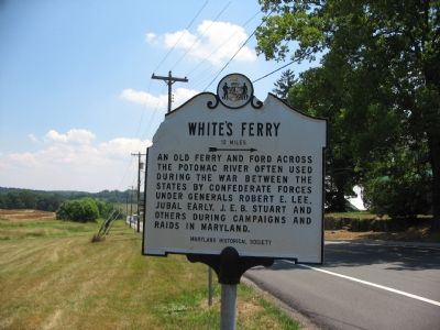
White’s Ferry
12 miles →
Erected by Maryland Historical Society.
Topics. This historical marker is listed in this topic list: War, US Civil.
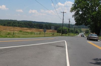
Location. 39° 7.732′ N, 77° 20.592′ W. Marker is near Boyds, Maryland, in Montgomery County. Marker is at the intersection of Darnestown Road (Maryland Route 28) and Whites Ferry Road (Maryland Route 107), on the right when traveling west on Darnestown Road. Touch for map. Marker is at or near this postal address: 16505 Darnestown Rd, Boyds MD 20841, United States of America. Touch for directions.
Other nearby markers. At least 8 other markers are within 4 miles of this marker, measured as the crow flies. A Mixed Community (approx. 1½ miles away); How the Mill Worked (approx. 1½ miles away); Black Rock Mill and Great Seneca Creek (approx. 1½ miles away); The Cliff Bland Recreation Area (approx. 3 miles away); Darnestown (approx. 3 miles away); The Historic St. Paul Community Church (approx. 3 miles away); The Signal Corps and Wartime Communications (approx. 3.3 miles away); The Civil War in Darnestown (approx. 3.3 miles away).
Credits. This page was last revised on February 23, 2023. It was originally submitted on July 14, 2007, by Craig Swain of Leesburg, Virginia. This page has been viewed 1,732 times since then and 51 times this year. Photos: 1, 2, 3. submitted on July 14, 2007, by Craig Swain of Leesburg, Virginia. • J. J. Prats was the editor who published this page.


