Lanexa in New Kent County, Virginia — The American South (Mid-Atlantic)
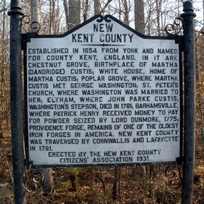
New Kent County
Erected 1931 by New Kent County Citizens' Association.
Topics. This historical marker is listed in these topic lists: Colonial Era • Political Subdivisions • Settlements & Settlers. A significant historical year for this entry is 1654.
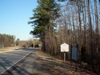
Location. 37° 25.437′ N, 76° 53.628′ W. Marker is in Lanexa, Virginia, in New Kent County. Marker is on Pocahontas Trail (U.S. 60) 0.1 miles east of Creeks End Road, on the right when traveling east. Touch for map. Marker is in this post office area: Lanexa VA 23089, United States of America. Touch for directions.
Other nearby markers. At least 8 other markers are within 4 miles of this marker, measured as the crow flies. Diascund Bridge (here, next to this marker); Liberty Baptist Church (within shouting distance of this marker); Cooper's Mill (about 300 feet away, measured in a direct line); Tyree's Plantation (about 300 feet away); Fort James (approx. 1.2 miles away); Chickahominy Water Trail (approx. 2.6 miles away); Old Stage Road (approx. 3.4 miles away); New Kent County / James City County (approx. 3.4 miles away). Touch for a list and map of all markers in Lanexa.
Also see . . . New Kent County Virginia History. (Submitted on March 7, 2009.)
Credits. This page was last revised on November 10, 2021. It was originally submitted on March 7, 2009, by Bernard Fisher of Richmond, Virginia. This page has been viewed 960 times since then and 22 times this year. Photos: 1, 2. submitted on March 7, 2009, by Bernard Fisher of Richmond, Virginia.

