University District in Columbus in Franklin County, Ohio — The American Midwest (Great Lakes)
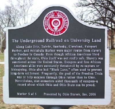
The Underground Railroad on University Land
Inscription.
Along Lake Erie, Toledo, Sandusky, Cleveland, Fairport Harbor, and Ashtabula Harbor were major routes from slavery to freedom in Canada. Even though African Americans lived throughout the state, Ohio itself was not really safe. Slavery was sanctioned across the United States. Escapees and free African Americans alike were constantly threatened by re-capture or kidnapping. Ohio also had “Black Laws,” often used to prevent long-term settlement. Frequently, the goal of the Freedom Train was to help escapees through Ohio rather than to Ohio. Nevertheless, stationmasters aided thousands of escapees - a record about which Ohio and Ohio State can be proud.
Erected 2006 by Ohio Staters, Inc. (Marker Number 5 of 5.)
Topics. This historical marker is listed in these topic lists: Abolition & Underground RR • African Americans • Education.
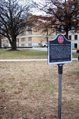
Location. 39° 59.882′ N, 83° 0.59′ W. Marker is in Columbus, Ohio, in Franklin County. It is in the University District. Marker is at the intersection of College Road and Hagerty Drive, on the left when traveling north on College Road. Marker is about 200 feet west of the Ohio Union, on The Ohio State University campus. Touch for map. Marker is in this post office area: Columbus OH 43210, United States of America. Touch for directions.
Other nearby markers. At least 8 other markers are within walking distance of this marker. A different marker also named The Underground Railroad on University Land (about 500 feet away, measured in a direct line); Block "O" Fire Pit (about 500 feet away); Browning Amphitheatre / The Outdoor Performance Center (approx. 0.2 miles away); The Ohio State University (approx. 0.2 miles away); a different marker also named The Underground Railroad on University Land (approx. 0.2 miles away); Tradition (approx. ¼ mile away); University Hall (approx. 0.3 miles away); Athletes (approx. 0.3 miles away). Touch for a list and map of all markers in Columbus.
Credits. This page was last revised on February 3, 2023. It was originally submitted on March 12, 2009, by William Fischer, Jr. of Scranton, Pennsylvania. This page has been viewed 1,494 times since then and 29 times this year. Photos: 1, 2. submitted on March 12, 2009, by William Fischer, Jr. of Scranton, Pennsylvania. • Christopher Busta-Peck was the editor who published this page.

