Concord in Contra Costa County, California — The American West (Pacific Coastal)
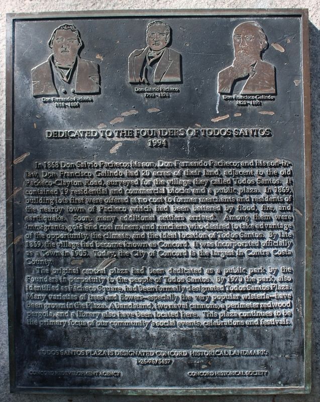
Dedicated to the Founders of Todos Santos
1994
Inscription.
{pictured above on the marker (left to right), Don Fernando Pacheco, 1818-1884; Don Salvio Pacheco, 1793-1876; Don Francisco Galindo, 1820-1891}
In 1868 Don Salvio Pacheco; his son, Don Fernando Pacheco; and his son-in-law, Don Francisco Galindo had 20 acres of land, adjacent to the old Pacheco-Clayton road, surveyed for the village they called Todos Santos. It contained 19 residential and commercial blocks and a public plaza. In 1869 building lots were offered at no cost to former merchants and residents of the nearby town of Pacheco which had been battered by flood, fire, and earthquake. Soon many additional settlers arrived. Among them were immigrants - gold and coal miners, and ranchers who desired to take advantage of the opportunity, the climate, and the ideal location of Todos Santos. By 1869, the village had become known as Concord. It was officially incorporated in 1905. Today the City of Concord is the largest in Contra Costa County.
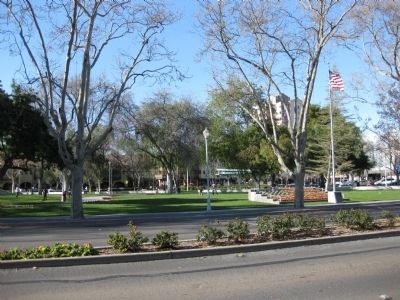
The original central plaza had been dedicated as a public park by the Founders in perpetuity to the people of Todos Santos. By 1970, the park, also identified as Pacheco Square, had been formally designated Todos Santos Plaza. Many varieties of trees and flowers -- especially the very popular wisteria -- have been grown in the plaza. A bandstand, two naval cannons, a perimeter redwood pergola, and a library have also been located here. This plaza continues to be the focus of our community's social events, celebrations and festivals.
Todos Santo Plaza is designated Concord Historical Landmark
1-26-76/5457
Concord Redevelopment Agency • Concord Historical Society
Erected 1994 by Concord Redevelopment Agency and the Concord Historical Society.
Topics. This historical marker is listed in these topic lists: Hispanic Americans • Notable Places. A significant historical year for this entry is 1868.
Location. 37° 58.615′ N, 122° 2.013′ W. Marker is in Concord, California, in Contra Costa County. Marker is on Willow Pass Road near Grant Street, on the left when traveling east. Touch for map. Marker is in this post office area: Concord CA 94520, United States of America. Touch for directions.
Other nearby markers. At least 8 other markers are within walking distance of this marker. About Don Salvio Pacheco (within shouting distance of this marker); County Fire House (about 300 feet away, measured in a direct line); Perry House (approx. 0.2 miles away); Old Fire Hall (approx. 0.2 miles away); Bibber House (approx. 0.2 miles away); Neustaedter House (approx. 0.2 miles away); Alves House (approx. 0.2 miles away); Barnett House (approx. 0.2 miles away). Touch for a list and map of all markers in Concord.
More about this marker

Photographed By Andrew Ruppenstein, March 22, 2009
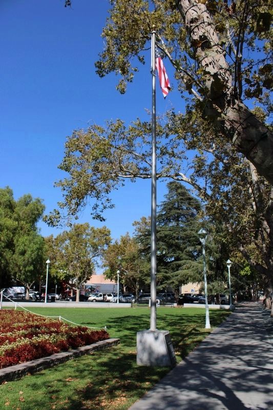
2. View of Todos Santos Plaza (Marker visible on base of the flagpole)
The plaza is about 2.5 acres. According to the Concord Historical Society's Historical Walking Tour Guide, the plaza's 1993-1994 renovation was the square's seventh major renovation.
Credits. This page was last revised on September 18, 2022. It was originally submitted on March 29, 2009, by Andrew Ruppenstein of Lamorinda, California. This page has been viewed 2,153 times since then and 29 times this year. Photos: 1. submitted on September 15, 2022, by Joseph Alvarado of Livermore, California. 2. submitted on March 29, 2009, by Andrew Ruppenstein of Lamorinda, California. 3. submitted on September 15, 2022, by Joseph Alvarado of Livermore, California. • Bill Pfingsten was the editor who published this page.

