Cumberland in Allegany County, Maryland — The American Northeast (Mid-Atlantic)
Palisado Fort or Stockade
— Fort Cumberland Trail —
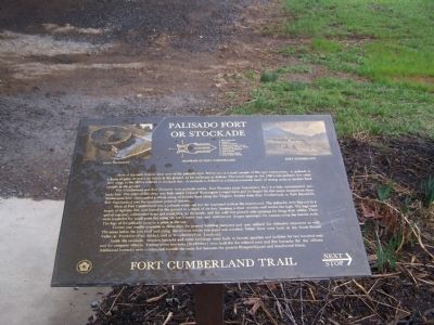
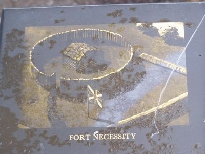
Fort Cumberland and Fort Necessity were palisado works. Fort Necessity (near Uniontown, Pa.) is a fully reconstructed palisado fort. The original fort there was built under Colonel Washington's supervision and he fought his first major engagement there. Washington later commanded a whole string of frontier forts along the Virginia frontier from Fort Cumberland to Fort Dinwiddie. Fort Cumberland was the outermost point of defense.
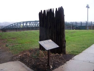
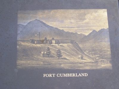
Most of Fort Cumberland was a palisado work--all but the bastioned work at the western end. The palisades were logs cut to a length of eighteen feet, and buried in the ground to a depth of six feet, forming a close wooden wall twelve feet high. The logs were spiked together, with leather strips and metal pins, on the inside, and the wall was pierced with openings for firing from within. There were loopholes for small arms fire along the fort's entire face and embrazures (large openings) for cannon along the bastion walls. The logs of the palisade came to a point at the top.
Timber was readily available in those days for general building purposes and was utilized for defensive structures as well. The areas below the fort bluff and along the streams where you stand was wooded. Other forts were built in the South Branch Valley, at Frankfort (Fort Ashby), and at Winchester (Fort Loudoun)
Inside the stockade, wooden barracks and other buildings were built to furnish quarters and facilities for two hundred men and the company officers. Twenty-seven barracks (15x20 feet) were built for the enlisted men and five barracks for the officers. Additional barracks were constructed outside the main fort between the present Prospect Square and Smallwood Street.
Fort Cumberland Trail
Topics. This historical marker is listed in these topic lists: Forts and Castles • War, French and Indian.
Location. 39° 38.946′ N, 78° 45.896′ W. Marker is in Cumberland, Maryland, in Allegany County. Marker can be reached from Greene St.. Marker is in Riverside Park. Touch for map. Marker is in this post office area: Cumberland MD 21502, United States of America. Touch for directions.
Other nearby markers. At least 8 other markers are within walking distance of this marker. Our Local Indian Heritage (within shouting distance of this marker); Col. Joshua Fry (within shouting distance of this marker); Cumberland Gateway Westward (within shouting distance of this marker); Headquarters of George Washington (within shouting distance of this marker); George Washington at Will’s Creek (within shouting distance of this marker); Beginning Of National Pike (within shouting distance of this marker); The Old National Pike (within shouting distance of this marker); Where the Road Began (within shouting distance of this marker). Touch for a list and map of all markers in Cumberland.
Credits. This page was last revised on June 16, 2016. It was originally submitted on April 9, 2009, by Bill Pfingsten of Bel Air, Maryland. This page has been viewed 1,945 times since then and 88 times this year. Photos: 1, 2, 3, 4. submitted on April 9, 2009, by Bill Pfingsten of Bel Air, Maryland.


