Burkeville in Nottoway County, Virginia — The American South (Mid-Atlantic)
Burkeville Junction
“Sights never to be forgotten”
— Wilson-Kautz Raid —
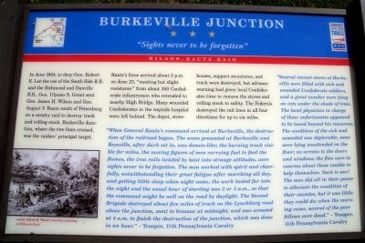
Kautz’s force arrived about 3 p.m. on June 23, “meeting but slight resistance” from about 300 Confederate infantrymen who retreated to nearby High Bridge. Many wounded Confederates in the wayside hospital were left behind. The depot, storehouses, support structures, and track were destroyed, but advance warning had given local Confederates time to remove the stores and rolling stock to safety. The Federals destroyed the rail lines in all four directions for up to six miles.
“When General Kautz,s command arrived at Burkeville, the destruction of the railroad began. The scene presented at Burkeville and Keysville, after dark set in, was demon-like; the burning track visible for miles, the moving figures of men carrying fuel to feed the flames, the iron rails twisted by heat into strange attitudes, were sights never to be forgotten. The men worked with spirit and cheerfully, notwithstanding their great fatigue after marching all day, and getting little sleep when night came, the work lasted far into the night and the usual hour of starting was 2 or 3 a.m., so that the command might be well on the road by daylight. The Second Brigade destroyed about five miles of track on the Lynchburg road above the junction, went to bivouac at midnight, and was aroused at 4 a.m. to finish the destruction of the junction, which was done in an hour.” – Trooper, 11th Pennsylvania Cavalry
“Several vacant stores at Burkeville were fitted with sick and wounded Confederate soldiers, and a great number were lying on cots under the shade of trees. The local physician in charge of these unfortunates appeared to be taxed beyond his resources. The condition of the sick and wounded was deplorable, some were lying unattended on the floor; no screens to the doors and windows; the flies were in swarms about those unable to help themselves. Such is war! The men did all in their power to alleviate the condition of their enemies, but it was little they could do; when the morning came, several of the poor fellows were dead.” - Trooper, 11th Pennsylvania Cavalry
Erected by Virginia Civil War Trails.
Topics and series. This historical marker is listed in this topic list: War, US Civil. In addition, it is included in the Virginia Civil War Trails series list. A significant historical month for this entry is June 1864.
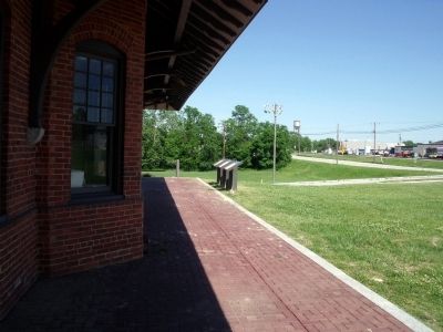
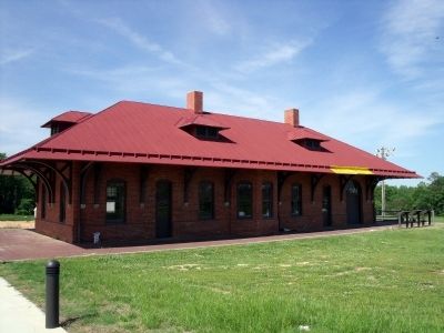
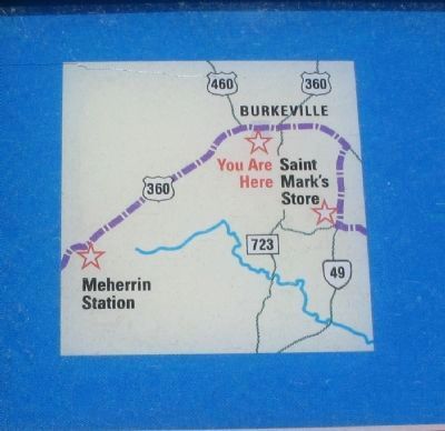
Location. 37° 11.353′ N, 78° 12.196′ W. Marker is in Burkeville, Virginia, in Nottoway County. Marker can be reached from 2nd Street NW (Business U.S. 460) near Maple Road. The marker is located in front of the Burkeville Depot. Touch for map. Marker is in this post office area: Burkeville VA 23922, United States of America. Touch for directions.
Other nearby markers. At least 8 other markers are within 3 miles of this marker, measured as the crow flies. A different marker also named Burkeville Junction (here, next to this marker); Wilson-Kautz Raid (here, next to this marker); Burkeville (within shouting distance of this marker); Ingleside Training Institute (approx. 0.7 miles away); Prince Edward County / Nottoway County (approx. 1.9 miles away); Ella Graham Agnew (approx. 2˝ miles away); T. O. Sandy (approx. 2˝ miles away); Old Nottoway Meeting House (approx. 2.6 miles away). Touch for a list and map of all markers in Burkeville.
More about this marker. On the lower left is a sketch captioned, "Artist Alfred R. Waud's wartime drawing of Wilson's Raid."
Credits. This page was last revised on November 10, 2021. It was originally submitted on May 11, 2009, by Bernard Fisher of Richmond, Virginia. This page has been viewed 1,247 times since then and 42 times this year. Photos: 1, 2, 3. submitted on May 11, 2009, by Bernard Fisher of Richmond, Virginia. 4. submitted on April 28, 2010, by Craig Swain of Leesburg, Virginia.


