Burkeville in Nottoway County, Virginia — The American South (Mid-Atlantic)
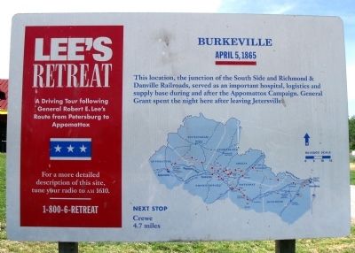
Burkeville
Lee's Retreat
— April 5, 1865 —
Next Stop
Crewe 4.7 miles
Erected by Virginia's Retreat.
Topics and series. This historical marker is listed in this topic list: War, US Civil. In addition, it is included in the Former U.S. Presidents: #18 Ulysses S. Grant series list. A significant historical date for this entry is April 5, 1865.
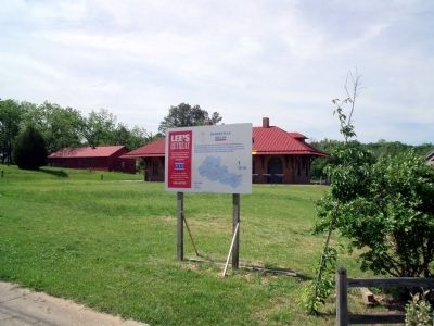
Location. 37° 11.335′ N, 78° 12.186′ W. Marker is in Burkeville, Virginia, in Nottoway County. Marker is at the intersection of 2nd Street NW (Business U.S. 460) and Maple Road, on the right when traveling west on 2nd Street NW. Touch for map. Marker is in this post office area: Burkeville VA 23922, United States of America. Touch for directions.
Other nearby markers. At least 8 other markers are within 3 miles of this marker, measured as the crow flies. Wilson-Kautz Raid (within shouting distance of this marker); Burkeville Junction (within shouting distance of this marker); a different marker also named Burkeville Junction (within shouting distance of this marker); Ingleside Training Institute (approx. 0.7 miles away); Prince Edward County / Nottoway County (approx. 1.9 miles away); Ella Graham Agnew (approx. 2˝ miles away); T. O. Sandy (approx. 2˝ miles away); Old Nottoway Meeting House (approx. 2.6 miles away). Touch for a list and map of all markers in Burkeville.
Also see . . . Inverness. National Register of Historic Places documentation for Inverness, located at 844 Inverness Street in Burkeville. Although the documentation does not mention such, other sources indicate Confederates captured at Sayler's Creek camped on the grounds. (Submitted on April 28, 2010, by Craig Swain of Leesburg, Virginia.)
Additional commentary.
1. After the Surrender
After the surrender of the Army of Northern Virginia at Appomattox, Federal troops concentrated at Burkeville. These forces remained in the vicinity for about a month, pending orders, and the surrender of other Confederate forces. Many Confederate prisoners from the Battle of Sayler's Creek were quartered at "Inverness," a house in Burkeville.
— Submitted April 28, 2010, by Craig Swain of Leesburg, Virginia.
Credits. This page was last revised on November 10, 2021. It was originally submitted on May 11, 2009, by Bernard Fisher of Richmond, Virginia. This page has been viewed 1,440 times since then and 55 times this year. Photos: 1, 2. submitted on May 11, 2009, by Bernard Fisher of Richmond, Virginia. 3. submitted on April 28, 2010, by Craig Swain of Leesburg, Virginia.


