Resaca in Gordon County, Georgia — The American South (South Atlantic)
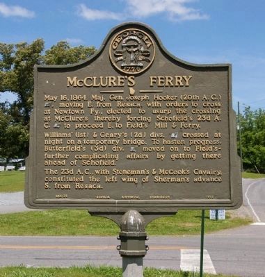
McClure’s Ferry
May 16, 1864. Maj. Gen. Joseph Hooker (20th A. C.) [US], moving E. from Resaca, with orders to cross at Newtown Fy., elected to usurp the crossing at McClure’s thereby forcing Schofield’s 23d A. C. [US] to proceed E. to Field’s Mill & Ferry.
William’s (1st) & Geary’s (2d) divs. [US] crossed at night on a temporary bridge. To hasten progress, Butterfield’s (3d) div. [US] moved on to Field’s -- further complicating affairs by getting there ahead of Schofield.
The 23d A. C., with Stoneman’s & McCook’s Cavalry, constituted the left wing of Sherman’s advance S. from Resaca.
Erected 1953 by Georgia Historical Commission. (Marker Number 064-22.)
Topics and series. This historical marker is listed in this topic list: War, US Civil. In addition, it is included in the Georgia Historical Society series list. A significant historical date for this entry is May 16, 1770.
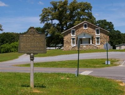
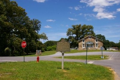
Location. 34° 34.775′ N, 84° 51.769′ W. Marker is in Resaca, Georgia, in Gordon County. Marker is at the intersection of West Pine Chapel Road and Pine Chapel Road, on the right when traveling east on West Pine Chapel Road. West Pine Chapel Road becomes Owens Gin Road at this intersection. Touch for map. Marker is in this post office area: Resaca GA 30735, United States of America. Touch for directions.
Other nearby markers. At least 8 other markers are within 4 miles of this marker, measured as the crow flies. Harlan’s Cross Roads (approx. one mile away); Field's Mill & Ferry (approx. 2 miles away); New Echota Ferry (approx. 3.7 miles away); Hicks/McCoy House Sites (approx. 3.8 miles away); New Echota (approx. 3.8 miles away); Historic Site in Journalism (approx. 3.8 miles away); Trail of Tears (approx. 3.8 miles away); Cherokee Indian Memorial (approx. 3.8 miles away).
Credits. This page was last revised on November 27, 2020. It was originally submitted on May 23, 2009, by David Seibert of Sandy Springs, Georgia. This page has been viewed 1,040 times since then and 17 times this year. Photos: 1, 2, 3. submitted on May 23, 2009, by David Seibert of Sandy Springs, Georgia. • Craig Swain was the editor who published this page.


