Ripon in San Joaquin County, California — The American West (Pacific Coastal)
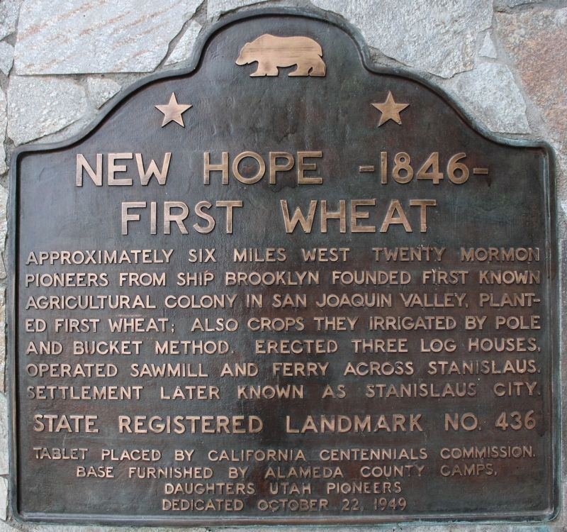
New Hope – 1846
First Wheat
State Registered Historical Landmark No. 436
Tablet placed by California Centennials Commission
Base furnished by Alameda County Camps,
Daughters Utah Pioneers
Dedicated October 22, 1949
Erected 1949 by California Centennials Commission and Daughters of Utah Pioneers. (Marker Number 436.)
Topics and series. This historical marker is listed in these topic lists: Agriculture • Settlements & Settlers. In addition, it is included in the California Historical Landmarks, and the Daughters of Utah Pioneers series lists. A significant historical date for this entry is October 22, 1806.
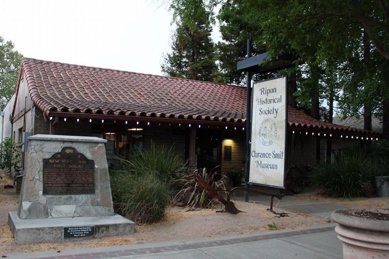
Location. 37° 44.357′ N, 121° 7.685′ W. Marker is in Ripon, California, in San Joaquin County. Marker is on West Main Street east of South Acacia Avenue, on the right when traveling east. The plaque is mounted to a masonry foundation in front of the Ripon Historical Society. Touch for map. Marker is at or near this postal address: 430 West Main Street, Ripon CA 95366, United States of America. Touch for directions.
Other nearby markers. At least 8 other markers are within 9 miles of this marker, measured as the crow flies. Ripon Memorial Library (a few steps from this marker); a different marker also named Ripon Memorial Library (about 400 feet away, measured in a direct line); Historic Ripon Jail (about 400 feet away); 75MM Howitzer (about 500 feet away); Ripon World War II Memorial (about 500 feet away); Estanislao's Stronghold (approx. 4.4 miles away); Durham Ferry (approx. 8.4 miles away); Site of San Joaquin City (approx. 8.9 miles away). Touch for a list and map of all markers in Ripon.
Regarding New Hope – 1846. This site was designated as California Registered Historical Landmark No. 436 on June 2, 1949.
Also see . . .
1. The Ship Brooklyn and Sam Brannon. (Submitted on June 1, 2009, by Syd Whittle of Mesa, Arizona.)
2. New Hope history thesis is gifted to Ripon Museum. Manteca / Ripon Bulletin
"Jim Odle believes the marker of the Mormon settlement in 1846 west of what is now present-day Ripon is incomplete in terms of history."(Submitted on May 18, 2023, by Joseph Alvarado of Livermore, California.)
Additional commentary.
1. New Hope - Stanislaus City
From Rensch and Hoover’s Historic Spots in California, published by The Stanford Press, 2002:
"Soon after their arrival, a log house, constructed after the Western manner and covered with oak shingles fashioned on the spot, was put up, while, with a crudely improvised sawmill, boards were hewn from oak logs for the cabin floor. Elk, bear and wild geese were so abundant that one man with a rifle could bring in enough game in three hours time to supply the colony for a week. Wheat, farm instruments and other necessary supplies had been brought and by the middle of January 1847, eighty acres of grain had been sown. The little settlement did indeed seem full of hope and promise.
But with the coming of winter rains the whole aspect was changed. The season was so stormy that the river overflowed its banks causing the little band of pioneers untold suffering and hardship. Then, too, serious dissentions arose among the colonists. So completely disheartened did they become that gradually the group disbanded. By the summer of 1847, only one man, a Mr. Buckland, remained and he too, was gone by November."
— Submitted June 1, 2009, by Syd Whittle of Mesa, Arizona.
2. New Hope
From Chronology of Stanislaus County History by Robert LeRoy Santos,
California State University, Stanislaus
University Library, 2002:
"Mormon Sam Brannan brought settlers to a spot 1 1/2
miles north of the junction of the Stanislaus and San Joaquin Rivers, near present day Salida. On the south bank had been Estanislao's camp, and on the north bank (in today's San Joaquin County), Brannan established the settlement of New Hope or Stanislaus City. But, settlers of New Hope lived on both sides of the river, which meant they lived in the future Stanislaus County. Mormon President Brigham Young could not agree with Brannan to settle the Mormon people at New Hope instead of in the Valley of the Great Salt Lake. Many of the Mormon settlers went to the gold mines or to Utah abandoning the settlement."
Source: http://library.csustan.edu/bsantos/chronology.html
— Submitted June 1, 2009, by Syd Whittle of Mesa, Arizona.
3. Marker Moved
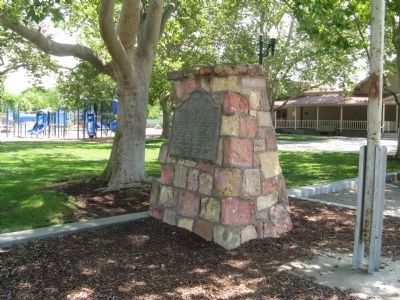
The plaque was relocated from Acacia Park on Fourth Street to the front of the Ripon Historical Society on West Main Street. A plaque below the marker states, "Relocated and Erected by Estanislao Chapter 58
of E Clampus Vitus May 8, 2010."
— Submitted May 18, 2023, by Joseph Alvarado of Livermore, California.
Credits. This page was last revised on May 18, 2023. It was originally submitted on June 1, 2009, by Syd Whittle of Mesa, Arizona. This page has been viewed 1,882 times since then and 32 times this year. Last updated on December 11, 2019, by Craig Baker of Sylmar, California. Photos: 1. submitted on May 18, 2023, by Joseph Alvarado of Livermore, California. 2. submitted on June 1, 2009, by Syd Whittle of Mesa, Arizona. 3. submitted on May 18, 2023, by Joseph Alvarado of Livermore, California. 4. submitted on June 1, 2009, by Syd Whittle of Mesa, Arizona. • J. Makali Bruton was the editor who published this page.


