Taylor Run in Alexandria, Virginia — The American South (Mid-Atlantic)
Panoramic View of Alexandria
Mathew Brady – 1864
Inscription.
Camp of the 44th New York Volunteer Infantry, also known as the "Ellsworth Avengers" and the "People's Ellsworth Regiment." The unit was raised in honor of Colonel Elmer E. Ellsworth, who was killed at the Marshall House Hotel on May 24, 1861, during the Union Army's occupation of Alexandria. The 44th New York was stationed at Alexandria from January 24, to April 29, 1964, and assigned to guard duty on U.S. Military Railroad trains. The unit's regimental history, published in 1911, provides a detailed description of its camp on Shuter's Hill.
. . . the regiment went into permanent camp for the rest of the winter, at the head of King Street. The grounds were spacious and the camp was laid out with great regularity. it is not too much to say that when completed the camp was a model in all its detail. After the streets and tents of the regiment had been put in superior condition, a beautiful arch was created at the foot of each street. All the arches except the central arch were of similar design and construction, elaborately and beautifully trimmed with evergreens.
On Sunday, the 20th of March, an artist came from Brady's famous war-time picture gallery in Washington and took different impressions of the camp from which large pictures were made, many of which are still preserved by members and friends of the regiment.
Topics. This historical marker is listed in this topic list: War, US Civil. A significant historical month for this entry is January 1938.
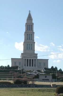
Location. 38° 48.443′ N, 77° 3.9′ W. Marker is in Alexandria, Virginia. It is in Taylor Run. Marker can be reached from Callahan Drive near King Street (Virginia Route 7). Marker is on the George Washington Masonic National Memorial grounds, on a landing of the ceremonial steps leading up to the memorial. Touch for map. Marker is at or near this postal address: 101 Callahan Drive, Alexandria VA 22301, United States of America. Touch for directions.
Other nearby markers. At least 5 other markers are within walking distance of this marker. George Washington Masonic National Memorial (about 300 feet away, measured in a direct line); a different marker also named The George Washington Masonic National Memorial (about 300 feet away); Fighting Back (about 500 feet away); Original Federal Boundary Stone, District of Columbia, Southwest 2 (about 700 feet away); Veterans Memorial (about 800 feet away). Touch for a list and map of all markers in Alexandria.
More about this marker. Marker is on the George Washington Masonic National Memorial grounds, on a landing of the ceremonial
steps leading up to the memorial. Parking is available at the memorial, or you can walk up the steps from the street.
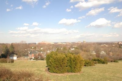
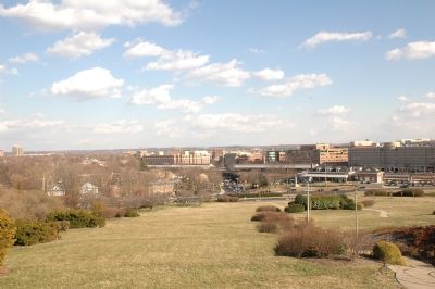
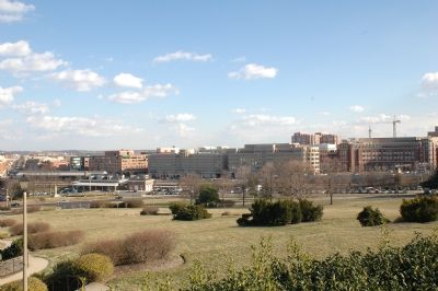
Regarding Panoramic View of Alexandria. Brady's panoramic view of the military camp, showing the rest of Alexandria on the horizon, is reproduced on the marker, along with a list of numbered Alexandria landmarks that can be seen. The marker appears to be placed at a location close to where Brady's artist took the photographs that were combined into the panorama.
Also see . . .
1. Brady, Mathew B., photographer. full-length seated. Photograph of the photographer from the Treasurenet Historical Image Collection. Click on the image to view. (Submitted on March 23, 2006, by Tom Fuchs of Greenbelt, Maryland.)
2. 44th Infantry Regiment. From the New York State Military Museum and Veterans Research Center (Submitted on March 23, 2006.)
3. The Murder of Colonel Ellsworth. Harper's Weekly article and pictures. (Submitted on March 23, 2006.)
4. The Civil War in Alexandria. (Submitted on March 23, 2006.)
5. Occupied city: Portrait of Civil War Alexandria, Virginia. Book by Jeremy J. Harvey at Amazon.com (Submitted on March 23, 2006, by J. J. Prats of Powell, Ohio.)
6. The Alexandria, Loudoun and Hampshire Railroad In The Civil War. (Submitted on March 23, 2006.)
7. George Washington Masonic National Memorial
. Official Web Site. (Submitted on March 23, 2006, by J. J. Prats of Powell, Ohio.)
Additional commentary.
1. George Washington Masonic National Memorial Grounds
Click on the map link, switch to satellite view, and zoom in further to examine the grounds of the George Washington Masonic National Memorial. It was on the west side of the hill on which the Memorial now stands that the camp depicted in the panorama was raised.
— Submitted March 23, 2006.
Credits. This page was last revised on January 27, 2023. It was originally submitted on March 23, 2006, by Tom Fuchs of Greenbelt, Maryland. This page has been viewed 3,207 times since then and 29 times this year. Photos: 1, 2, 3, 4, 5. submitted on March 23, 2006, by Tom Fuchs of Greenbelt, Maryland. • J. J. Prats was the editor who published this page.


