Athens in Athens-Clarke County, Georgia — The American South (South Atlantic)
The Stoneman Raid
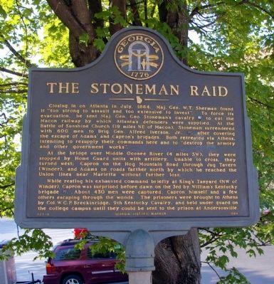
Closing in on Atlanta in July, 1864, Maj. Gen. W.T. Sherman found it "too strong to assault and too extensive to invest". To force its evacuation, he sent Maj. Gen. Geo. Stoneman’s cavalry [US] to cut the Macon railway by which Atlanta’s defenders were supplied. At the Battle of Sunshine Church (19 miles NE of Macon), Stoneman surrendered with 600 men to Brig. Gen. Alfred Iverson, Jr., [CS], after covering the escape of Adams’ and Capron's brigades. Both retreated via Athens, intending to resupply their commands here and to "destroy the armory and other government works".
At the bridge over Middle Oconee River (4 miles SW), they were stopped by Home Guard units with artillery. Unable to cross, they turned west: Capron on the Hog Mountain Road through Jug Tavern (Winder), and Adams on roads farther north by which he reached the Union lines near Marietta without further loss.
While resting his exhausted command briefly at King’s Tanyard (NW of Winder), Capron was surprised before dawn on the 3rd by William’s Kentucky brigade [CS]. About 430 men were captured, Capron himself and a few others escaping through the woods. The prisoners were brought to Athens by Col. W.C.P. Breckinridge, 9th Kentucky Cavalry, and held under guard on the college campus until they could be sent to the prison at Andersonville.
Erected 1984 by Georgia Department of Natural Resources. (Marker Number 029-6.)
Topics and series. This historical marker is listed in this topic list: War, US Civil. In addition, it is included in the Georgia Historical Society series list. A significant historical month for this entry is July 1864.
Location. 33° 57.433′ N, 83° 22.632′ W. Marker is in Athens, Georgia, in Athens-Clarke County. Marker is at the intersection of West Broad Street (U.S. 78) and South Lumpkin Street, on the right when traveling east on West Broad Street. Touch for map. Marker is in this post office area: Athens GA 30601, United States of America. Touch for directions.
Other nearby markers. At least 8 other markers are within walking distance of this marker. Georgia Theatre (about 400 feet away, measured in a direct line); Commeration of the Golden Anniversary of a Classic Partnership (about 400 feet away); Albon Chase House (about 500 feet away); The Red and Black (about 500 feet away); Herty Field (about 600 feet away); Chapel Bell (about 600 feet away); University of Georgia (about 600 feet away); Holmes/Hunter Academic Building (about 600 feet away). Touch for a list and map of all markers in Athens.
Credits. This page was last revised on July 16, 2018. It was originally submitted on June 4, 2009, by David Seibert of Sandy Springs, Georgia. This page has been viewed 1,526 times since then and 21 times this year. Photos: 1, 2. submitted on June 4, 2009, by David Seibert of Sandy Springs, Georgia. • Craig Swain was the editor who published this page.

