West Milton in Miami County, Ohio — The American Midwest (Great Lakes)
The Underground Railroad in West Milton
Inscription.
Side A:
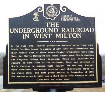
In the year 1798, several prospectors traveled north from their North Carolina homes in search of new lands for themselves and their friends. Four of these known Quaker prospectors were John Mast, Jr., Martin Davenport and David Hoover from North Carolina and Benjamin Iddings from Tennessee. These men examined the country on both sides of the Stillwater River and returned to North Carolina to prepare their families for the long journey. Upon departure, sixty-four relatives and abolitionists made up the wagon train. The first group arrived in September of 1801; the second group in 1802, and a third group from Georgia in 1805.
(Continued on other side)
Side B:
(Continued from other side)
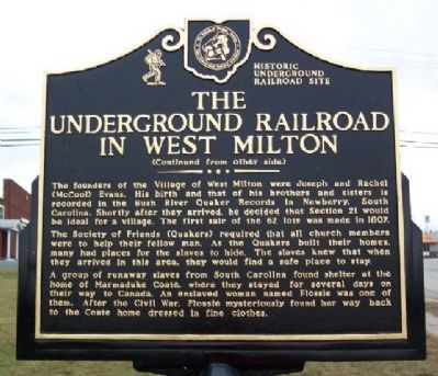
The founders of the Village of West Milton were Joseph and Rachel (McCool) Evans. His birth and that of his brothers and sisters is recorded in the Bush River Quaker Records in Newberry, South Carolina. Shortly after they arrived, he decided that Section 21 would be ideal for a village. The first sale of the 62 lots was made in 1807. The Society of Friends (Quakers) required that all church members were to help their fellow man. As the Quakers built their homes, many had places for the slaves to hide. The slaves knew that when they arrived in this area, they would find a safe place to stay. A group of runaway slaves from South Carolina found shelter at the home of Marmaduke Coate, where they stayed for several days on their way to Canada. An enslaved woman named Flossie was one of them. After the Civil War, Flossie mysteriously found her way back to the Coate home dressed in fine clothes.
Erected by Friends of Freedom Society and Ohio Underground Railroad Association.
Topics and series. This historical marker is listed in these topic lists: Abolition & Underground RR • African Americans • Charity & Public Work • Churches & Religion • Settlements & Settlers. In addition, it is included in the Quakerism series list. A significant historical month for this entry is September 1801.
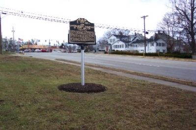
Location. 39° 57.853′ N, 84° 19.642′ W. Marker is in West Milton, Ohio, in Miami County. Marker is on Tipp Pike (Ohio Route 571), on the right when traveling east. Marker is between Washington Street and Community Drive, next to the Masonic Temple. Touch for map. Marker is in this post office area: West Milton OH 45383, United States of America. Touch for directions.
Other nearby markers. At least 8 other markers are within 4 miles of this marker, measured as the crow flies. West Milton Friends Meeting (about 700 feet away, measured in a direct line); West Milton Korean War Memorial (approx. 0.2 miles away); Charles Furnas 1880- 1941 (approx. 0.2 miles away); 1804 Quaker Meeting House
(approx. 2 miles away); The Brick Wall (approx. 2 miles away); John Hoover (approx. 2 miles away); Hanktown (approx. 3.3 miles away); 1804 Iddings Log House (approx. 3.6 miles away). Touch for a list and map of all markers in West Milton.
Credits. This page was last revised on June 16, 2016. It was originally submitted on June 7, 2009, by William Fischer, Jr. of Scranton, Pennsylvania. This page has been viewed 4,775 times since then and 200 times this year. Photos: 1, 2, 3. submitted on June 7, 2009, by William Fischer, Jr. of Scranton, Pennsylvania. • Craig Swain was the editor who published this page.


