Near Brodnax in Brunswick County, Virginia — The American South (Mid-Atlantic)
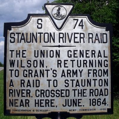
Staunton River Raid
Erected 1935 by Conservation & Development Commission. (Marker Number S-74.)
Topics and series. This historical marker is listed in this topic list: War, US Civil. In addition, it is included in the Virginia Department of Historic Resources (DHR) series list. A significant historical month for this entry is June 1864.
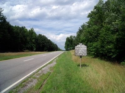
Location. 36° 46.936′ N, 77° 59.785′ W. Marker is near Brodnax, Virginia, in Brunswick County. Marker is at the intersection of Boydton Plank Road (U.S. 1) and Old Indian Road on Boydton Plank Road. Touch for map. Marker is in this post office area: Brodnax VA 23920, United States of America. Touch for directions.
Other nearby markers. At least 8 other markers are within 5 miles of this marker, measured as the crow flies. Brunswick County, Virginia (approx. 2.1 miles away); Brunswick County / Mecklenburg County (approx. 2.1 miles away); Saint Paul’s Chapel School (approx. 3.6 miles away); Tobacco As a Way of Life (approx. 3.8 miles away); The American Thoroughbred in Brunswick (approx. 3.9 miles away); Bridges of Brunswick County (approx. 4.2 miles away); You are Traveling Through the Scenic Meherrin River Watershed! (approx. 4.3 miles away); Rolling Post Office (approx. 4˝ miles away).
Credits. This page was last revised on June 16, 2016. It was originally submitted on June 22, 2009, by Bernard Fisher of Richmond, Virginia. This page has been viewed 959 times since then and 20 times this year. Photos: 1, 2. submitted on June 22, 2009, by Bernard Fisher of Richmond, Virginia.

