Sharpsburg in Washington County, Maryland — The American Northeast (Mid-Atlantic)
The East Woods
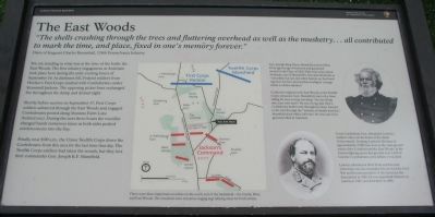
"The shells crashing through the trees and fluttering overhead as well as the musketry...all contributed to mark the time, and place, fixed in one's memory forever."
Diary of Sergeant Charles Broomhall, 124th Pennsylvania Infantry
You are standing in what was at the time of the battle the East Woods. The first infantry engagement at Antietam took place here during the early evening hours of September 16. As darkness fell, Federal soldiers from Hooker's First Corps clashed with Confederates under Stonewall Jackson. The opposing picket lines exchanged fire throughout the damp and dismal night.
Shortly before sunrise on September 17, First Corps soldiers advanced through the East Woods and engaged Confederates posted along Mumma Farm Lane (behind you). During the next three hours the woodlot changed hands numerous times as both sides pushed reinforcements into the fray.
Finally, near 8:00 a.m., the Union Twelfth Corps drove the Confederates from this area for the last time that day. The Twelfth Corps had taken the woods, but they lost their commander Gen. Joseph K.E. Mansfield.
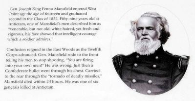
Gen. Joseph King Fenno Mansfield entered West Point at the age of fourteen and graduated second in the Class of 1822. Fifty-nine years old at Antietam, one of Mansfield's men described him as "venerable, but not old; white haired, yet fresh and vigorous, his face showed that intelligent courage which a soldier admires."
Confusion reigned in the East Woods as the Twelfth Corps advanced. Gen. Mansfield rode to the front telling his men to stop shooting, "You are firing into your own men!" He was wrong. Just then a Confederate bullet went through his chest. Carried to the rear through the "tornado of deadly missiles," Mansfield died within 24 hours. He was one of six generals killed at Antietam.
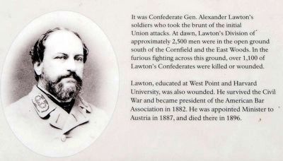
It was Confederate Gen. Alexander Lawton's soldiers who took the brunt of the initial Union attacks. At dawn, Lawton's Division of approximately 2,500 men were in the open ground south of the Cornfield and the East Woods. In the furious fighting across the ground, over 1,100 of Lawton's Confederates were killed or wounded.
Lawton, educated at West Point and Harvard University, was also wounded. He survived the Civil War and became president of the American Bar Association in 1882. He was appointed Minister to Austria in 1887, and died there in 1896.
Erected 2009 by Antietam National Battlefield - National Park Service - U.S. Department of the Interior.
Topics. This historical marker is listed in this topic list: War, US Civil. A significant historical date for this entry is September 17, 1862.
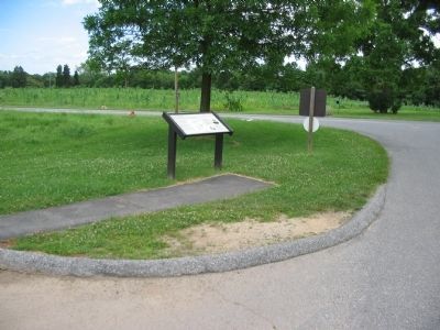
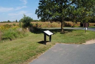
Location. 39° 28.88′ N, 77° 44.505′ W. Marker is in Sharpsburg, Maryland, in Washington County. Marker is at the intersection of Cornfield Avenue and Smoketown Road, on the right when traveling west on Cornfield Avenue. Located at stop three of the driving tour of the Antietam Battlefield. Touch for map. Marker is in this post office area: Sharpsburg MD 21782, United States of America. Touch for directions.
Other nearby markers. At least 10 other markers are within walking distance of this marker. "You Are Firing Into Our Own Men" (here, next to this marker); Greene's Division, Twelfth Army Corps (a few steps from this marker); Jackson's Command (a few steps from this marker); Longstreet's Command (within shouting distance of this marker); 13th New Jersey Infantry (about 300 feet away, measured in a direct line); Sixth Army Corps (about 400 feet away); a different marker also named Longstreet's Command (about 400 feet away); First New Jersey Brigade (about 600 feet away); a different marker also named Jackson's Command (about 600 feet away); U.S. Artillery (about 600 feet away). Touch for a list and map of all markers in Sharpsburg.
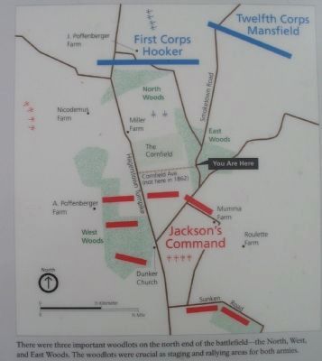
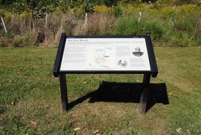
More about this marker. In the center is a map of the this section of the battlefield illustrating the disposition of forces at the start of the battle. There were three important woodlots on the north end of the battlefield - the North, West, and East Woods. The woodlots were crucial as staging and rallying areas for both armies. To the right are portraits of Gens. Mansfield and Lawton.
Also see . . .
1. Antietam Battlefield. National Park Service site. (Submitted on July 11, 2009, by Craig Swain of Leesburg, Virginia.)
2. Sgt. Charles Broomhall - A Biography. Less than three weeks after his enlistment, Sgt Broomhall and the 124th Pennsylvania Volunteers were marching hard toward a rendezvous with the Army of Northern Virginia at Antietam. (Submitted on October 24, 2015, by Brian Scott of Anderson, South Carolina.)
3. Extract from Sgt. Charles Broomhall's Diary. The diary was found in Milford, CT in 1989 by the Janes family. The diary was signed only by the four initials "C.D.M.B.", along with the soldier's rank and company. It was written in a composition booklet similar to the blue exam booklets used today for college essays, measuring approximately 8-1/2 by 6-3/4 inches. It was bound by thread that had been broken or rotted, and some of the pages were out of order. The diary was written in ink, and may have been recopied by the Sergeant, perhaps from a soldier's diary that would have been more easily carried in the field. (Submitted on October 24, 2015, by Brian Scott of Anderson, South Carolina.)
4. Joseph K. Mansfield. Joseph King Fenno Mansfield (December 22, 1803 – September 18, 1862) was a career United States Army
officer, civil engineer, and a Union general in the American Civil War, mortally wounded at the Battle of Antietam. (Submitted on October 24, 2015, by Brian Scott of Anderson, South Carolina.)
5. Alexander Lawton. Alexander Robert Lawton (November 4, 1818 – July 2, 1896) was a lawyer, politician, diplomat, and brigadier general in the Confederate States Army during the American Civil War. (Submitted on October 24, 2015, by Brian Scott of Anderson, South Carolina.)
Credits. This page was last revised on May 21, 2021. It was originally submitted on July 11, 2009, by Craig Swain of Leesburg, Virginia. This page has been viewed 1,165 times since then and 29 times this year. Photos: 1, 2. submitted on July 11, 2009, by Craig Swain of Leesburg, Virginia. 3, 4, 5. submitted on October 24, 2015, by Brian Scott of Anderson, South Carolina. 6. submitted on July 11, 2009, by Craig Swain of Leesburg, Virginia. 7. submitted on October 24, 2015, by Brian Scott of Anderson, South Carolina.
