Olde Towne in Portsmouth, Virginia — The American South (Mid-Atlantic)
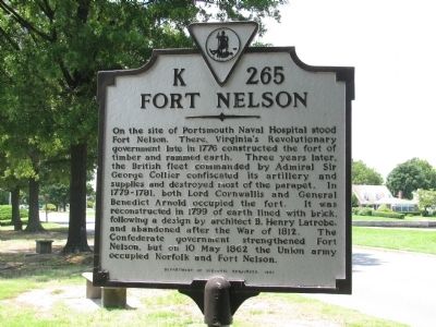
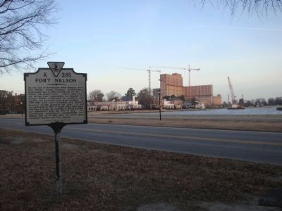
Fort Nelson
Erected 1997 by Department of Historic Resources. (Marker Number K-265.)
Topics and series. This historical marker is listed in these topic lists: War of 1812 • War, US Civil • War, US Revolutionary. In addition, it is included in the Virginia Department of Historic Resources (DHR) series list. A significant historical date for this entry is May 10, 1862.
Location. 36° 50.416′ N, 76° 18.108′ W. Marker is in Portsmouth, Virginia. It is in Olde Towne. Marker is on Crawford Parkway west of Court Street, on the left when traveling west. Touch for map. Marker is in this post office area: Portsmouth VA 23704, United States of America. Touch for directions.
Other nearby markers. At least 8 other markers are within walking distance of this marker. Olde Towne Portsmouth (a few steps from this marker); Cornwallis at Portsmouth (within shouting distance of this marker); Arnold's British Defenses, 1781 (within shouting distance of this marker); Craney Island (within shouting distance of this marker); Crawford Bay (about 300 feet away, measured in a direct line); Collier's Raid (about 700 feet away); The Yellow Fever of 1855 (about 700 feet away); Watts House (about 700 feet away). Touch for a list and map of all markers in Portsmouth.
Credits. This page was last revised on February 1, 2023. It was originally submitted on July 27, 2009, by Kristin Rollins of Portsmouth, Virginia. This page has been viewed 1,466 times since then and 41 times this year. Photos: 1. submitted on July 27, 2009, by Kristin Rollins of Portsmouth, Virginia. 2. submitted on February 14, 2014, by Mike Wintermantel of Pittsburgh, Pennsylvania. • Kevin W. was the editor who published this page.

